TopoQuest Logo
Do you find TopoQuest useful?
Help keep TopoQuest running and adding new maps/features by donating!
Bitcoin:  19c7KJd3qBynnjoSw5npx9KScwjBe4ifkT
Litecoin:  LXs6TkuXGGXo1vDsWCkWVdjQX94eUKd6ui
Home View Maps Find Maps Find Places Resources & Links


Colver, Pennsylvania Topographic Map

USGS Map Title: Colver, PA
USGS Map MRC: 40078E7
DRG (GeoTIFF) Download: o40078e7.tif


Neighboring USGS Topographic Map Quads:


  Commodore, PA  
40078F8
 

  Barnesboro, PA  
40078F7
 

  Hastings, PA  
40078F6
 

  Strongstown, PA  
40078E8
 

  Colver, PA  
40078E7
 

  Carrolltown, PA  
40078E6
 

  Vintondale, PA  
40078D8
 

  Nanty Glo, PA  
40078D7
 

  Ebensburg, PA  
40078D6


Map MRC Location:

N41°
W79°
N41°
W78°
H8 H7 H6 H5 H4 H3 H2 H1
G8 G7 G6 G5 G4 G3 G2 G1
F8 F7 F6 F5 F4 F3 F2 F1
E8 E7 E6 E5 E4 E3 E2 E1
D8 D7 D6 D5 D4 D3 D2 D1
C8 C7 C6 C5 C4 C3 C2 C1
B8 B7 B6 B5 B4 B3 B2 B1
A8 A7 A6 A5 A4 A3 A2 A1
N40°
W79°
N40°
W78°

Colver, PA USGS 1:24K Topographic Map Preview:
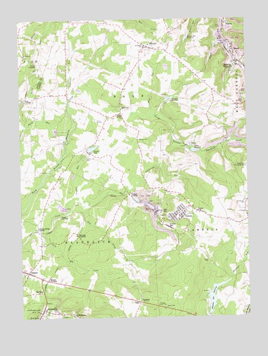
Colver, PA USGS Topographic Map
Click on map above to begin viewing in our Map Viewer.

This topographic map contains these locations and features:
Feature Name Type Latitude Longitude GNIS ID View Map
BakersvillePopulated PlaceN40.5317°W78.7881°1212796View Map
BarnesPopulated PlaceN40.6123°W78.7567°1168734View Map
BelsanoPopulated PlaceN40.5195°W78.8711°1169209View Map
Belsano CrossingPopulated PlaceN40.5159°W78.8609°1203060View Map
Belsano Post OfficePost OfficeN40.5195°W78.8707°2773074View Map
Belsano Post Office (historical)Post OfficeN40.5195°W78.8711°1214339View Map
Bethel ChurchChurchN40.5062°W78.8109°1169387View Map
Big Brown DamDamN40.6167°W78.7814°1194946View Map
Blue GoosePopulated PlaceN40.5856°W78.8186°1169872View Map
Browns Run ReservoirReservoirN40.6168°W78.7825°1170407View Map
California RunStreamN40.5540°W78.8156°1170888View Map
Cambria Township Volunteer Fire Company Station 40BuildingN40.5423°W78.7904°2645585View Map
Clear Spring LakeReservoirN40.5027°W78.7505°2516396View Map
ColverPopulated PlaceN40.5434°W78.7878°1172252View Map
Colver Census Designated PlaceCensusN40.5427°W78.7892°2389349View Map
Colver DamDamN40.5710°W78.7818°1194907View Map
Colver Post OfficePost OfficeN40.5426°W78.7898°2772642View Map
Colver ReservoirReservoirN40.5699°W78.7753°1192286View Map
Concrete Bridge CrossingPopulated PlaceN40.5373°W78.8672°1203318View Map
Crooked RunStreamN40.5503°W78.8439°1172725View Map
Duman LakeReservoirN40.5709°W78.8351°1173589View Map
Duman Lake ParkParkN40.5681°W78.8389°1173590View Map
Dutch RunStreamN40.5756°W78.8478°1198060View Map
Edwards CrossingPopulated PlaceN40.5345°W78.8431°1203497View Map
F PortalMineN40.5442°W78.7517°1174399View Map
GriffithtownPopulated PlaceN40.5017°W78.8459°1176230View Map
Hill CreekStreamN40.5484°W78.8397°1177074View Map
Hoppel RunStreamN40.6173°W78.7634°1209302View Map
IvisonLocaleN40.5642°W78.8697°1200996View Map
Kingdom Hall ChurchChurchN40.5876°W78.8181°1178484View Map
Kinter CrossingPopulated PlaceN40.6065°W78.8628°1203943View Map
Krumenacker AirportAirportN40.5940°W78.7770°1194036View Map
Lesle RunStreamN40.6062°W78.7525°1179214View Map
Little Elk CreekStreamN40.5365°W78.8628°1179534View Map
Mount Hermon CemeteryCemeteryN40.5472°W78.7515°1181699View Map
Mount Union ChurchChurchN40.6106°W78.8725°1181870View Map
NicktownPopulated PlaceN40.6134°W78.8034°1182451View Map
Nicktown Fire Company Station 59BuildingN40.6152°W78.8090°2645826View Map
Nicktown Post OfficePost OfficeN40.6134°W78.8049°2780014View Map
Nine RowPopulated PlaceN40.5442°W78.7975°1182462View Map
PindletonPopulated PlaceN40.5065°W78.8097°1183755View Map
Pindleton Lookout TowerPillarN40.5051°W78.7964°1183756View Map
Portal Number 1MineN40.5745°W78.8081°1184291View Map
Portal Number 15MineN40.5826°W78.8292°1184292View Map
Powell CemeteryCemeteryN40.5238°W78.7721°1184364View Map
Preisser CrossingPopulated PlaceN40.5517°W78.8147°1204445View Map
Preisser StationLocaleN40.5517°W78.8189°1212795View Map
Regan JunctionPopulated PlaceN40.5431°W78.8520°1204482View Map
Saint Nicholas SchoolSchoolN40.6140°W78.8053°1186526View Map
SeldersvillePopulated PlaceN40.5040°W78.8631°1187239View Map
Shirfs Run DamDamN40.5917°W78.7931°1194926View Map
Spangler ReservoirReservoirN40.5919°W78.7919°1188149View Map
Stiles CrossingPopulated PlaceN40.5915°W78.8720°1204737View Map
Teakettle RunStreamN40.5951°W78.8439°1189333View Map
ThomasLocaleN40.5445°W78.7567°1201110View Map
Township of BarrCivilN40.6060°W78.8120°1216073View Map
Township of BlacklickCivilN40.5169°W78.8495°1216074View Map
TripoliPopulated PlaceN40.5448°W78.7770°1189815View Map
Twenty RowPopulated PlaceN40.5381°W78.7931°1189999View Map
VeteraPopulated PlaceN40.5726°W78.7811°1204873View Map
Williams Run DamDamN40.5017°W78.7714°1194874View Map
Williams Run ReservoirReservoirN40.5082°W78.7693°1191473View Map
Wolf RunStreamN40.5840°W78.8025°1191670View Map

Note: Coordinates in the location and feature list above are referenced to NAD83 datum.


Copyright (C) 2008-2025 Ryan Niemi / Sunset Dynamics ... All Rights Reserved