TopoQuest Logo
Do you find TopoQuest useful?
Help keep TopoQuest running and adding new maps/features by donating!
Bitcoin:  19c7KJd3qBynnjoSw5npx9KScwjBe4ifkT
Litecoin:  LXs6TkuXGGXo1vDsWCkWVdjQX94eUKd6ui
Home View Maps Find Maps Find Places Resources & Links


Hastings, Pennsylvania Topographic Map

USGS Map Title: Hastings, PA
USGS Map MRC: 40078F6
DRG (GeoTIFF) Download: o40078f6.tif


Neighboring USGS Topographic Map Quads:


  Burnside, PA  
40078G7
 

  Westover, PA  
40078G6
 

  Irvona, PA  
40078G5
 

  Barnesboro, PA  
40078F7
 

  Hastings, PA  
40078F6
 

  Coalport, PA  
40078F5
 

  Colver, PA  
40078E7
 

  Carrolltown, PA  
40078E6
 

  Ashville, PA  
40078E5


Map MRC Location:

N41°
W79°
N41°
W78°
H8 H7 H6 H5 H4 H3 H2 H1
G8 G7 G6 G5 G4 G3 G2 G1
F8 F7 F6 F5 F4 F3 F2 F1
E8 E7 E6 E5 E4 E3 E2 E1
D8 D7 D6 D5 D4 D3 D2 D1
C8 C7 C6 C5 C4 C3 C2 C1
B8 B7 B6 B5 B4 B3 B2 B1
A8 A7 A6 A5 A4 A3 A2 A1
N40°
W79°
N40°
W78°

Hastings, PA USGS 1:24K Topographic Map Preview:
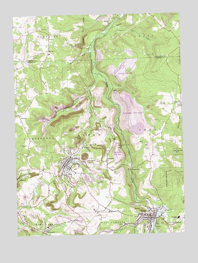
Hastings, PA USGS Topographic Map
Click on map above to begin viewing in our Map Viewer.

This topographic map contains these locations and features:
Feature Name Type Latitude Longitude GNIS ID View Map
AldburnLocaleN40.6990°W78.6989°1201186View Map
Ashcraft RunStreamN40.7459°W78.6731°1192083View Map
Borough of HastingsCivilN40.6647°W78.7094°1215024View Map
Borough of PattonCivilN40.6325°W78.6498°1215030View Map
Borough of WestoverCivilN40.7465°W78.6822°1215112View Map
Brubaker RunStreamN40.7167°W78.6897°1198486View Map
Cambria Heights 7th and 8th Wards Middle SchoolSchoolN40.6642°W78.7139°1207322View Map
Cambria Heights Senior High SchoolSchoolN40.6334°W78.6297°1207324View Map
Cambrian Hills GolfLocaleN40.6578°W78.7239°1206172View Map
CymbriaPopulated PlaceN40.6576°W78.7481°1203384View Map
Driscoll HollowValleyN40.7047°W78.6956°1173483View Map
East Ridge ChurchChurchN40.7295°W78.7231°1173860View Map
Fairview CemeteryCemeteryN40.6382°W78.6413°1174487View Map
Father's Love AirportAirportN40.6471°W78.7316°2770606View Map
Flanigans RiverStreamN40.6295°W78.6620°1202048View Map
GarwayLocaleN40.7276°W78.6878°1201135View Map
HastingsPopulated PlaceN40.6651°W78.7122°1176640View Map
Hastings Area Ambulance Association Station 69BuildingN40.6645°W78.7110°2719447View Map
Hastings Post OfficePost OfficeN40.6653°W78.7121°2779575View Map
Hastings Volunteer Fire Company Station 55BuildingN40.6652°W78.7110°2645752View Map
Karen Number 1 Mine StationLocaleN40.7359°W78.6881°1213039View Map
Little Brubaker RunStreamN40.7065°W78.6936°1179484View Map
Little Chest CreekStreamN40.6320°W78.6472°1198085View Map
Miners Medical CenterHospitalN40.6582°W78.7054°2718004View Map
Moss RunStreamN40.7292°W78.6909°1199191View Map
PattonPopulated PlaceN40.6340°W78.6503°1183382View Map
Patton Area Ambulance Association Station 67BuildingN40.6385°W78.6496°2719543View Map
Patton Borough Police DepartmentBuildingN40.6342°W78.6475°2780461View Map
Patton Elementary SchoolSchoolN40.6351°W78.6506°1207323View Map
Patton Fire Company Station 62BuildingN40.6342°W78.6482°2645923View Map
Patton Post OfficePost OfficeN40.6342°W78.6491°2779932View Map
PlattsvillePopulated PlaceN40.6923°W78.7459°1204419View Map
ReillysPopulated PlaceN40.6303°W78.6695°1184881View Map
Rock RunStreamN40.7134°W78.6803°1185278View Map
Rogues Harbor RunStreamN40.7437°W78.6745°1185396View Map
Saint BenedictPopulated PlaceN40.6276°W78.7295°1185819View Map
Saint Benedict Post OfficePost OfficeN40.6273°W78.7311°2648388View Map
Saint Benedict Presbyterian ChurchChurchN40.6291°W78.7296°2648387View Map
Saint Bernard CemeteryCemeteryN40.6725°W78.7060°1185831View Map
Saint BonifacePopulated PlaceN40.6667°W78.6809°1185839View Map
Saint Josephs ChurchChurchN40.6337°W78.7084°1186232View Map
Saint LawrencePopulated PlaceN40.6987°W78.6253°1186271View Map
Saint Lawrence Lookout TowerTowerN40.6984°W78.6367°1186274View Map
Saint Marys CemeteryCemeteryN40.6279°W78.6352°1186388View Map
SlickportPopulated PlaceN40.6731°W78.7097°1187804View Map
State Game Lands Number 108ParkN40.6598°W78.6345°1209259View Map
SwedetownPopulated PlaceN40.6748°W78.6989°1189165View Map
SylvisPopulated PlaceN40.7365°W78.7228°1204791View Map
Thomas MillsPopulated PlaceN40.6617°W78.6631°1204809View Map
Township of ElderCivilN40.6750°W78.6897°1216083View Map
Union CemeteryCemeteryN40.6331°W78.6961°1209229View Map
WNCC-AM (Barnesboro)TowerN40.6798°W78.7403°1200446View Map

Note: Coordinates in the location and feature list above are referenced to NAD83 datum.


Copyright (C) 2008-2024 Ryan Niemi / Sunset Dynamics ... All Rights Reserved