TopoQuest Logo
Do you find TopoQuest useful?
Help keep TopoQuest running and adding new maps/features by donating!
Bitcoin:  19c7KJd3qBynnjoSw5npx9KScwjBe4ifkT
Litecoin:  LXs6TkuXGGXo1vDsWCkWVdjQX94eUKd6ui
Home View Maps Find Maps Find Places Resources & Links


Stalker Lake, Minnesota Topographic Map

USGS Map Title: Stalker Lake, MN
USGS Map MRC: 46095B7
DRG (GeoTIFF) Download: o46095b7.tif


Neighboring USGS Topographic Map Quads:


  Wall Lake, MN  
46095C8
 

  Underwood, MN  
46095C7
 

  Battle Lake, MN  
46095C6
 

  Dalton, MN  
46095B8
 

  Stalker Lake, MN  
46095B7
 

  Eagle Lake, MN  
46095B6
 

  Fourmile Lake, MN  
46095A8
 

  Ashby, MN  
46095A7
 

  Evansville, MN  
46095A6


Map MRC Location:

N47°
W96°
N47°
W95°
H8 H7 H6 H5 H4 H3 H2 H1
G8 G7 G6 G5 G4 G3 G2 G1
F8 F7 F6 F5 F4 F3 F2 F1
E8 E7 E6 E5 E4 E3 E2 E1
D8 D7 D6 D5 D4 D3 D2 D1
C8 C7 C6 C5 C4 C3 C2 C1
B8 B7 B6 B5 B4 B3 B2 B1
A8 A7 A6 A5 A4 A3 A2 A1
N46°
W96°
N46°
W95°

Stalker Lake, MN USGS 1:24K Topographic Map Preview:
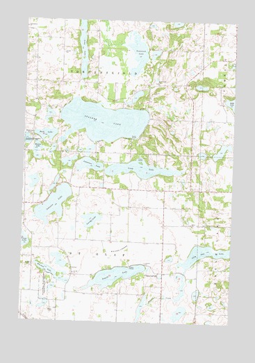
Stalker Lake, MN USGS Topographic Map
Click on map above to begin viewing in our Map Viewer.

This topographic map contains these locations and features:
Feature Name Type Latitude Longitude GNIS ID View Map
Back LakeLakeN46.2025°W95.8619°639549View Map
Bethel CemeteryCemeteryN46.1661°W95.7747°2071830View Map
Bethel ChurchChurchN46.1658°W95.7748°640028View Map
Blacken LakeLakeN46.1464°W95.8598°640235View Map
Evangelical Lutheran Rolling Prairie Congregational CemeteryCemeteryN46.2292°W95.8708°2071825View Map
Free Lutheran CemeteryCemeteryN46.2472°W95.8747°2071826View Map
Hanson LakeLakeN46.1971°W95.8672°644645View Map
Hollo LakeLakeN46.2156°W95.7503°645094View Map
Johannes LakeLakeN46.1898°W95.8360°645663View Map
Johnson LakeLakeN46.1735°W95.8565°645692View Map
Jolly Ann LakeLakeN46.1541°W95.7630°645725View Map
Kvam CemeteryCemeteryN46.1453°W95.8436°2071831View Map
KVAM ChurchChurchN46.1452°W95.8445°646022View Map
Lacey LakeLakeN46.1672°W95.8338°646307View Map
Lakeside CemeteryCemeteryN46.1497°W95.8017°646420View Map
Lakeway Golf CourseLocaleN46.1972°W95.8306°2073110View Map
Long LakeLakeN46.2401°W95.8416°647116View Map
Long LakeLakeN46.1884°W95.8060°647077View Map
Saint Olaf CemeteryCemeteryN46.1486°W95.8695°650926View Map
Saint Olaf Post Office (historical)Post OfficeN46.1819°W95.8056°2072979View Map
School Number 2 (historical)SchoolN46.1728°W95.8022°2112819View Map
School Number 20 (historical)SchoolN46.2211°W95.8692°2112817View Map
School Number 4 (historical)SchoolN46.1375°W95.8639°2112824View Map
School Number 42 (historical)SchoolN46.1397°W95.8003°2112825View Map
School Number 71 (historical)SchoolN46.2233°W95.7989°2112818View Map
School Number 9 (historical)SchoolN46.1647°W95.8744°2112820View Map
Sewell LakeLakeN46.1442°W95.8188°651878View Map
Stalker LakeLakeN46.2081°W95.8286°652537View Map
Stenerson LakeLakeN46.2002°W95.8739°652617View Map
Tamarack LakeLakeN46.2360°W95.8086°653005View Map
Tordenskjold ChurchChurchN46.2241°W95.7962°653240View Map
Tordenskjold Free Mission Church CemeteryCemeteryN46.2239°W95.7956°2071824View Map
Township of Saint OlafCivilN46.1515°W95.8323°665528View Map
Township of TordenskjoldCivilN46.2386°W95.8325°665798View Map
Whitman LakebedLakeN46.1552°W95.8170°654111View Map

Note: Coordinates in the location and feature list above are referenced to NAD83 datum.


Copyright (C) 2008-2024 Ryan Niemi / Sunset Dynamics ... All Rights Reserved