TopoQuest Logo
Do you find TopoQuest useful?
Help keep TopoQuest running and adding new maps/features by donating!
Bitcoin:  19c7KJd3qBynnjoSw5npx9KScwjBe4ifkT
Litecoin:  LXs6TkuXGGXo1vDsWCkWVdjQX94eUKd6ui
Home View Maps Find Maps Find Places Resources & Links


Cedar Fort, Utah Topographic Map

USGS Map Title: Cedar Fort, UT
USGS Map MRC: 40112C1
DRG (GeoTIFF) Download: o40112c1.tif


Neighboring USGS Topographic Map Quads:


  Lowe Peak, UT  
40112D2
 

  Tickville Spring, UT  
40112D1
 

  Jordan Narrows, UT  
40111D8
 

  Mercur, UT  
40112C2
 

  Cedar Fort, UT  
40112C1
 

  Saratoga Springs, UT  
40111C8
 

  Fivemile Pass, UT  
40112B2
 

  Goshen Pass, UT  
40112B1
 

  Soldiers Pass, UT  
40111B8


Map MRC Location:

N41°
W113°
N41°
W112°
H8 H7 H6 H5 H4 H3 H2 H1
G8 G7 G6 G5 G4 G3 G2 G1
F8 F7 F6 F5 F4 F3 F2 F1
E8 E7 E6 E5 E4 E3 E2 E1
D8 D7 D6 D5 D4 D3 D2 D1
C8 C7 C6 C5 C4 C3 C2 C1
B8 B7 B6 B5 B4 B3 B2 B1
A8 A7 A6 A5 A4 A3 A2 A1
N40°
W113°
N40°
W112°

Cedar Fort, UT USGS 1:24K Topographic Map Preview:
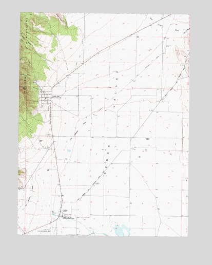
Cedar Fort, UT USGS Topographic Map
Click on map above to begin viewing in our Map Viewer.

This topographic map contains these locations and features:
Feature Name Type Latitude Longitude GNIS ID View Map
Big SpringSpringN40.2622°W112.1007°1425555View Map
Broadmouth CanyonValleyN40.3347°W112.0991°1425987View Map
Camp Floyd CemeteryCemeteryN40.2522°W112.0984°1435240View Map
Camp Floyd State Historical SiteLocaleN40.2527°W112.0994°1426308View Map
Cedar FortPopulated PlaceN40.3272°W112.1044°1455091View Map
Cedar Fort CemeteryCemeteryN40.3225°W112.1087°2766906View Map
Cedar Fort Fire DepartmentBuildingN40.3300°W112.1073°2627437View Map
Cedar Fort Pioneer CemeteryCemeteryN40.3247°W112.1066°2766907View Map
Cedar Fort Station (historical)BuildingN40.3163°W112.0722°1435278View Map
Cedar Valley AirportAirportN40.3572°W112.0178°1434583View Map
Cedar Valley Elementary SchoolSchoolN40.3270°W112.1065°1435290View Map
Cedar Valley Post OfficePost OfficeN40.3253°W112.1028°1455129View Map
City of Eagle MountainCivilN40.3137°W112.0114°2410380View Map
Crafts CanyonValleyN40.3397°W112.0927°1427071View Map
Eagle MountainPopulated PlaceN40.3141°W112.0069°1759211View Map
FairfieldPopulated PlaceN40.2622°W112.0930°1427871View Map
Fairfield CemeteryCemeteryN40.2630°W112.0961°1435518View Map
Freebairns Ranch (historical)LocaleN40.3399°W112.0399°1435554View Map
Lehi DivisionCivilN40.2724°W112.0111°1939383View Map
Spring CreekStreamN40.3311°W112.1088°1432842View Map
Stage Coach Inn State Historical SiteLocaleN40.2605°W112.0930°1432901View Map
The Church of Jesus Christ of Latter Day SaintsChurchN40.3266°W112.1072°1436848View Map
Threemile CanyonValleyN40.3397°W112.0927°1433497View Map
Town of Cedar FortCivilN40.3414°W112.1086°2413183View Map
Unified Fire Authority Fire Station 251 - Eagle MountainBuildingN40.3070°W112.0114°2627350View Map

Note: Coordinates in the location and feature list above are referenced to NAD83 datum.


Copyright (C) 2008-2025 Ryan Niemi / Sunset Dynamics ... All Rights Reserved