TopoQuest Logo
Do you find TopoQuest useful?
Help keep TopoQuest running and adding new maps/features by donating!
Bitcoin:  19c7KJd3qBynnjoSw5npx9KScwjBe4ifkT
Litecoin:  LXs6TkuXGGXo1vDsWCkWVdjQX94eUKd6ui
Home View Maps Find Maps Find Places Resources & Links


Celeste, Georgia Topographic Map

USGS Map Title: Celeste, GA
USGS Map MRC: 33082G7
DRG (GeoTIFF) Download: o33082g7.tif


Neighboring USGS Topographic Map Quads:


  Vesta, GA  
33082H8
 

  Jacksons Crossroads, GA  
33082H7
 

  Broad, GA  
33082H6
 

  Rayle, GA  
33082G8
 

  Celeste, GA  
33082G7
 

  Tignall, GA  
33082G6
 

  Philomath, GA  
33082F8
 

  Washington West, GA  
33082F7
 

  Washington East, GA  
33082F6


Map MRC Location:

N34°
W83°
N34°
W82°
H8 H7 H6 H5 H4 H3 H2 H1
G8 G7 G6 G5 G4 G3 G2 G1
F8 F7 F6 F5 F4 F3 F2 F1
E8 E7 E6 E5 E4 E3 E2 E1
D8 D7 D6 D5 D4 D3 D2 D1
C8 C7 C6 C5 C4 C3 C2 C1
B8 B7 B6 B5 B4 B3 B2 B1
A8 A7 A6 A5 A4 A3 A2 A1
N33°
W83°
N33°
W82°

Celeste, GA USGS 1:24K Topographic Map Preview:
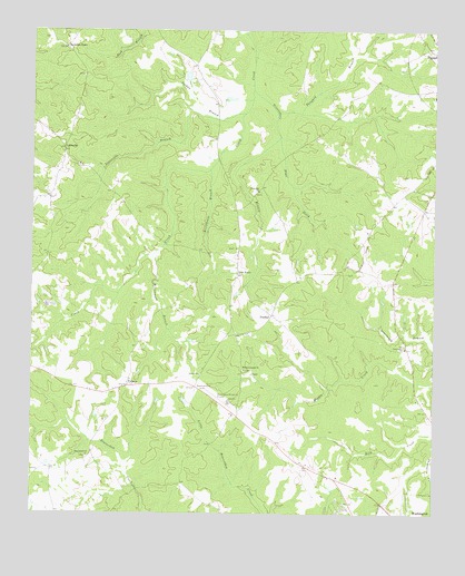
Celeste, GA USGS Topographic Map
Click on map above to begin viewing in our Map Viewer.

This topographic map contains these locations and features:
Feature Name Type Latitude Longitude GNIS ID View Map
Armstrong (historical)Populated PlaceN33.8101°W82.7624°342734View Map
Beaverdam CemeteryCemeteryN33.7646°W82.8579°342735View Map
Beaverdam ChurchChurchN33.7648°W82.8574°354511View Map
Bessie (historical)Populated PlaceN33.8148°W82.8110°342737View Map
BrickhousePopulated PlaceN33.7751°W82.8107°342740View Map
Brickhouse BranchStreamN33.8390°W82.8199°311779View Map
CelestePopulated PlaceN33.7829°W82.8449°326213View Map
Flint Hill ChurchChurchN33.8335°W82.8046°314225View Map
Greensboro BranchStreamN33.8598°W82.8065°314870View Map
Grimaude LakeReservoirN33.8633°W82.8268°339460View Map
Grimaude Lake DamDamN33.8618°W82.8265°339459View Map
Hilliard Station ChurchChurchN33.7873°W82.8088°356303View Map
Jackson HeightsPopulated PlaceN33.7521°W82.7796°342766View Map
Jacksons StoreLocaleN33.8704°W82.8646°316025View Map
Jordan BranchStreamN33.8523°W82.8176°316263View Map
Kingdom Hall ChurchChurchN33.7857°W82.8221°342769View Map
LinesvillePopulated PlaceN33.8440°W82.8651°326370View Map
Linesville BranchStreamN33.8537°W82.8090°316911View Map
Lyonsville ChurchChurchN33.8401°W82.8604°342772View Map
New TownPopulated PlaceN33.8121°W82.8107°332493View Map
New Town ChurchChurchN33.8185°W82.8115°342781View Map
Newtown CemeteryCemeteryN33.8187°W82.8118°342782View Map
Newtown Fire DepartmentBuildingN33.8134°W82.8106°2604138View Map
PratherPopulated PlaceN33.8015°W82.8001°332755View Map
Sims DitchStreamN33.8476°W82.7979°323024View Map
Tanyard BranchStreamN33.8540°W82.7993°323914View Map
Twin Oaks ChurchChurchN33.7929°W82.7585°324458View Map
Victory ChurchChurchN33.7862°W82.8221°324699View Map
Washington-Wilkes County AirportAirportN33.7799°W82.8140°326834View Map
Washington-Wilkes Orchard LakeReservoirN33.7901°W82.8565°338787View Map
Washinton-Wilkes Orchard DamDamN33.7901°W82.8565°338786View Map
White Rock ChurchChurchN33.7740°W82.8521°342819View Map
Wilkes County ChurchChurchN33.8218°W82.7563°342821View Map
Williamson BranchStreamN33.8185°W82.8346°325374View Map

Note: Coordinates in the location and feature list above are referenced to NAD83 datum.


Copyright (C) 2008-2025 Ryan Niemi / Sunset Dynamics ... All Rights Reserved