TopoQuest Logo
Do you find TopoQuest useful?
Help keep TopoQuest running and adding new maps/features by donating!
Bitcoin:  19c7KJd3qBynnjoSw5npx9KScwjBe4ifkT
Litecoin:  LXs6TkuXGGXo1vDsWCkWVdjQX94eUKd6ui
Home View Maps Find Maps Find Places Resources & Links


Clifton City, Missouri Topographic Map

USGS Map Title: Clifton City, MO
USGS Map MRC: 38093G1
DRG (GeoTIFF) Download: o38093g1.tif


Neighboring USGS Topographic Map Quads:


  Longwood, MO  
38093H2
 

  Nelson, MO  
38093H1
 

  Pilot Grove North, MO  
38092H8
 

  Beaman, MO  
38093G2
 

  Clifton City, MO  
38093G1
 

  Pilot Grove South, MO  
38092G8
 

  Sedalia East, MO  
38093F2
 

  Otterville West, MO  
38093F1
 

  Otterville East, MO  
38092F8


Map MRC Location:

N39°
W94°
N39°
W93°
H8 H7 H6 H5 H4 H3 H2 H1
G8 G7 G6 G5 G4 G3 G2 G1
F8 F7 F6 F5 F4 F3 F2 F1
E8 E7 E6 E5 E4 E3 E2 E1
D8 D7 D6 D5 D4 D3 D2 D1
C8 C7 C6 C5 C4 C3 C2 C1
B8 B7 B6 B5 B4 B3 B2 B1
A8 A7 A6 A5 A4 A3 A2 A1
N38°
W94°
N38°
W93°

Clifton City, MO USGS 1:24K Topographic Map Preview:
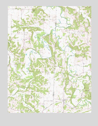
Clifton City, MO USGS Topographic Map
Click on map above to begin viewing in our Map Viewer.

This topographic map contains these locations and features:
Feature Name Type Latitude Longitude GNIS ID View Map
BushLocaleN38.7728°W93.0141°740336View Map
Clifton CityPopulated PlaceN38.7647°W93.0413°739984View Map
Clifton City Fire DepartmentBuildingN38.7643°W93.0417°2621690View Map
Dickman Lake DamDamN38.8350°W93.0919°764491View Map
Dilthey Lake DamDamN38.8584°W93.0552°764492View Map
Fortune Lake DamDamN38.8550°W93.0685°762339View Map
Fortunes LakeReservoirN38.8555°W93.0692°762340View Map
Irwin CemeteryCemeteryN38.7963°W93.0677°720170View Map
Johnson BranchStreamN38.7909°W93.0219°720351View Map
Lamine CemeteryCemeteryN38.8131°W93.0530°720777View Map
Lamine ChurchChurchN38.8042°W93.0488°720778View Map
Lamine School (historical)SchoolN38.8040°W93.0524°743884View Map
Landon BranchStreamN38.8414°W93.0663°720788View Map
Lee CemeteryCemeteryN38.7559°W93.0837°720884View Map
LookoutLocaleN38.8361°W93.1008°721563View Map
Lovelace School (historical)SchoolN38.7753°W93.0824°745409View Map
Memorial ChurchChurchN38.8706°W93.0894°729776View Map
Mount Moriah ChurchChurchN38.7759°W93.0035°722788View Map
Muddy CreekStreamN38.8467°W93.0563°729787View Map
Olive BranchStreamN38.7703°W93.1169°723804View Map
Pipkin BranchStreamN38.8050°W93.0319°724428View Map
Reinharot School (historical)SchoolN38.8153°W93.0130°754976View Map
Saint Josephs CemeteryCemeteryN38.7758°W93.0407°725808View Map
Scott SchoolSchoolN38.8692°W93.0883°726153View Map
Shaver CreekStreamN38.7914°W93.0871°726284View Map
Sowers CemeteryCemeteryN38.8331°W93.0318°726822View Map
Sweeney (historical)LocaleN38.7567°W93.0241°743792View Map
Township of Bowling GreenCivilN38.7545°W93.1137°767160View Map
Township of Heath CreekCivilN38.8651°W93.1095°767166View Map
Union ChurchChurchN38.8586°W93.0713°727994View Map
Vollmer School (historical)SchoolN38.8556°W93.0216°743885View Map
Willow BranchStreamN38.8220°W93.1221°728934View Map

Note: Coordinates in the location and feature list above are referenced to NAD83 datum.


Copyright (C) 2008-2025 Ryan Niemi / Sunset Dynamics ... All Rights Reserved