TopoQuest Logo
Do you find TopoQuest useful?
Help keep TopoQuest running and adding new maps/features by donating!
Bitcoin:  19c7KJd3qBynnjoSw5npx9KScwjBe4ifkT
Litecoin:  LXs6TkuXGGXo1vDsWCkWVdjQX94eUKd6ui
Home View Maps Find Maps Find Places Resources & Links


Pilot Grove North, Missouri Topographic Map

USGS Map Title: Pilot Grove North, MO
USGS Map MRC: 38092H8
DRG (GeoTIFF) Download: o38092h8.tif


Neighboring USGS Topographic Map Quads:


  Napton, MO  
39093A1
 

  Arrow Rock, MO  
39092A8
 

  Franklin, MO  
39092A7
 

  Nelson, MO  
38093H1
 

  Pilot Grove North, MO  
38092H8
 

  Billingsville, MO  
38092H7
 

  Clifton City, MO  
38093G1
 

  Pilot Grove South, MO  
38092G8
 

  Bunceton, MO  
38092G7


Map MRC Location:

N39°
W93°
N39°
W92°
H8 H7 H6 H5 H4 H3 H2 H1
G8 G7 G6 G5 G4 G3 G2 G1
F8 F7 F6 F5 F4 F3 F2 F1
E8 E7 E6 E5 E4 E3 E2 E1
D8 D7 D6 D5 D4 D3 D2 D1
C8 C7 C6 C5 C4 C3 C2 C1
B8 B7 B6 B5 B4 B3 B2 B1
A8 A7 A6 A5 A4 A3 A2 A1
N38°
W93°
N38°
W92°

Pilot Grove North, MO USGS 1:24K Topographic Map Preview:
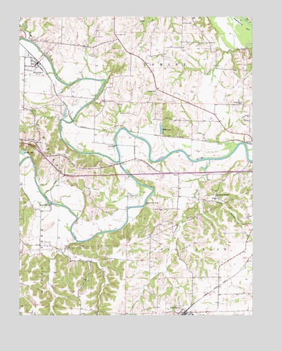
Pilot Grove North, MO USGS Topographic Map
Click on map above to begin viewing in our Map Viewer.

This topographic map contains these locations and features:
Feature Name Type Latitude Longitude GNIS ID View Map
Becker School (historical)SchoolN38.8925°W92.9442°743876View Map
BlackwaterPopulated PlaceN38.9803°W92.9908°714334View Map
Blackwater Elementary SchoolSchoolN38.9821°W92.9934°2571131View Map
Blackwater Post OfficePost OfficeN38.9810°W92.9903°2782606View Map
Blackwater RiverStreamN38.9392°W92.9471°729709View Map
Blackwater Rural Fire DepartmentBuildingN38.9806°W92.9917°2621691View Map
Brush CreekStreamN38.9056°W92.9694°714846View Map
Bryant Bottom BridgeBridgeN38.9220°W92.9330°755015View Map
Buffalo Prairie School (historical)SchoolN38.9045°W92.9963°743878View Map
Chouteau BranchStreamN38.9250°W92.9041°715802View Map
Chouteau CreekStreamN38.9400°W92.8985°715803View Map
Chouteau School (historical)SchoolN38.9267°W92.9184°743879View Map
Chouteau SpringsPopulated PlaceN38.9250°W92.8949°740740View Map
City of BlackwaterCivilN38.9792°W92.9920°2394182View Map
Corioli (historical)Populated PlaceN38.9042°W92.9891°740524View Map
Dicks BridgeBridgeN38.9461°W92.9482°755048View Map
Fenical Lake DamDamN38.9384°W92.9819°762258View Map
Flat CreekStreamN38.9897°W92.9932°717988View Map
Herndon CemeteryCemeteryN38.9592°W92.8769°719401View Map
Lamine ChurchChurchN38.9689°W92.9269°720779View Map
Locust Grove School (historical)SchoolN38.9636°W92.8810°721387View Map
Oakwood School Number One (historical)SchoolN38.9975°W92.9129°743882View Map
Old Lamine CemeteryCemeteryN38.9683°W92.9275°2681480View Map
Peninsula ChurchChurchN38.9481°W92.9921°724200View Map
Peninsula School (historical)SchoolN38.9272°W92.9632°743880View Map
Pilot Grove High SchoolSchoolN38.8753°W92.9068°2571142View Map
Pilot Grove Middle SchoolSchoolN38.8753°W92.9076°2571141View Map
Pilot Grove Number 1 CemeteryCemeteryN38.8785°W92.9131°2681507View Map
Pleasant Grove School (historical)SchoolN38.9692°W92.9266°743881View Map
Roberts Bluff BridgeBridgeN38.9217°W92.9835°755378View Map
Saint Martin CemeteryCemeteryN38.9170°W92.8780°725822View Map
Salt BranchStreamN38.9295°W92.9366°725965View Map
Simmons School (historical)SchoolN38.8911°W92.9002°743877View Map
Slaughterhouse BendBendN38.9959°W92.8791°726538View Map
Township of LamineCivilN38.9899°W92.9323°766531View Map
Township of Pilot GroveCivilN38.8953°W92.9000°766536View Map
Widel LakeLakeN38.9530°W92.9239°728815View Map
Wilson LakeLakeN38.9434°W92.9984°728978View Map

Note: Coordinates in the location and feature list above are referenced to NAD83 datum.


Copyright (C) 2008-2025 Ryan Niemi / Sunset Dynamics ... All Rights Reserved