TopoQuest Logo
Do you find TopoQuest useful?
Help keep TopoQuest running and adding new maps/features by donating!
Bitcoin:  19c7KJd3qBynnjoSw5npx9KScwjBe4ifkT
Litecoin:  LXs6TkuXGGXo1vDsWCkWVdjQX94eUKd6ui
Home View Maps Find Maps Find Places Resources & Links


Coleman, Georgia Topographic Map

USGS Map Title: Coleman, GA
USGS Map MRC: 31084F8
DRG (GeoTIFF) Download: o31084f8.tif


Neighboring USGS Topographic Map Quads:


  Hatcher, GA  
31085G1
 

  Morris, GA  
31084G8
 

  Cuthbert, GA  
31084G7
 

  Fort Gaines NE, GA  
31085F1
 

  Coleman, GA  
31084F8
 

  Carnegie, GA  
31084F7
 

  Fort Gaines, GA  
31085E1
 

  Zetto, GA  
31084E8
 

  Bluffton, GA  
31084E7


Map MRC Location:

N32°
W85°
N32°
W84°
H8 H7 H6 H5 H4 H3 H2 H1
G8 G7 G6 G5 G4 G3 G2 G1
F8 F7 F6 F5 F4 F3 F2 F1
E8 E7 E6 E5 E4 E3 E2 E1
D8 D7 D6 D5 D4 D3 D2 D1
C8 C7 C6 C5 C4 C3 C2 C1
B8 B7 B6 B5 B4 B3 B2 B1
A8 A7 A6 A5 A4 A3 A2 A1
N31°
W85°
N31°
W84°

Coleman, GA USGS 1:24K Topographic Map Preview:
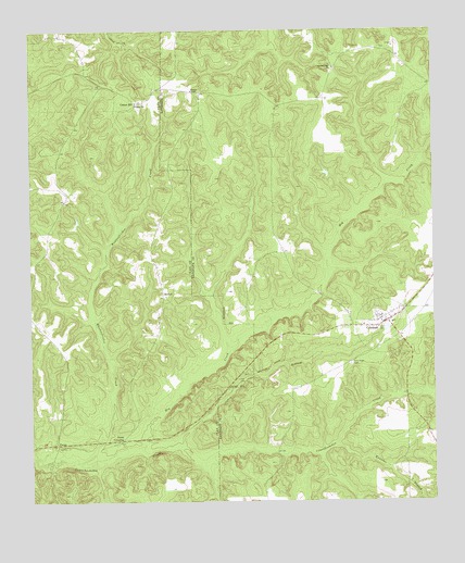
Coleman, GA USGS Topographic Map
Click on map above to begin viewing in our Map Viewer.

This topographic map contains these locations and features:
Feature Name Type Latitude Longitude GNIS ID View Map
BethelPopulated PlaceN31.6796°W84.9591°326182View Map
Bethel ChurchChurchN31.6796°W84.9580°344799View Map
Caney BranchStreamN31.6396°W84.9666°312299View Map
Clay CountyCivilN31.6263°W84.9801°344805View Map
ColemanPopulated PlaceN31.6729°W84.8891°312820View Map
Coleman Census Designated PlaceCensusN31.6717°W84.8902°2629784View Map
Cotton HillPopulated PlaceN31.7310°W84.9669°331463View Map
Ebenezer CemeteryCemeteryN31.7454°W84.8910°344733View Map
Ebenezer Church (historical)ChurchN31.7452°W84.8910°344734View Map
Hog CreekStreamN31.6393°W84.9663°315504View Map
Jones CrossingPopulated PlaceN31.6416°W84.9721°326347View Map
Knowles BranchStreamN31.6399°W84.9058°316504View Map
Little CreekStreamN31.6796°W84.9444°344824View Map
New Hope Baptist Church (historical)ChurchN31.6621°W84.9002°344750View Map
New Hope CemeteryCemeteryN31.6618°W84.9008°319356View Map
PecanPopulated PlaceN31.6407°W84.9921°326461View Map
Pecan CemeteryCemeteryN31.6404°W84.9883°344834View Map
Pleasant Hill Baptist Church CemeteryCemeteryN31.7400°W84.9060°2585314View Map
Pleasant Hill ChurchChurchN31.7402°W84.9058°320920View Map
Randolph County Fire Department Coleman StationBuildingN31.6731°W84.8893°2604797View Map
Shiloh CemeteryCemeteryN31.7296°W84.9660°344835View Map
Shiloh ChurchChurchN31.7302°W84.9669°322901View Map
Shorter ChapelChurchN31.7341°W84.9496°322959View Map
Singletary CemeteryCemeteryN31.6585°W84.9683°344836View Map
Waukeefriskee CreekStreamN31.6354°W84.9855°324928View Map
Wolf BranchStreamN31.6377°W84.9110°344782View Map

Note: Coordinates in the location and feature list above are referenced to NAD83 datum.


Copyright (C) 2008-2024 Ryan Niemi / Sunset Dynamics ... All Rights Reserved