TopoQuest Logo
Do you find TopoQuest useful?
Help keep TopoQuest running and adding new maps/features by donating!
Bitcoin:  19c7KJd3qBynnjoSw5npx9KScwjBe4ifkT
Litecoin:  LXs6TkuXGGXo1vDsWCkWVdjQX94eUKd6ui
Home View Maps Find Maps Find Places Resources & Links


Carnegie, Georgia Topographic Map

USGS Map Title: Carnegie, GA
USGS Map MRC: 31084F7
DRG (GeoTIFF) Download: o31084f7.tif


Neighboring USGS Topographic Map Quads:


  Morris, GA  
31084G8
 

  Cuthbert, GA  
31084G7
 

  Brooksville, GA  
31084G6
 

  Coleman, GA  
31084F8
 

  Carnegie, GA  
31084F7
 

  Martins Crossroads, GA  
31084F6
 

  Zetto, GA  
31084E8
 

  Bluffton, GA  
31084E7
 

  Edison, GA  
31084E6


Map MRC Location:

N32°
W85°
N32°
W84°
H8 H7 H6 H5 H4 H3 H2 H1
G8 G7 G6 G5 G4 G3 G2 G1
F8 F7 F6 F5 F4 F3 F2 F1
E8 E7 E6 E5 E4 E3 E2 E1
D8 D7 D6 D5 D4 D3 D2 D1
C8 C7 C6 C5 C4 C3 C2 C1
B8 B7 B6 B5 B4 B3 B2 B1
A8 A7 A6 A5 A4 A3 A2 A1
N31°
W85°
N31°
W84°

Carnegie, GA USGS 1:24K Topographic Map Preview:
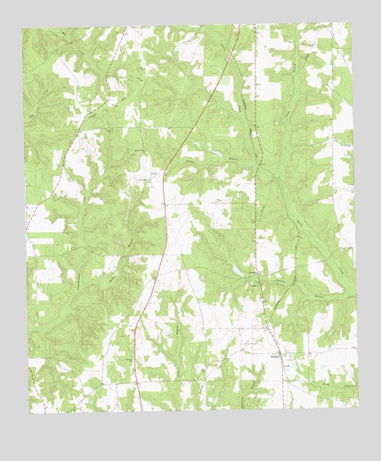
Carnegie, GA USGS Topographic Map
Click on map above to begin viewing in our Map Viewer.

This topographic map contains these locations and features:
Feature Name Type Latitude Longitude GNIS ID View Map
Andrews Airport (historical)AirportN31.6468°W84.7908°344715View Map
Bass StorePopulated PlaceN31.6757°W84.8230°344717View Map
CarnegiePopulated PlaceN31.6429°W84.7791°354995View Map
Carnegie Baptist ChurchChurchN31.6429°W84.7771°344725View Map
Carnegie Baptist Church CemeteryCemeteryN31.6443°W84.7773°2585283View Map
Coffin LakeReservoirN31.7084°W84.8017°342066View Map
Coffin Lake DamDamN31.7085°W84.7999°342065View Map
Cuthbert DivisionCivilN31.7287°W84.8221°1936209View Map
Grubb (historical)Populated PlaceN31.6710°W84.7730°344739View Map
Lower Chattahoochee Regional AirportAirportN31.7012°W84.8255°326806View Map
McDonald LakeReservoirN31.7098°W84.8504°340881View Map
McDonald Lake DamDamN31.7085°W84.8499°340880View Map
Mitchell Grove Baptist Church CemeteryCemeteryN31.7092°W84.8281°2585309View Map
Mitchell Grove ChurchChurchN31.7099°W84.8280°318344View Map
Mobley School (historical)SchoolN31.6682°W84.8277°344747View Map
Mount Hebron ChurchChurchN31.6693°W84.7866°318657View Map
Mount Hebron Church CemeteryCemeteryN31.6697°W84.7864°2585311View Map
Mount Zion Church (historical)ChurchN31.7057°W84.8196°344749View Map
Pleasant Grove Church (historical)ChurchN31.6335°W84.8727°344757View Map
Randolph County Fire Department Carnegie StationBuildingN31.6429°W84.7789°2604430View Map
Rhodes BranchStreamN31.6666°W84.8538°321549View Map
Saint Lukes ChurchChurchN31.6657°W84.7863°322157View Map
Saint Lukes School (historical)SchoolN31.6799°W84.7883°344766View Map
Saint Marys Church (historical)ChurchN31.6435°W84.8346°344767View Map
Tabor BranchStreamN31.7043°W84.7866°323880View Map
Tigner School (historical)SchoolN31.6574°W84.8358°344776View Map
Town BranchStreamN31.6999°W84.7774°324242View Map
Weatherbys Mill (historical)LocaleN31.6682°W84.7924°344781View Map
Wohlender LakeReservoirN31.6702°W84.7950°342064View Map
Wohlender Lake DamDamN31.6685°W84.7933°342063View Map
Yankee BranchStreamN31.6632°W84.7508°325599View Map

Note: Coordinates in the location and feature list above are referenced to NAD83 datum.


Copyright (C) 2008-2024 Ryan Niemi / Sunset Dynamics ... All Rights Reserved