TopoQuest Logo
Do you find TopoQuest useful?
Help keep TopoQuest running and adding new maps/features by donating!
Bitcoin:  19c7KJd3qBynnjoSw5npx9KScwjBe4ifkT
Litecoin:  LXs6TkuXGGXo1vDsWCkWVdjQX94eUKd6ui
Home View Maps Find Maps Find Places Resources & Links


Mahaffey, Pennsylvania Topographic Map

USGS Map Title: Mahaffey, PA
USGS Map MRC: 40078H6
DRG (GeoTIFF) Download: o40078h6.tif


Neighboring USGS Topographic Map Quads:


  Du Bois, PA  
41078A7
 

  Luthersburg, PA  
41078A6
 

  Elliott Park, PA  
41078A5
 

  McGees Mills, PA  
40078H7
 

  Mahaffey, PA  
40078H6
 

  Curwensville, PA  
40078H5
 

  Burnside, PA  
40078G7
 

  Westover, PA  
40078G6
 

  Irvona, PA  
40078G5


Map MRC Location:

N41°
W79°
N41°
W78°
H8 H7 H6 H5 H4 H3 H2 H1
G8 G7 G6 G5 G4 G3 G2 G1
F8 F7 F6 F5 F4 F3 F2 F1
E8 E7 E6 E5 E4 E3 E2 E1
D8 D7 D6 D5 D4 D3 D2 D1
C8 C7 C6 C5 C4 C3 C2 C1
B8 B7 B6 B5 B4 B3 B2 B1
A8 A7 A6 A5 A4 A3 A2 A1
N40°
W79°
N40°
W78°

Mahaffey, PA USGS 1:24K Topographic Map Preview:
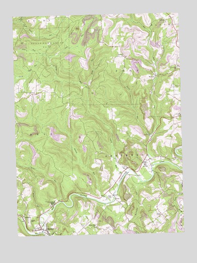
Mahaffey, PA USGS Topographic Map
Click on map above to begin viewing in our Map Viewer.

This topographic map contains these locations and features:
Feature Name Type Latitude Longitude GNIS ID View Map
Banner Ridge ChurchChurchN40.8792°W78.6909°1198355View Map
Bell RunStreamN40.9134°W78.6472°1169154View Map
Bells LandingPopulated PlaceN40.9170°W78.6495°1169185View Map
Bells Landing Mine StationLocaleN40.9165°W78.6414°1213000View Map
BowerPopulated PlaceN40.8948°W78.6753°1203129View Map
Camp CorblyLocaleN40.8973°W78.6775°1170996View Map
Camp Meeting GroundsLocaleN40.8940°W78.7228°1171051View Map
Cherry CornerPopulated PlaceN40.8859°W78.6411°1203256View Map
Chest CreekStreamN40.8770°W78.7306°1171692View Map
Community Volunteer Fire Department of Mahaffey Station 29BuildingN40.8789°W78.7311°2645432View Map
Curry RunPopulated PlaceN40.9126°W78.6659°1172845View Map
Curry RunStreamN40.9092°W78.6675°1172848View Map
Daily RunStreamN40.9595°W78.6945°1172887View Map
Fryor RunStreamN40.9781°W78.7275°1175320View Map
Goffe SchoolSchoolN40.9959°W78.6345°1175776View Map
Haslett RunStreamN40.8940°W78.6786°1176636View Map
Hickory Number 1 Mine StationLocaleN40.9159°W78.6347°1213003View Map
Irish RunStreamN40.9762°W78.7220°1177832View Map
IrishtownPopulated PlaceN40.9762°W78.6659°1177838View Map
Laurel Branch RunStreamN40.9976°W78.7448°1178923View Map
Laurel RunStreamN40.8945°W78.7170°1178984View Map
Mahaffey Junction StationLocaleN40.8842°W78.7273°1213002View Map
McCracken RunStreamN40.9045°W78.6556°1180668View Map
MiddletonPopulated PlaceN40.8856°W78.7459°1181068View Map
Miller RunStreamN40.8878°W78.7298°1181227View Map
Nugent Mine StationLocaleN40.8792°W78.7414°1213001View Map
Poplar RunStreamN40.9303°W78.6464°1184260View Map
Rock Springs CemeteryCemeteryN40.9555°W78.7376°1185297View Map
RowlesLocaleN40.9556°W78.7370°1212999View Map
Saint Bonaventure CemeteryCemeteryN40.9692°W78.6270°1185836View Map
State Game Lands Number 87ParkN40.9834°W78.7239°1188538View Map
Township of GreenwoodCivilN40.9128°W78.6631°1216236View Map
Township of PennCivilN40.9650°W78.6411°1216244View Map
WalltownPopulated PlaceN40.9648°W78.6428°1190535View Map
Woods CemeteryCemeteryN40.9924°W78.6282°1191760View Map

Note: Coordinates in the location and feature list above are referenced to NAD83 datum.


Copyright (C) 2008-2025 Ryan Niemi / Sunset Dynamics ... All Rights Reserved