TopoQuest Logo
Do you find TopoQuest useful?
Help keep TopoQuest running and adding new maps/features by donating!
Bitcoin:  19c7KJd3qBynnjoSw5npx9KScwjBe4ifkT
Litecoin:  LXs6TkuXGGXo1vDsWCkWVdjQX94eUKd6ui
Home View Maps Find Maps Find Places Resources & Links


Haile, Louisiana Topographic Map

USGS Map Title: Haile, LA
USGS Map MRC: 32092G2
DRG (GeoTIFF) Download: o32092g2.tif


Neighboring USGS Topographic Map Quads:


  Marion West, LA  
32092H3
 

  Marion East, LA  
32092H2
 

  Fish Lake, LA  
32092H1
 

  De Loutre, LA  
32092G3
 

  Haile, LA  
32092G2
 

  Harrell Lake, LA  
32092G1
 

  Point, LA  
32092F3
 

  Rocky Branch, LA  
32092F2
 

  Sterlington, LA  
32092F1


Map MRC Location:

N33°
W93°
N33°
W92°
H8 H7 H6 H5 H4 H3 H2 H1
G8 G7 G6 G5 G4 G3 G2 G1
F8 F7 F6 F5 F4 F3 F2 F1
E8 E7 E6 E5 E4 E3 E2 E1
D8 D7 D6 D5 D4 D3 D2 D1
C8 C7 C6 C5 C4 C3 C2 C1
B8 B7 B6 B5 B4 B3 B2 B1
A8 A7 A6 A5 A4 A3 A2 A1
N32°
W93°
N32°
W92°

Haile, LA USGS 1:24K Topographic Map Preview:
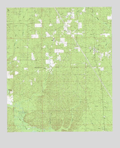
Haile, LA USGS Topographic Map
Click on map above to begin viewing in our Map Viewer.

This topographic map contains these locations and features:
Feature Name Type Latitude Longitude GNIS ID View Map
Abstent CemeteryCemeteryN32.8595°W92.1931°553257View Map
Buffalo HoleBendN32.7701°W92.2293°544878View Map
Crow CemeteryCemeteryN32.8693°W92.2379°554146View Map
HailePopulated PlaceN32.8310°W92.1462°544859View Map
Liberty CemeteryCemeteryN32.8215°W92.1871°544068View Map
Liberty ChurchChurchN32.8221°W92.1865°544863View Map
Lingrove ChurchChurchN32.8229°W92.2268°544864View Map
LinvillePopulated PlaceN32.8421°W92.1929°555043View Map
Linville Lookout TowerTowerN32.8201°W92.2465°558796View Map
Linville Post OfficePost OfficeN32.8418°W92.1932°1630770View Map
Lonnie BranchStreamN32.7551°W92.1993°544865View Map
Macedonia CemeteryCemeteryN32.8232°W92.2079°544866View Map
MonroePopulated PlaceN32.8151°W92.2057°544877View Map
Odom CreekStreamN32.8582°W92.2265°544868View Map
Rock CreekStreamN32.7740°W92.2318°555818View Map
Saint Johns ChurchChurchN32.7954°W92.2393°544870View Map
Spikner CemeteryCemeteryN32.8208°W92.2434°556109View Map
Tenmile CreekStreamN32.7535°W92.1843°544872View Map
Turkey CreekStreamN32.8393°W92.2393°544873View Map
Union Church (historical)ChurchN32.8521°W92.1815°544874View Map
UpcoPopulated PlaceN32.7646°W92.1357°544875View Map

Note: Coordinates in the location and feature list above are referenced to NAD83 datum.


Copyright (C) 2008-2025 Ryan Niemi / Sunset Dynamics ... All Rights Reserved