TopoQuest Logo
Do you find TopoQuest useful?
Help keep TopoQuest running and adding new maps/features by donating!
Bitcoin:  19c7KJd3qBynnjoSw5npx9KScwjBe4ifkT
Litecoin:  LXs6TkuXGGXo1vDsWCkWVdjQX94eUKd6ui
Home View Maps Find Maps Find Places Resources & Links


Fort Valley West, Georgia Topographic Map

USGS Map Title: Fort Valley West, GA
USGS Map MRC: 32083E8
DRG (GeoTIFF) Download: o32083e8.tif


Neighboring USGS Topographic Map Quads:


  Roberta, GA  
32084F1
 

  Knoxville, GA  
32083F8
 

  Byron, GA  
32083F7
 

  Reynolds, GA  
32084E1
 

  Fort Valley West, GA  
32083E8
 

  Fort Valley East, GA  
32083E7
 

  Garden Valley, GA  
32084D1
 

  Marshallville, GA  
32083D8
 

  Perry West, GA  
32083D7


Map MRC Location:

N33°
W84°
N33°
W83°
H8 H7 H6 H5 H4 H3 H2 H1
G8 G7 G6 G5 G4 G3 G2 G1
F8 F7 F6 F5 F4 F3 F2 F1
E8 E7 E6 E5 E4 E3 E2 E1
D8 D7 D6 D5 D4 D3 D2 D1
C8 C7 C6 C5 C4 C3 C2 C1
B8 B7 B6 B5 B4 B3 B2 B1
A8 A7 A6 A5 A4 A3 A2 A1
N32°
W84°
N32°
W83°

Fort Valley West, GA USGS 1:24K Topographic Map Preview:
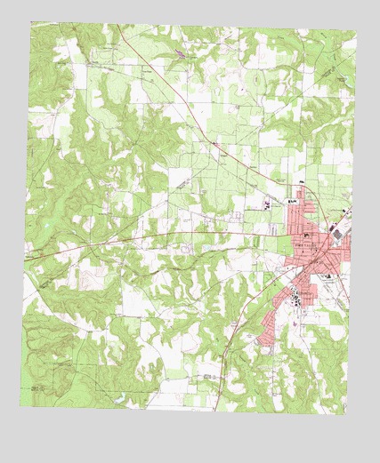
Fort Valley West, GA USGS Topographic Map
Click on map above to begin viewing in our Map Viewer.

This topographic map contains these locations and features:
Feature Name Type Latitude Longitude GNIS ID View Map
Alice Ingram SubdivisionPopulated PlaceN32.5288°W83.8921°343119View Map
Beckley Farms AirportAirportN32.5013°W83.9320°2646204View Map
Benevolence CemeteryCemeteryN32.6115°W83.9852°342907View Map
Benevolence ChurchChurchN32.6121°W83.9849°354549View Map
Burney's GreenhouseBuildingN32.6067°W83.8964°2674799View Map
Chamlee ChurchChurchN32.5718°W83.8927°355106View Map
Church of GodChurchN32.5376°W83.8757°343126View Map
City of Fort ValleyCivilN32.5522°W83.8815°2403649View Map
Congregational Methodist Church (historical)ChurchN32.5557°W83.8896°343127View Map
Cool Spring CemeteryCemeteryN32.6146°W83.9388°342917View Map
Cool Spring ChurchChurchN32.6149°W83.9380°312932View Map
Crawford County Fire Department Station 7BuildingN32.6116°W83.9789°2604231View Map
First Baptist Church of Fort ValleyChurchN32.5521°W83.8894°343130View Map
First Methodist ChurchChurchN32.5535°W83.8902°343131View Map
Fort ValleyPopulated PlaceN32.5538°W83.8874°355881View Map
Fort Valley ChurchChurchN32.5821°W83.8927°343132View Map
Fort Valley City HallBuildingN32.5540°W83.8882°343133View Map
Fort Valley Female College (historical)SchoolN32.5540°W83.8882°343134View Map
Fort Valley Female Seminary (historical)SchoolN32.5515°W83.8899°343135View Map
Fort Valley Fire Department Station 1BuildingN32.5543°W83.8882°2603913View Map
Fort Valley Fire Department Station 2BuildingN32.5530°W83.8839°2603726View Map
Fort Valley High School (historical)SchoolN32.5585°W83.8921°343136View Map
Fort Valley Male Academy (historical)SchoolN32.5518°W83.8935°343137View Map
Fort Valley Middle SchoolSchoolN32.5690°W83.8971°343138View Map
Fort Valley Police DepartmentBuildingN32.5541°W83.8876°2733563View Map
Fort Valley Post OfficePost OfficeN32.5540°W83.8877°352140View Map
Fort Valley Primary SchoolSchoolN32.5524°W83.8932°343139View Map
Fort Valley Shopping CenterLocaleN32.5757°W83.8944°343140View Map
Fort Valley State UniversitySchoolN32.5388°W83.8944°355882View Map
Fort Valley State University PoliceBuildingN32.5370°W83.8982°2734011View Map
Gassick CemeteryCemeteryN32.6038°W83.9830°355984View Map
Grady Institute (historical)SchoolN32.5515°W83.8899°343143View Map
GroganPopulated PlaceN32.5854°W83.9255°331875View Map
Harris ChapelChurchN32.6171°W83.9674°315190View Map
Harris Chapel CemeteryCemeteryN32.6171°W83.9680°342932View Map
HartleyPopulated PlaceN32.5796°W83.9146°331921View Map
Hebron ChurchChurchN32.6121°W83.9707°342933View Map
Hunnicutt LakeReservoirN32.5038°W83.9611°341013View Map
Hunnicutt Lake DamDamN32.5018°W83.9616°341012View Map
Hunt Elementary SchoolSchoolN32.5451°W83.8830°343145View Map
Hunt SchoolSchoolN32.5451°W83.8846°315826View Map
Indian CreekStreamN32.6163°W83.8835°315894View Map
Indian OaksPopulated PlaceN32.5560°W83.8760°343146View Map
Jones CemeteryCemeteryN32.5713°W83.9924°316212View Map
Kingdom Hall ChurchChurchN32.5399°W83.9085°343149View Map
Lee PopePopulated PlaceN32.6121°W83.9557°332199View Map
Matthews School (historical)SchoolN32.5299°W83.9624°334716View Map
Mount Olive Methodist Episcopal ChurchChurchN32.5610°W83.8902°343151View Map
Mount Zion CemeteryCemeteryN32.5635°W83.9685°342944View Map
Mount Zion ChurchChurchN32.5632°W83.9685°318982View Map
Oak Lawn CemeteryCemeteryN32.5465°W83.9021°319839View Map
Oak Lawn ChurchChurchN32.5307°W83.9632°319840View Map
Peach County CourthouseBuildingN32.5535°W83.8882°343154View Map
Peach County Fire Department Station 3BuildingN32.5299°W83.9028°2604625View Map
Peach County Fire Station 6BuildingN32.5741°W83.9039°2604628View Map
Peach County High SchoolSchoolN32.5671°W83.9074°343155View Map
Peach County JailBuildingN32.5546°W83.8838°343157View Map
Peach County Sheriff's DepartmentBuildingN32.5484°W83.8771°2733713View Map
Peach County Training School (historical)SchoolN32.5410°W83.8971°343158View Map
Peach Regional Medical CenterHospitalN32.5666°W83.8781°343156View Map
Peach ValleyPopulated PlaceN32.5524°W83.8760°343160View Map
Pierceson LakeReservoirN32.6135°W83.9416°341194View Map
Pierceson Lake DamDamN32.6135°W83.9416°341193View Map
Ponderosa LakePopulated PlaceN32.5254°W83.9049°343162View Map
Rose Chapel (historical)ChurchN32.5413°W83.8932°334717View Map
Ross ChapelChurchN32.6185°W83.9666°321941View Map
Ross Chapel CemeteryCemeteryN32.6185°W83.9668°342962View Map
Royal C Peabody Trade SchoolSchoolN32.5385°W83.8955°343164View Map
Saint Andrews Episcopal ChurchChurchN32.5526°W83.8907°343165View Map
Saint Juliana ChurchChurchN32.5440°W83.8791°322144View Map
Stallworth Trailer ParkPopulated PlaceN32.5246°W83.9124°343170View Map
State CollegePopulated PlaceN32.5376°W83.8952°334718View Map
Taylors PondLakeN32.6099°W83.8791°323964View Map
Thomas Public LibraryBuildingN32.5557°W83.8896°343171View Map
Trinity Baptist ChurchChurchN32.5451°W83.8921°343172View Map
Union Baptist ChurchChurchN32.5476°W83.8896°343173View Map
Union ChurchChurchN32.5488°W83.8819°324521View Map
Ushers TempleChurchN32.5499°W83.8877°324637View Map
Valley PinesPopulated PlaceN32.5571°W83.8988°343174View Map
Washington SquarePopulated PlaceN32.5229°W83.9074°343175View Map
Webb and Shepard Farm Airport (historical)AirportN32.5618°W83.9399°326812View Map
Williams CemeteryCemeteryN32.5524°W83.9546°325331View Map
Willow LakePopulated PlaceN32.5293°W83.9044°343177View Map
Willow Lake CemeteryCemeteryN32.5065°W83.9038°325405View Map
WKXK-FM (Fort Valley)TowerN32.5763°W83.9046°352694View Map
WXKO-AM (Fort Valley)TowerN32.5763°W83.9046°352444View Map
ZenithPopulated PlaceN32.6118°W83.9777°326604View Map

Note: Coordinates in the location and feature list above are referenced to NAD83 datum.


Copyright (C) 2008-2025 Ryan Niemi / Sunset Dynamics ... All Rights Reserved