TopoQuest Logo
Do you find TopoQuest useful?
Help keep TopoQuest running and adding new maps/features by donating!
Bitcoin:  19c7KJd3qBynnjoSw5npx9KScwjBe4ifkT
Litecoin:  LXs6TkuXGGXo1vDsWCkWVdjQX94eUKd6ui
Home View Maps Find Maps Find Places Resources & Links


Geneva, Pennsylvania Topographic Map

USGS Map Title: Geneva, PA
USGS Map MRC: 41080E2
DRG (GeoTIFF) Download: o41080e2.tif


Neighboring USGS Topographic Map Quads:


  Harmonsburg, PA  
41080F3
 

  Meadville, PA  
41080F2
 

  Blooming Valley, PA  
41080F1
 

  Conneaut Lake, PA  
41080E3
 

  Geneva, PA  
41080E2
 

  Cochranton, PA  
41080E1
 

  Greenville East, PA  
41080D3
 

  Hadley, PA  
41080D2
 

  New Lebanon, PA  
41080D1


Map MRC Location:

N42°
W81°
N42°
W80°
H8 H7 H6 H5 H4 H3 H2 H1
G8 G7 G6 G5 G4 G3 G2 G1
F8 F7 F6 F5 F4 F3 F2 F1
E8 E7 E6 E5 E4 E3 E2 E1
D8 D7 D6 D5 D4 D3 D2 D1
C8 C7 C6 C5 C4 C3 C2 C1
B8 B7 B6 B5 B4 B3 B2 B1
A8 A7 A6 A5 A4 A3 A2 A1
N41°
W81°
N41°
W80°

Geneva, PA USGS 1:24K Topographic Map Preview:
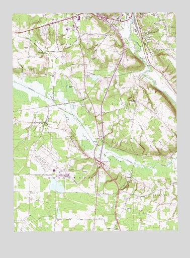
Geneva, PA USGS Topographic Map
Click on map above to begin viewing in our Map Viewer.

This topographic map contains these locations and features:
Feature Name Type Latitude Longitude GNIS ID View Map
Allison CornersLocaleN41.5184°W80.1620°1168208View Map
Anderson CemeteryCemeteryN41.5346°W80.2072°1168284View Map
Andrews CemeteryCemeteryN41.5931°W80.2367°1168302View Map
Berrie SchoolSchoolN41.5428°W80.1376°1200688View Map
Bootis Church (historical)ChurchN41.5076°W80.2190°1200682View Map
Brown Hill School (historical)SchoolN41.5984°W80.2465°1200695View Map
Buchanan StationLocaleN41.5984°W80.1470°1170503View Map
Cascade CreekStreamN41.5384°W80.1292°1989392View Map
Center Road CornersLocaleN41.5742°W80.1553°1171445View Map
Center SchoolSchoolN41.5742°W80.1548°1200692View Map
Church SchoolSchoolN41.6142°W80.1498°1200698View Map
Clark School (historical)SchoolN41.5589°W80.2170°1200689View Map
Conneaut MarshSwampN41.5579°W80.1979°1172341View Map
Conneaut Marsh DamDamN41.5751°W80.2181°1195671View Map
Conneaut Marsh ReservoirReservoirN41.5384°W80.1581°1195648View Map
CustardsPopulated PlaceN41.5303°W80.1592°1172870View Map
Custards DamDamN41.5384°W80.1581°1195649View Map
Dice School (historical)SchoolN41.5226°W80.2206°1200684View Map
Franklin Pike CornersPopulated PlaceN41.6134°W80.1484°1175162View Map
GenevaPopulated PlaceN41.5626°W80.2251°1175519View Map
Geneva Census Designated PlaceCensusN41.5620°W80.2260°2389835View Map
Greenwood CemeteryCemeteryN41.5071°W80.2175°1176197View Map
Greenwood ChurchChurchN41.5070°W80.1851°1176201View Map
Greenwood Volunteer Fire and Rescue Department 40BuildingN41.5610°W80.2239°2644874View Map
Grinell School (historical)SchoolN41.5226°W80.2206°1200687View Map
Halls CornersLocaleN41.5228°W80.2376°1176403View Map
Hidden LakeLakeN41.5829°W80.2076°1176990View Map
Kebort School (historical)SchoolN41.5928°W80.1701°1200694View Map
Keborts CornersPopulated PlaceN41.5895°W80.1945°1178273View Map
Kerrtown Elementary SchoolSchoolN41.6220°W80.1676°1211651View Map
Kreiter SchoolSchoolN41.6026°W80.1873°1200697View Map
Mallory SchoolSchoolN41.5226°W80.1373°1200686View Map
Mumford ChurchChurchN41.5242°W80.1326°1182076View Map
Neason Hill Elementary SchoolSchoolN41.6228°W80.1384°1211652View Map
Orris SchoolSchoolN41.5884°W80.1342°1200693View Map
Pennsylvania State Police Troop E Meadville StationBuildingN41.6196°W80.2066°2777335View Map
Peterson School (historical)SchoolN41.5209°W80.1709°1200685View Map
Rock CreekStreamN41.5370°W80.1590°1193202View Map
Rock Creek FallsFallsN41.5234°W80.1681°1201377View Map
Roselawn Memorial GardensCemeteryN41.6230°W80.1950°1213422View Map
Saint Brigid's CemeteryCemeteryN41.6217°W80.1356°1185845View Map
Shafer School (historical)SchoolN41.5617°W80.1692°1200690View Map
Slavens School (historical)SchoolN41.5062°W80.2042°1200683View Map
State Game Lands Number 213ParkN41.5664°W80.2137°1188490View Map
Township of GreenwoodCivilN41.5269°W80.2238°1216306View Map
Township of UnionCivilN41.5684°W80.1612°1216323View Map
Trace SchoolSchoolN41.5773°W80.1953°1200691View Map
Trace SchoolSchoolN41.6037°W80.2209°1200696View Map
Van Horne CreekStreamN41.6064°W80.1562°1190336View Map
Vernon Central Hose Company Department 23BuildingN41.6161°W80.2044°2645263View Map
Vernon Township Police DepartmentBuildingN41.6169°W80.2023°2777139View Map
Watson RunPopulated PlaceN41.5898°W80.2170°1190690View Map
Watson RunStreamN41.5770°W80.2240°1190694View Map
Watson Run ChurchChurchN41.6023°W80.2262°1190695View Map
Wecas CornersLocaleN41.5014°W80.1737°1190766View Map
West Mead Township District 1 Volunteer Fire Company Liberty Street Station Department 28BuildingN41.6112°W80.1478°2645863View Map
Williams RunStreamN41.5426°W80.1823°1191471View Map

Note: Coordinates in the location and feature list above are referenced to NAD83 datum.


Copyright (C) 2008-2025 Ryan Niemi / Sunset Dynamics ... All Rights Reserved