TopoQuest Logo
Do you find TopoQuest useful?
Help keep TopoQuest running and adding new maps/features by donating!
Bitcoin:  19c7KJd3qBynnjoSw5npx9KScwjBe4ifkT
Litecoin:  LXs6TkuXGGXo1vDsWCkWVdjQX94eUKd6ui
Home View Maps Find Maps Find Places Resources & Links


New Lebanon, Pennsylvania Topographic Map

USGS Map Title: New Lebanon, PA
USGS Map MRC: 41080D1
DRG (GeoTIFF) Download: o41080d1.tif


Neighboring USGS Topographic Map Quads:


  Geneva, PA  
41080E2
 

  Cochranton, PA  
41080E1
 

  Sugar Lake, PA  
41079E8
 

  Hadley, PA  
41080D2
 

  New Lebanon, PA  
41080D1
 

  Utica, PA  
41079D8
 

  Jackson Center, PA  
41080C2
 

  Sandy Lake, PA  
41080C1
 

  Polk, PA  
41079C8


Map MRC Location:

N42°
W81°
N42°
W80°
H8 H7 H6 H5 H4 H3 H2 H1
G8 G7 G6 G5 G4 G3 G2 G1
F8 F7 F6 F5 F4 F3 F2 F1
E8 E7 E6 E5 E4 E3 E2 E1
D8 D7 D6 D5 D4 D3 D2 D1
C8 C7 C6 C5 C4 C3 C2 C1
B8 B7 B6 B5 B4 B3 B2 B1
A8 A7 A6 A5 A4 A3 A2 A1
N41°
W81°
N41°
W80°

New Lebanon, PA USGS 1:24K Topographic Map Preview:
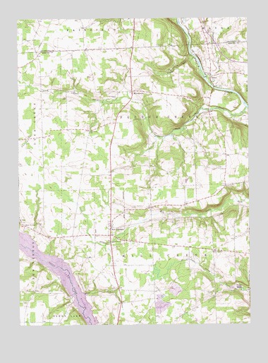
New Lebanon, PA USGS Topographic Map
Click on map above to begin viewing in our Map Viewer.

This topographic map contains these locations and features:
Feature Name Type Latitude Longitude GNIS ID View Map
Blair SchoolSchoolN41.4442°W80.0120°1205374View Map
Borough of New LebanonCivilN41.4196°W80.0755°1215445View Map
Boyd CemeteryCemeteryN41.3845°W80.1220°1198469View Map
Boylan SchoolSchoolN41.4734°W80.1187°1205383View Map
Calton Post OfficePost OfficeN41.4771°W80.0206°2779873View Map
CarltonPopulated PlaceN41.4762°W80.0198°1204927View Map
Chatley School (historical)SchoolN41.4701°W80.0831°1206663View Map
Crouser SchoolSchoolN41.4173°W80.0512°1205377View Map
Deer Creek ChurchChurchN41.4539°W80.0856°1198647View Map
Dugan RunStreamN41.3876°W80.0895°1199859View Map
Fairfield ChurchChurchN41.4153°W80.1123°1198720View Map
Five PointsPopulated PlaceN41.4053°W80.0195°1198739View Map
Foulk RunStreamN41.4842°W80.0287°1199870View Map
Glenn SchoolSchoolN41.3862°W80.0187°1205378View Map
Kerrtown School (historical)SchoolN41.3884°W80.0748°1205380View Map
Klingensmith SchoolSchoolN41.4426°W80.0517°1205375View Map
Mill CreekLocaleN41.4237°W80.0064°1205376View Map
MilledgevillePopulated PlaceN41.4703°W80.0623°1199164View Map
Milledgeville CemeteryCemeteryN41.4681°W80.0706°1199165View Map
Montgomery School (historical)SchoolN41.4070°W80.0945°1205381View Map
Mount Hope ChurchChurchN41.4173°W80.1245°1199198View Map
New LebanonPopulated PlaceN41.4148°W80.0748°1199217View Map
New Lebanon CemeteryCemeteryN41.4228°W80.0635°1199218View Map
New Lebanon ChurchChurchN41.4087°W80.0739°1199219View Map
New VernonPopulated PlaceN41.4159°W80.1217°1199220View Map
North Deer CreekStreamN41.4634°W80.0003°1199921View Map
Pontiac School (historical)SchoolN41.4751°W80.0348°1205373View Map
Powdermill RunStreamN41.4751°W80.0226°1199338View Map
Ross SchoolSchoolN41.4409°W80.1245°1205382View Map
Township of French CreekCivilN41.4598°W80.0505°1216799View Map
Township of Mill CreekCivilN41.4013°W80.0467°1216809View Map
Urey SchoolSchoolN41.3884°W80.0523°1205379View Map

Note: Coordinates in the location and feature list above are referenced to NAD83 datum.


Copyright (C) 2008-2025 Ryan Niemi / Sunset Dynamics ... All Rights Reserved