TopoQuest Logo
Do you find TopoQuest useful?
Help keep TopoQuest running and adding new maps/features by donating!
Bitcoin:  19c7KJd3qBynnjoSw5npx9KScwjBe4ifkT
Litecoin:  LXs6TkuXGGXo1vDsWCkWVdjQX94eUKd6ui
Home View Maps Find Maps Find Places Resources & Links


Cochranton, Pennsylvania Topographic Map

USGS Map Title: Cochranton, PA
USGS Map MRC: 41080E1
DRG (GeoTIFF) Download: o41080e1.tif


Neighboring USGS Topographic Map Quads:


  Meadville, PA  
41080F2
 

  Blooming Valley, PA  
41080F1
 

  Townville, PA  
41079F8
 

  Geneva, PA  
41080E2
 

  Cochranton, PA  
41080E1
 

  Sugar Lake, PA  
41079E8
 

  Hadley, PA  
41080D2
 

  New Lebanon, PA  
41080D1
 

  Utica, PA  
41079D8


Map MRC Location:

N42°
W81°
N42°
W80°
H8 H7 H6 H5 H4 H3 H2 H1
G8 G7 G6 G5 G4 G3 G2 G1
F8 F7 F6 F5 F4 F3 F2 F1
E8 E7 E6 E5 E4 E3 E2 E1
D8 D7 D6 D5 D4 D3 D2 D1
C8 C7 C6 C5 C4 C3 C2 C1
B8 B7 B6 B5 B4 B3 B2 B1
A8 A7 A6 A5 A4 A3 A2 A1
N41°
W81°
N41°
W80°

Cochranton, PA USGS 1:24K Topographic Map Preview:
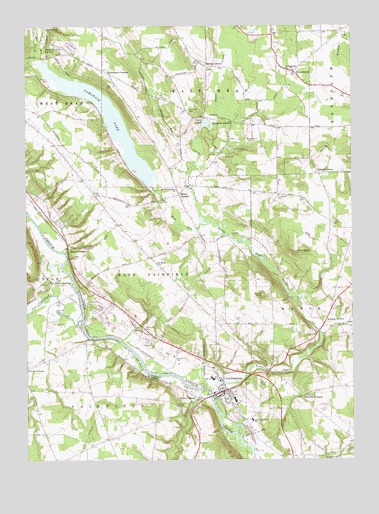
Cochranton, PA USGS Topographic Map
Click on map above to begin viewing in our Map Viewer.

This topographic map contains these locations and features:
Feature Name Type Latitude Longitude GNIS ID View Map
Bell Hill School (historical)SchoolN41.5392°W80.0306°1200705View Map
Borough of CochrantonCivilN41.5192°W80.0470°1215133View Map
Bousson School (historical)SchoolN41.5973°W80.0392°1200714View Map
Boussons CornersLocaleN41.5976°W80.0451°1170037View Map
Brown SchoolSchoolN41.5692°W80.0073°1200709View Map
Brunot CornersLocaleN41.5828°W80.0123°1170433View Map
Byham SchoolSchoolN41.5912°W80.1137°1200710View Map
Calvin CornersLocaleN41.5264°W80.1245°1170954View Map
CochrantonPopulated PlaceN41.5201°W80.0484°1172115View Map
Cochranton Elementary SchoolSchoolN41.5114°W80.0387°1213826View Map
Cochranton Junior - Senior High SchoolSchoolN41.5234°W80.0538°1211650View Map
Cochranton Police DepartmentBuildingN41.5204°W80.0478°2776927View Map
Cochranton Post OfficePost OfficeN41.5206°W80.0489°2777383View Map
Cochranton Volunteer Fire Department 4BuildingN41.5205°W80.0476°2645089View Map
Conneaut OutletStreamN41.5403°W80.1039°1172342View Map
Davis SchoolSchoolN41.5934°W80.0756°1200712View Map
Dean SchoolSchoolN41.5381°W80.0823°1200703View Map
Deckard RunStreamN41.5367°W80.0101°1173043View Map
Dutch Hill GreenhousesBuildingN41.5517°W80.1233°2650607View Map
Ewing CornersLocaleN41.6142°W80.0548°1174383View Map
FrenchtownPopulated PlaceN41.6120°W80.0217°1175231View Map
Jennings School (historical)SchoolN41.5901°W80.0156°1200715View Map
Kantz CornersPopulated PlaceN41.5181°W80.0592°1178226View Map
Kasters CornersLocaleN41.5395°W80.0103°1178247View Map
Kiser Hill CemeteryCemeteryN41.6009°W80.0627°1178549View Map
Kiser SchoolSchoolN41.6014°W80.0639°1200713View Map
Kiters SchoolSchoolN41.5209°W80.0073°1200702View Map
Laird SchoolSchoolN41.5056°W80.0939°1200699View Map
Little Sugar CreekStreamN41.5198°W80.0545°1179685View Map
Mallard SchoolSchoolN41.5709°W80.0381°1200708View Map
McNamaras CornersLocaleN41.6112°W80.0926°1180793View Map
Moore SchoolSchoolN41.5173°W80.0620°1200701View Map
Mud RunStreamN41.5687°W80.0573°1182030View Map
Pettis CornersLocaleN41.5764°W80.0659°1183644View Map
Pettis Road GreenhouseBuildingN41.5656°W80.0589°2650606View Map
Pine Grove ChurchChurchN41.5987°W80.0501°1183814View Map
Pine KnollSummitN41.5601°W80.0212°1183853View Map
Ponce de Leon SpringSpringN41.6189°W80.1164°1184226View Map
Prospect SchoolSchoolN41.5676°W80.0895°1200707View Map
Rosedale SchoolSchoolN41.5409°W80.0537°1200704View Map
Round KnobSummitN41.5473°W80.0339°1185533View Map
Rung SchoolSchoolN41.5517°W80.1231°1200706View Map
Rynd SchoolSchoolN41.5023°W80.0189°1200700View Map
Saint Hippolytes ChurchChurchN41.6123°W80.0217°1185993View Map
Saint Marks ChurchChurchN41.5570°W80.0745°1186341View Map
Saints Peter and Paul ChurchChurchN41.5778°W80.0667°1186796View Map
Shaws CornersPopulated PlaceN41.5612°W80.1087°1187409View Map
Shaws LandingPopulated PlaceN41.5514°W80.1145°1204630View Map
Stockton CornersLocaleN41.5181°W80.0198°1188697View Map
Swamp SchoolSchoolN41.5989°W80.0956°1200711View Map
Tamarack LakeReservoirN41.5980°W80.0939°1189246View Map
Tamarack Lake Dam ADamN41.6151°W80.1164°1195702View Map
Tamarack Lake Dam BDamN41.5784°W80.0764°1195676View Map
Township of East FairfieldCivilN41.5562°W80.0752°1216302View Map
Township of FairfieldCivilN41.5096°W80.1078°1216305View Map
Yosets LakeLakeN41.5967°W80.0553°1191911View Map

Note: Coordinates in the location and feature list above are referenced to NAD83 datum.


Copyright (C) 2008-2025 Ryan Niemi / Sunset Dynamics ... All Rights Reserved