TopoQuest Logo
Do you find TopoQuest useful?
Help keep TopoQuest running and adding new maps/features by donating!
Bitcoin:  19c7KJd3qBynnjoSw5npx9KScwjBe4ifkT
Litecoin:  LXs6TkuXGGXo1vDsWCkWVdjQX94eUKd6ui
Home View Maps Find Maps Find Places Resources & Links


Greenville East, Pennsylvania Topographic Map

USGS Map Title: Greenville East, PA
USGS Map MRC: 41080D3
DRG (GeoTIFF) Download: o41080d3.tif


Neighboring USGS Topographic Map Quads:


  Hartstown, PA  
41080E4
 

  Conneaut Lake, PA  
41080E3
 

  Geneva, PA  
41080E2
 

  Greenville West, PA  
41080D4
 

  Greenville East, PA  
41080D3
 

  Hadley, PA  
41080D2
 

  Sharpsville, PA  
41080C4
 

  Fredonia, PA  
41080C3
 

  Jackson Center, PA  
41080C2


Map MRC Location:

N42°
W81°
N42°
W80°
H8 H7 H6 H5 H4 H3 H2 H1
G8 G7 G6 G5 G4 G3 G2 G1
F8 F7 F6 F5 F4 F3 F2 F1
E8 E7 E6 E5 E4 E3 E2 E1
D8 D7 D6 D5 D4 D3 D2 D1
C8 C7 C6 C5 C4 C3 C2 C1
B8 B7 B6 B5 B4 B3 B2 B1
A8 A7 A6 A5 A4 A3 A2 A1
N41°
W81°
N41°
W80°

Greenville East, PA USGS 1:24K Topographic Map Preview:
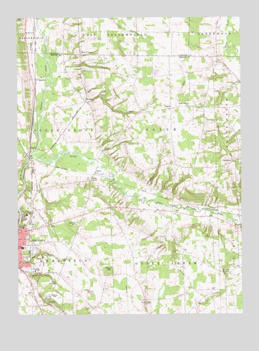
Greenville East, PA USGS Topographic Map
Click on map above to begin viewing in our Map Viewer.

This topographic map contains these locations and features:
Feature Name Type Latitude Longitude GNIS ID View Map
Amasa StationLocaleN41.4395°W80.3656°1212202View Map
Bluff RunStreamN41.4712°W80.3562°1198456View Map
Camp RowlandLocaleN41.3881°W80.3534°1198526View Map
Crooked CreekStreamN41.4437°W80.3656°1198620View Map
Freeland CemeteryCemeteryN41.4234°W80.2853°1198772View Map
Furance CornersLocaleN41.3923°W80.2598°1198776View Map
Greenville Dam Number ThreeDamN41.4051°W80.3548°1195549View Map
Greenville ReservoirReservoirN41.4051°W80.3548°1195548View Map
Greenville Senior High SchoolSchoolN41.4031°W80.3723°1211686View Map
Hadley DamDamN41.4251°W80.2515°1213430View Map
Hadley Dam ReservoirReservoirN41.4251°W80.2515°1195570View Map
Hempfield Elementary SchoolSchoolN41.3937°W80.3653°1211685View Map
Hempfield Township Police DepartmentBuildingN41.3937°W80.3720°2777123View Map
Hempfield Township Volunteer Fire Department Station 2BuildingN41.3939°W80.3719°2645692View Map
Hempfield Township Volunteer Fire Department Station 94BuildingN41.4123°W80.3670°2645282View Map
HenleinPopulated PlaceN41.3803°W80.3576°1203781View Map
Jim Lee Airport (historical)AirportN41.4881°W80.3215°1194241View Map
K O JunctionPopulated PlaceN41.4742°W80.3645°1203907View Map
KashnerPopulated PlaceN41.3809°W80.3045°1198959View Map
KennardPopulated PlaceN41.4651°W80.3365°1198968View Map
Leechs CornersPopulated PlaceN41.4314°W80.3342°1199017View Map
Life Force of Western PennsylvaniaBuildingN41.4137°W80.3663°2719622View Map
Mathay DamDamN41.3834°W80.3448°1213429View Map
Mathay Run PondReservoirN41.3834°W80.3448°1195526View Map
Minis Hollow RunStreamN41.4745°W80.3565°1212203View Map
Minnis CornerPopulated PlaceN41.4845°W80.3387°1204191View Map
Morrison RunStreamN41.4131°W80.2501°1199914View Map
North Salem ChurchChurchN41.4626°W80.2795°1199235View Map
OsbornPopulated PlaceN41.4620°W80.2890°1204338View Map
OsgoodPopulated PlaceN41.4448°W80.3676°1199258View Map
PetersburgPopulated PlaceN41.4392°W80.2548°1209170View Map
Pinehill Golf CourseLocaleN41.4273°W80.3562°1205594View Map
Quarry HillSummitN41.3823°W80.3526°1199346View Map
SalemPopulated PlaceN41.4345°W80.3317°1199474View Map
Salem CemeteryCemeteryN41.3856°W80.2670°1199475View Map
Saul Run DamDamN41.4017°W80.3598°1195541View Map
Saul Run Dam ReservoirReservoirN41.4005°W80.3592°1195542View Map
Snyder HillSummitN41.4137°W80.3406°1199558View Map
Stevenson CemeteryCemeteryN41.4528°W80.3131°1199620View Map
Township of HempfieldCivilN41.3910°W80.3568°1216802View Map
Township of Otter CreekCivilN41.3944°W80.2934°1216811View Map
Township of SalemCivilN41.4528°W80.2934°1216815View Map
Township of Sugar GroveCivilN41.4536°W80.3519°1216821View Map
University of Pennsylvania Medical Center Horizon GreenvilleHospitalN41.4117°W80.3720°2718067View Map
Wheeler HillSummitN41.3934°W80.3240°1199775View Map

Note: Coordinates in the location and feature list above are referenced to NAD83 datum.


Copyright (C) 2008-2025 Ryan Niemi / Sunset Dynamics ... All Rights Reserved