TopoQuest Logo
Do you find TopoQuest useful?
Help keep TopoQuest running and adding new maps/features by donating!
Bitcoin:  19c7KJd3qBynnjoSw5npx9KScwjBe4ifkT
Litecoin:  LXs6TkuXGGXo1vDsWCkWVdjQX94eUKd6ui
Home View Maps Find Maps Find Places Resources & Links


Gladstone, Virginia Topographic Map

USGS Map Title: Gladstone, VA
USGS Map MRC: 37078E7
DRG (GeoTIFF) Download: o37078e7.tif


Neighboring USGS Topographic Map Quads:


  Arrington, VA  
37078F8
 

  Shipman, VA  
37078F7
 

  Howardsville, VA  
37078F6
 

  Buffalo Ridge, VA  
37078E8
 

  Gladstone, VA  
37078E7
 

  Saint Joy, VA  
37078E6
 

  Stonewall, VA  
37078D8
 

  Vera, VA  
37078D7
 

  Holiday Lake, VA  
37078D6


Map MRC Location:

N38°
W79°
N38°
W78°
H8 H7 H6 H5 H4 H3 H2 H1
G8 G7 G6 G5 G4 G3 G2 G1
F8 F7 F6 F5 F4 F3 F2 F1
E8 E7 E6 E5 E4 E3 E2 E1
D8 D7 D6 D5 D4 D3 D2 D1
C8 C7 C6 C5 C4 C3 C2 C1
B8 B7 B6 B5 B4 B3 B2 B1
A8 A7 A6 A5 A4 A3 A2 A1
N37°
W79°
N37°
W78°

Gladstone, VA USGS 1:24K Topographic Map Preview:
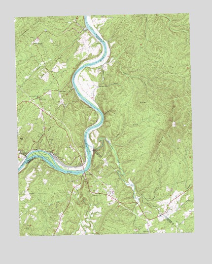
Gladstone, VA USGS Topographic Map
Click on map above to begin viewing in our Map Viewer.

This topographic map contains these locations and features:
Feature Name Type Latitude Longitude GNIS ID View Map
Alabama CreekStreamN37.5996°W78.8122°1462384View Map
Allens CreekStreamN37.5454°W78.8681°1462415View Map
Allens CreekPopulated PlaceN37.5468°W78.8686°1494809View Map
Bent CreekStreamN37.5351°W78.8286°1463080View Map
Bent CreekPopulated PlaceN37.5349°W78.8270°1494836View Map
Bible RidgeRidgeN37.5565°W78.8553°1463292View Map
Brick Kiln BranchStreamN37.5090°W78.7692°1463803View Map
Buck MountainSummitN37.5743°W78.7867°1463989View Map
Buck MountainSummitN37.5557°W78.8706°1494855View Map
Buffalo SpringsPopulated PlaceN37.6096°W78.8620°1477154View Map
Buffalo StationLocaleN37.6174°W78.8228°1464051View Map
Carter CreekStreamN37.6115°W78.8309°1464480View Map
CaskiePopulated PlaceN37.5396°W78.8300°1494865View Map
Cove MountainSummitN37.5049°W78.8700°1465331View Map
David CreekStreamN37.5515°W78.8242°1465627View Map
Eldridge CornerPopulated PlaceN37.5846°W78.8159°1477296View Map
Five ForksPopulated PlaceN37.5793°W78.8586°1477332View Map
Four ForksPopulated PlaceN37.5821°W78.8445°1494940View Map
GladstonePopulated PlaceN37.5468°W78.8495°1494955View Map
Gladstone Rescue SquadBuildingN37.5503°W78.8364°2086124View Map
Gladstone SchoolSchoolN37.5504°W78.8364°1467126View Map
Gladstone Volunteer Fire DepartmentBuildingN37.5507°W78.8374°2086123View Map
GreenwayPopulated PlaceN37.5843°W78.8336°1494971View Map
Iron BranchStreamN37.5240°W78.7539°1468515View Map
Jack Wrights HollowValleyN37.5679°W78.8127°1468575View Map
Mack Brandon BranchStreamN37.5201°W78.7853°1469991View Map
Maple Grove Baptist ChurchChurchN37.5310°W78.8372°1470072View Map
Migginsons Ferry (historical)CrossingN37.5838°W78.8325°1501559View Map
Mineral Springs ChurchChurchN37.5829°W78.8506°1470602View Map
Negro Den HollowValleyN37.5970°W78.8128°1471366View Map
North Branch Brick Kiln BranchStreamN37.5140°W78.7606°1471578View Map
Owens CreekStreamN37.6182°W78.8231°1471994View Map
Pruetts MountainSummitN37.5538°W78.7700°1495100View Map
Sears RidgeRidgeN37.5971°W78.8470°1474129View Map
Second Mineral Springs ChurchChurchN37.5788°W78.8592°1474145View Map
Seven BranchStreamN37.5532°W78.8100°1474172View Map
Smith IslandsIslandN37.5474°W78.8584°1474762View Map
Spears MountainSummitN37.5618°W78.7628°1474935View Map
Stevens RunStreamN37.5201°W78.7886°1475126View Map
Tower HillLocaleN37.5013°W78.7820°1475801View Map

Note: Coordinates in the location and feature list above are referenced to NAD83 datum.


Copyright (C) 2008-2024 Ryan Niemi / Sunset Dynamics ... All Rights Reserved