TopoQuest Logo
Do you find TopoQuest useful?
Help keep TopoQuest running and adding new maps/features by donating!
Bitcoin:  19c7KJd3qBynnjoSw5npx9KScwjBe4ifkT
Litecoin:  LXs6TkuXGGXo1vDsWCkWVdjQX94eUKd6ui
Home View Maps Find Maps Find Places Resources & Links


Fredonia, Pennsylvania Topographic Map

USGS Map Title: Fredonia, PA
USGS Map MRC: 41080C3
DRG (GeoTIFF) Download: o41080c3.tif


Neighboring USGS Topographic Map Quads:


  Greenville West, PA  
41080D4
 

  Greenville East, PA  
41080D3
 

  Hadley, PA  
41080D2
 

  Sharpsville, PA  
41080C4
 

  Fredonia, PA  
41080C3
 

  Jackson Center, PA  
41080C2
 

  Sharon East, PA  
41080B4
 

  Greenfield, PA  
41080B3
 

  Mercer, PA  
41080B2


Map MRC Location:

N42°
W81°
N42°
W80°
H8 H7 H6 H5 H4 H3 H2 H1
G8 G7 G6 G5 G4 G3 G2 G1
F8 F7 F6 F5 F4 F3 F2 F1
E8 E7 E6 E5 E4 E3 E2 E1
D8 D7 D6 D5 D4 D3 D2 D1
C8 C7 C6 C5 C4 C3 C2 C1
B8 B7 B6 B5 B4 B3 B2 B1
A8 A7 A6 A5 A4 A3 A2 A1
N41°
W81°
N41°
W80°

Fredonia, PA USGS 1:24K Topographic Map Preview:
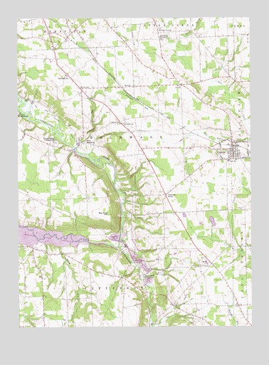
Fredonia, PA USGS Topographic Map
Click on map above to begin viewing in our Map Viewer.

This topographic map contains these locations and features:
Feature Name Type Latitude Longitude GNIS ID View Map
All Saints Church (historical)ChurchN41.2526°W80.2651°1205339View Map
Big BendPopulated PlaceN41.2845°W80.3195°1203087View Map
Big Bend ChurchChurchN41.2709°W80.3073°1169480View Map
Big Bend HillSummitN41.2951°W80.3259°1169481View Map
Borough of FredoniaCivilN41.3219°W80.2581°1215438View Map
Busch CemeteryCemeteryN41.3711°W80.2981°1170760View Map
Caldwell SchoolSchoolN41.3326°W80.3192°1170875View Map
Camp KiondashawaLocaleN41.3370°W80.3742°1171041View Map
Daley RunStreamN41.2828°W80.3520°1198149View Map
Deep Hollow SchoolSchoolN41.3262°W80.3720°1205335View Map
Delaware CemeteryCemeteryN41.3337°W80.3178°1173122View Map
Delaware GrovePopulated PlaceN41.3037°W80.2951°1173125View Map
Five PointsPopulated PlaceN41.3481°W80.2862°1174871View Map
FredoniaPopulated PlaceN41.3217°W80.2587°1175197View Map
Fredonia Post OfficePost OfficeN41.3222°W80.2589°2779865View Map
Fredonia Volunteer Fire Department Station 97BuildingN41.3208°W80.2597°2645800View Map
Fruit SchoolSchoolN41.3023°W80.3670°1205336View Map
Homer SchoolSchoolN41.3023°W80.3381°1205337View Map
Jerusalem Reformed ChurchChurchN41.3673°W80.2973°1178069View Map
Kitches CornersLocaleN41.3689°W80.2981°1178569View Map
KremisPopulated PlaceN41.3473°W80.3115°1178684View Map
Lackawannock CreekStreamN41.2826°W80.3206°1178742View Map
Lawango RunStreamN41.3217°W80.3437°1179044View Map
McCullough SchoolSchoolN41.2623°W80.3690°1205338View Map
Mercer CountyCivilN41.3022°W80.2577°1213678View Map
Mercer Public Golf CourseLocaleN41.2839°W80.2870°1205592View Map
Millbank CemeteryCemeteryN41.3256°W80.2578°1181203View Map
New HamburgPopulated PlaceN41.3253°W80.3417°1182328View Map
OniontownPopulated PlaceN41.3467°W80.3403°1182994View Map
Reichard SchoolSchoolN41.3509°W80.3467°1184869View Map
Saint Johns ChurchChurchN41.3323°W80.3178°1186163View Map
Temple Grove CampgroundLocaleN41.3262°W80.3542°1189351View Map
Township of DelawareCivilN41.3282°W80.3254°1216796View Map
Township of JeffersonCivilN41.2645°W80.3216°1216805View Map
Ye Royal Strip (historical)AirportN41.2806°W80.2809°1213805View Map

Note: Coordinates in the location and feature list above are referenced to NAD83 datum.


Copyright (C) 2008-2025 Ryan Niemi / Sunset Dynamics ... All Rights Reserved