TopoQuest Logo
Do you find TopoQuest useful?
Help keep TopoQuest running and adding new maps/features by donating!
Bitcoin:  19c7KJd3qBynnjoSw5npx9KScwjBe4ifkT
Litecoin:  LXs6TkuXGGXo1vDsWCkWVdjQX94eUKd6ui
Home View Maps Find Maps Find Places Resources & Links


Jackson Center, Pennsylvania Topographic Map

USGS Map Title: Jackson Center, PA
USGS Map MRC: 41080C2
DRG (GeoTIFF) Download: o41080c2.tif


Neighboring USGS Topographic Map Quads:


  Greenville East, PA  
41080D3
 

  Hadley, PA  
41080D2
 

  New Lebanon, PA  
41080D1
 

  Fredonia, PA  
41080C3
 

  Jackson Center, PA  
41080C2
 

  Sandy Lake, PA  
41080C1
 

  Greenfield, PA  
41080B3
 

  Mercer, PA  
41080B2
 

  Grove City, PA  
41080B1


Map MRC Location:

N42°
W81°
N42°
W80°
H8 H7 H6 H5 H4 H3 H2 H1
G8 G7 G6 G5 G4 G3 G2 G1
F8 F7 F6 F5 F4 F3 F2 F1
E8 E7 E6 E5 E4 E3 E2 E1
D8 D7 D6 D5 D4 D3 D2 D1
C8 C7 C6 C5 C4 C3 C2 C1
B8 B7 B6 B5 B4 B3 B2 B1
A8 A7 A6 A5 A4 A3 A2 A1
N41°
W81°
N41°
W80°

Jackson Center, PA USGS 1:24K Topographic Map Preview:
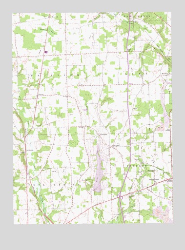
Jackson Center, PA USGS Topographic Map
Click on map above to begin viewing in our Map Viewer.

This topographic map contains these locations and features:
Feature Name Type Latitude Longitude GNIS ID View Map
Bethany CemeteryCemeteryN41.3178°W80.1548°1169337View Map
Borough of Jackson CenterCivilN41.2731°W80.1397°1215442View Map
Cape Horn School (historical)SchoolN41.2556°W80.1562°1205369View Map
Cass SchoolSchoolN41.2889°W80.1565°1205367View Map
Centenary CemeteryCemeteryN41.3517°W80.1578°1171416View Map
Center SchoolSchoolN41.3242°W80.1337°1205370View Map
Cool SpringPopulated PlaceN41.2931°W80.2403°1172396View Map
Cool Spring ChurchChurchN41.3073°W80.1937°1172397View Map
FairviewPopulated PlaceN41.3259°W80.2301°1174468View Map
Fairview ChurchChurchN41.2926°W80.2409°1174526View Map
Ferrell FieldAirportN41.2993°W80.2074°2443634View Map
Filer CornersPopulated PlaceN41.3039°W80.1262°1174748View Map
Five PointsPopulated PlaceN41.2956°W80.1723°1174870View Map
Fox RunStreamN41.2789°W80.1462°1175110View Map
Godfrey SchoolSchoolN41.3117°W80.1998°1205364View Map
Halfmoon SwampSwampN41.3648°W80.2206°1176386View Map
Jackson CenterPopulated PlaceN41.2728°W80.1389°1177915View Map
Jackson Center Post OfficePost OfficeN41.2716°W80.1438°2779994View Map
Jackson Center StationLocaleN41.2676°W80.1506°1205368View Map
Jackson Center Volunteer Fire Department Station 92BuildingN41.2731°W80.1374°2645802View Map
Kents RunStreamN41.2656°W80.2284°1178385View Map
Lake LatonkaPopulated PlaceN41.2904°W80.1813°2633822View Map
Lake LatonkaReservoirN41.2799°W80.1830°1195425View Map
Lake Latonka Census Designated PlaceCensusN41.2830°W80.1831°2633821View Map
Lake Latonka DamDamN41.2701°W80.1848°1195426View Map
Maple Shade SchoolSchoolN41.2698°W80.2023°1205365View Map
Mill RunStreamN41.3248°W80.2445°1181188View Map
Nesbit CornersPopulated PlaceN41.2764°W80.1251°1182250View Map
North MillsPopulated PlaceN41.3026°W80.1820°1182609View Map
Oak Grove ChurchChurchN41.3253°W80.2059°1182751View Map
Oak Hill SchoolSchoolN41.2553°W80.1990°1205366View Map
Old Cool Spring CemeteryCemeteryN41.2759°W80.1937°1182908View Map
Orr SchoolSchoolN41.3495°W80.2078°1205362View Map
Paoli SchoolSchoolN41.2873°W80.1256°1206659View Map
Pennsylvania State Police Troop D Mercer StationBuildingN41.2636°W80.1733°2777334View Map
Pleasant Hill CemeteryCemeteryN41.2673°W80.1578°1184032View Map
Slater School (historical)SchoolN41.3512°W80.1645°1205372View Map
State Game Lands Number 294ParkN41.3084°W80.2415°1208381View Map
Still Meadow Farm AirportAirportN41.3111°W80.1623°2442907View Map
Township of CoolspringCivilN41.2693°W80.2208°1216794View Map
Township of FairviewCivilN41.3364°W80.2201°1216798View Map
Township of JacksonCivilN41.2696°W80.1623°1216804View Map
Township of LakeCivilN41.3372°W80.1451°1216807View Map
White SchoolSchoolN41.3495°W80.2340°1205363View Map
Zahniser CemeteryCemeteryN41.2875°W80.1514°1191935View Map
Zahniser SchoolSchoolN41.3084°W80.1673°1205371View Map

Note: Coordinates in the location and feature list above are referenced to NAD83 datum.


Copyright (C) 2008-2025 Ryan Niemi / Sunset Dynamics ... All Rights Reserved