TopoQuest Logo
Do you find TopoQuest useful?
Help keep TopoQuest running and adding new maps/features by donating!
Bitcoin:  19c7KJd3qBynnjoSw5npx9KScwjBe4ifkT
Litecoin:  LXs6TkuXGGXo1vDsWCkWVdjQX94eUKd6ui
Home View Maps Find Maps Find Places Resources & Links


Sandy Lake, Pennsylvania Topographic Map

USGS Map Title: Sandy Lake, PA
USGS Map MRC: 41080C1
DRG (GeoTIFF) Download: o41080c1.tif


Neighboring USGS Topographic Map Quads:


  Hadley, PA  
41080D2
 

  New Lebanon, PA  
41080D1
 

  Utica, PA  
41079D8
 

  Jackson Center, PA  
41080C2
 

  Sandy Lake, PA  
41080C1
 

  Polk, PA  
41079C8
 

  Mercer, PA  
41080B2
 

  Grove City, PA  
41080B1
 

  Barkeyville, PA  
41079B8


Map MRC Location:

N42°
W81°
N42°
W80°
H8 H7 H6 H5 H4 H3 H2 H1
G8 G7 G6 G5 G4 G3 G2 G1
F8 F7 F6 F5 F4 F3 F2 F1
E8 E7 E6 E5 E4 E3 E2 E1
D8 D7 D6 D5 D4 D3 D2 D1
C8 C7 C6 C5 C4 C3 C2 C1
B8 B7 B6 B5 B4 B3 B2 B1
A8 A7 A6 A5 A4 A3 A2 A1
N41°
W81°
N41°
W80°

Sandy Lake, PA USGS 1:24K Topographic Map Preview:
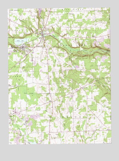
Sandy Lake, PA USGS Topographic Map
Click on map above to begin viewing in our Map Viewer.

This topographic map contains these locations and features:
Feature Name Type Latitude Longitude GNIS ID View Map
Arab SchoolSchoolN41.3162°W80.0581°1205388View Map
Booher CornersPopulated PlaceN41.3478°W80.0173°1169986View Map
Borough of Sandy LakeCivilN41.3502°W80.0837°1215446View Map
Borough of StoneboroCivilN41.3336°W80.1121°1215450View Map
BowiePopulated PlaceN41.2581°W80.1062°1170058View Map
Butchery CreekStreamN41.3431°W80.0578°1170786View Map
Carmichael School (historical)SchoolN41.2853°W80.0456°1205389View Map
Carroll CemeteryCemeteryN41.2553°W80.0692°1171263View Map
Currier SchoolSchoolN41.3681°W80.0856°1205384View Map
Fairview CemeteryCemeteryN41.2589°W80.0648°1174500View Map
Fiddlers GreenLocaleN41.3267°W80.1106°1205393View Map
Giebner School (historical)SchoolN41.3053°W80.0753°1205392View Map
HendersonvillePopulated PlaceN41.3014°W80.0353°1176832View Map
Hodge School (historical)SchoolN41.2798°W80.1123°1205391View Map
KilgorePopulated PlaceN41.2623°W80.0012°1178449View Map
Lake Wilhelm DamDamN41.3701°W80.0864°1195507View Map
Lakeview Consolidated High SchoolSchoolN41.3401°W80.0895°1178807View Map
Lytle SchoolSchoolN41.3603°W80.0601°1205386View Map
McConnell RunStreamN41.3376°W80.0476°1180653View Map
McCutcheon RunStreamN41.3498°W80.0781°1180684View Map
Oak Hill CemeteryCemeteryN41.3387°W80.0806°1182773View Map
Pa-474 DamDamN41.3351°W80.0948°1195484View Map
Pa-474 ReservoirReservoirN41.3343°W80.0944°1195483View Map
Perrine CornersPopulated PlaceN41.2887°W80.0714°1183593View Map
Pine SwampSwampN41.2951°W80.1012°1183913View Map
Porter School (historical)SchoolN41.3217°W80.0231°1205387View Map
Reeds FurnacePopulated PlaceN41.3342°W80.0048°1184830View Map
Rocky Springs CemeteryCemeteryN41.3720°W80.0728°1185374View Map
Saint John SchoolSchoolN41.2701°W80.0181°1206664View Map
Saint Paul SchoolSchoolN41.2501°W80.0223°1205390View Map
Sandy LakeLakeN41.3452°W80.1092°1186952View Map
Sandy LakePopulated PlaceN41.3487°W80.0823°1186953View Map
Sandy Lake Borough Police DeptartmentBuildingN41.3497°W80.0823°2780497View Map
Sandy Lake Post OfficePost OfficeN41.3495°W80.0822°2779646View Map
Sandy Lake Volunteer Fire Department Station 84BuildingN41.3511°W80.0823°2644782View Map
Sawmill RunStreamN41.3492°W80.0912°1187032View Map
State Game Lands Number 130ParkN41.3270°W80.0359°1188442View Map
StoneboroPopulated PlaceN41.3392°W80.1051°1193476View Map
Stoneboro Police DepartmentBuildingN41.3393°W80.1074°2780590View Map
Stoneboro Post OfficePost OfficeN41.3402°W80.1086°2779836View Map
Stoneboro Volunteer Fire Department Station 76BuildingN41.3403°W80.1082°2645095View Map
Township of Sandy LakeCivilN41.3392°W80.0540°1216817View Map
Township of WorthCivilN41.2713°W80.0489°1216824View Map
Wades CornersLocaleN41.3701°W80.0506°1190461View Map
Wesleyan CampgroundLocaleN41.3392°W80.1189°1190865View Map
Yankee Hill CemeteryCemeteryN41.3398°W80.0762°1191855View Map
Yankee Hill SchoolSchoolN41.3367°W80.0756°1205385View Map
Zion ChurchChurchN41.2962°W80.0745°1192014View Map

Note: Coordinates in the location and feature list above are referenced to NAD83 datum.


Copyright (C) 2008-2025 Ryan Niemi / Sunset Dynamics ... All Rights Reserved