TopoQuest Logo
Do you find TopoQuest useful?
Help keep TopoQuest running and adding new maps/features by donating!
Bitcoin:  19c7KJd3qBynnjoSw5npx9KScwjBe4ifkT
Litecoin:  LXs6TkuXGGXo1vDsWCkWVdjQX94eUKd6ui
Home View Maps Find Maps Find Places Resources & Links


Westover, Pennsylvania Topographic Map

USGS Map Title: Westover, PA
USGS Map MRC: 40078G6
DRG (GeoTIFF) Download: o40078g6.tif


Neighboring USGS Topographic Map Quads:


  McGees Mills, PA  
40078H7
 

  Mahaffey, PA  
40078H6
 

  Curwensville, PA  
40078H5
 

  Burnside, PA  
40078G7
 

  Westover, PA  
40078G6
 

  Irvona, PA  
40078G5
 

  Barnesboro, PA  
40078F7
 

  Hastings, PA  
40078F6
 

  Coalport, PA  
40078F5


Map MRC Location:

N41°
W79°
N41°
W78°
H8 H7 H6 H5 H4 H3 H2 H1
G8 G7 G6 G5 G4 G3 G2 G1
F8 F7 F6 F5 F4 F3 F2 F1
E8 E7 E6 E5 E4 E3 E2 E1
D8 D7 D6 D5 D4 D3 D2 D1
C8 C7 C6 C5 C4 C3 C2 C1
B8 B7 B6 B5 B4 B3 B2 B1
A8 A7 A6 A5 A4 A3 A2 A1
N40°
W79°
N40°
W78°

Westover, PA USGS 1:24K Topographic Map Preview:
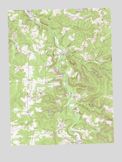
Westover, PA USGS Topographic Map
Click on map above to begin viewing in our Map Viewer.

This topographic map contains these locations and features:
Feature Name Type Latitude Longitude GNIS ID View Map
Barrett RunStreamN40.8262°W78.6470°1168764View Map
Benjamin HeliportAirportN40.7834°W78.6664°1213791View Map
Benjamin Number 3 Mine StationLocaleN40.7976°W78.6781°1213005View Map
Benjamin Number 6 Mine StationLocaleN40.7659°W78.6775°1213004View Map
BethlehemPopulated PlaceN40.8617°W78.7303°1169425View Map
Borough of MahaffeyCivilN40.8745°W78.7275°1215105View Map
Borough of New WashingtonCivilN40.8218°W78.7019°1215107View Map
Borough of NewburgCivilN40.8399°W78.6841°1215106View Map
Cross CemeteryCemeteryN40.8637°W78.6362°1172737View Map
Crossroads School (historical)SchoolN40.8098°W78.7261°1201271View Map
Deer Run School (historical)SchoolN40.8353°W78.7200°1201272View Map
Five PointsPopulated PlaceN40.7937°W78.6720°1203585View Map
HarmonyPopulated PlaceN40.7812°W78.7286°1176543View Map
Harmony School (historical)SchoolN40.7803°W78.7289°1201270View Map
Herd School (historical)SchoolN40.8159°W78.6747°1201269View Map
Kings RunStreamN40.7770°W78.6734°1178497View Map
La Jose CemeteryCemeteryN40.8354°W78.6858°1178737View Map
La Jose Post OfficePost OfficeN40.8358°W78.6779°1214700View Map
La Jose StationLocaleN40.8367°W78.6806°1213007View Map
LaJose Junction StationLocaleN40.8342°W78.6853°1213006View Map
MahaffeyPopulated PlaceN40.8728°W78.7242°1192872View Map
Mahaffey CemeteryCemeteryN40.8700°W78.7168°1180200View Map
Mahaffey Community Ambulance Service Station 29BuildingN40.8706°W78.7203°2719573View Map
Mahaffey Junction StationLocaleN40.8745°W78.7298°1213008View Map
Mahaffey Post OfficePost OfficeN40.8697°W78.7191°2779900View Map
Mahaffey RacetrackLocaleN40.8365°W78.7109°1213278View Map
McMasters RunStreamN40.8251°W78.6570°1180778View Map
Mount Joy ChurchChurchN40.7951°W78.7278°1181730View Map
Mount Zion ChurchChurchN40.8337°W78.7256°1181926View Map
New WashingtonPopulated PlaceN40.8234°W78.7053°1182379View Map
NewburgPopulated PlaceN40.8353°W78.6770°1182388View Map
North Camp RunStreamN40.7912°W78.6736°1198102View Map
OstendPopulated PlaceN40.8692°W78.7189°1183072View Map
Pine RunStreamN40.7728°W78.6667°1183878View Map
Rattling RunStreamN40.8417°W78.6886°1184689View Map
Snyder RunStreamN40.7970°W78.6761°1187957View Map
Snyder RunStreamN40.8628°W78.7111°1187958View Map
Spring RunStreamN40.7856°W78.6778°1188259View Map
ThompsontownPopulated PlaceN40.8176°W78.6320°1189517View Map
Township of ChestCivilN40.7753°W78.6378°1216229View Map
Tuckers RunStreamN40.8384°W78.6820°1189907View Map
WestoverPopulated PlaceN40.7503°W78.6709°1191177View Map
Westover Area Volunteer Fire Company Station 45BuildingN40.7556°W78.6776°2645704View Map
Westover Post OfficePost OfficeN40.7525°W78.6698°2768373View Map
Wilson RunStreamN40.8356°W78.6825°1191547View Map
Wood School (historical)SchoolN40.8376°W78.6572°1201268View Map
Woods RunStreamN40.8326°W78.6745°1191764View Map

Note: Coordinates in the location and feature list above are referenced to NAD83 datum.


Copyright (C) 2008-2025 Ryan Niemi / Sunset Dynamics ... All Rights Reserved