TopoQuest Logo
Do you find TopoQuest useful?
Help keep TopoQuest running and adding new maps/features by donating!
Bitcoin:  19c7KJd3qBynnjoSw5npx9KScwjBe4ifkT
Litecoin:  LXs6TkuXGGXo1vDsWCkWVdjQX94eUKd6ui
Home View Maps Find Maps Find Places Resources & Links


Irvona, Pennsylvania Topographic Map

USGS Map Title: Irvona, PA
USGS Map MRC: 40078G5
DRG (GeoTIFF) Download: o40078g5.tif


Neighboring USGS Topographic Map Quads:


  Mahaffey, PA  
40078H6
 

  Curwensville, PA  
40078H5
 

  Glen Richey, PA  
40078H4
 

  Westover, PA  
40078G6
 

  Irvona, PA  
40078G5
 

  Ramey, PA  
40078G4
 

  Hastings, PA  
40078F6
 

  Coalport, PA  
40078F5
 

  Blandburg, PA  
40078F4


Map MRC Location:

N41°
W79°
N41°
W78°
H8 H7 H6 H5 H4 H3 H2 H1
G8 G7 G6 G5 G4 G3 G2 G1
F8 F7 F6 F5 F4 F3 F2 F1
E8 E7 E6 E5 E4 E3 E2 E1
D8 D7 D6 D5 D4 D3 D2 D1
C8 C7 C6 C5 C4 C3 C2 C1
B8 B7 B6 B5 B4 B3 B2 B1
A8 A7 A6 A5 A4 A3 A2 A1
N40°
W79°
N40°
W78°

Irvona, PA USGS 1:24K Topographic Map Preview:
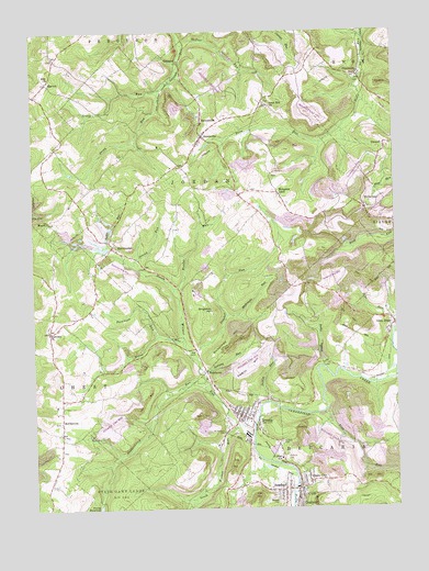
Irvona, PA USGS Topographic Map
Click on map above to begin viewing in our Map Viewer.

This topographic map contains these locations and features:
Feature Name Type Latitude Longitude GNIS ID View Map
AnsonvillePopulated PlaceN40.8476°W78.5656°1168330View Map
Beccaria MillsLocaleN40.7876°W78.5247°1206971View Map
BerwinsdalePopulated PlaceN40.8192°W78.5972°1169322View Map
Blain CityPopulated PlaceN40.7565°W78.5331°1169782View Map
Borough of IrvonaCivilN40.7737°W78.5501°1215103View Map
BretonvillePopulated PlaceN40.8520°W78.5659°1170210View Map
CarnwathPopulated PlaceN40.8634°W78.5122°1171235View Map
Comfort RunLocaleN40.7920°W78.5689°1213017View Map
Comfort RunStreamN40.7915°W78.5706°1172262View Map
Davidson RunStreamN40.7953°W78.5814°1172981View Map
DeWitt HillSummitN40.7876°W78.5503°1173016View Map
DeWitt RunStreamN40.7778°W78.5445°1173017View Map
Dickerman HillSummitN40.7970°W78.5539°1173245View Map
DiehltownPopulated PlaceN40.7862°W78.5650°1203418View Map
Dotts HollowValleyN40.7875°W78.5249°1173409View Map
ErhardPopulated PlaceN40.8451°W78.5028°1174302View Map
Fairview ChurchChurchN40.7970°W78.6197°1174522View Map
Fairview School (historical)SchoolN40.7898°W78.6170°1201282View Map
Fruit Hill ChurchChurchN40.8556°W78.5428°1175305View Map
GazzamPopulated PlaceN40.8670°W78.5742°1203657View Map
Glen HopePopulated PlaceN40.7984°W78.5000°1175695View Map
Green RunStreamN40.8595°W78.5800°1176111View Map
Green Run School (historical)SchoolN40.8542°W78.6009°1201283View Map
Hazelton School (historical)SchoolN40.7784°W78.6156°1201281View Map
Hockenberry RunStreamN40.7823°W78.5659°1198074View Map
Holes RunStreamN40.7945°W78.5725°1177195View Map
Hunter RunStreamN40.8081°W78.5764°1177610View Map
IrvonaPopulated PlaceN40.7745°W78.5534°1177869View Map
Irvona Post OfficePost OfficeN40.7747°W78.5521°2772762View Map
Irvona ReservoirReservoirN40.7502°W78.6030°1212154View Map
Irvona Volunteer Ambulance Service Station 27BuildingN40.7750°W78.5516°2719519View Map
Irvona Volunteer Fire Company Station 27BuildingN40.7751°W78.5518°2645361View Map
Johnston School (historical)SchoolN40.8273°W78.5447°1201280View Map
MarronPopulated PlaceN40.8617°W78.6192°1204104View Map
MayesPopulated PlaceN40.8256°W78.6195°1204119View Map
McCartneyPopulated PlaceN40.8284°W78.5097°1180614View Map
McCarveyLocaleN40.7967°W78.6192°1206972View Map
McDonald RunStreamN40.8006°W78.5575°1180691View Map
McNeel RunStreamN40.8714°W78.5720°1209312View Map
McPherronPopulated PlaceN40.7726°W78.6156°1180801View Map
Morgans LandPopulated PlaceN40.8328°W78.5397°1181555View Map
North Witmer RunStreamN40.7701°W78.5495°1182656View Map
Pine RunStreamN40.7753°W78.5247°1183879View Map
Raccoon RunStreamN40.7870°W78.5675°1184582View Map
RosebudPopulated PlaceN40.7542°W78.5414°1185464View Map
Saint Basil CemeteryCemeteryN40.7675°W78.5395°1185814View Map
Saint Michaels CemeteryCemeteryN40.7700°W78.5592°1186479View Map
Saint Pauls CemeteryCemeteryN40.7625°W78.5375°1186564View Map
Singleton HillSummitN40.8017°W78.5628°1187715View Map
South Witmer RunStreamN40.7715°W78.5550°1188122View Map
Spangle CemeteryCemeteryN40.7516°W78.5414°1188145View Map
Stony RunStreamN40.8595°W78.5800°1188789View Map
Strong RunStreamN40.8145°W78.5895°1188888View Map
Sucker RunStreamN40.8192°W78.5989°1213016View Map
Township of BeccariaCivilN40.7618°W78.5113°1216222View Map
Township of JordanCivilN40.8345°W78.5683°1216239View Map
Zion CemeteryCemeteryN40.8432°W78.5930°1191963View Map
Zion ChurchChurchN40.8631°W78.6184°1192004View Map

Note: Coordinates in the location and feature list above are referenced to NAD83 datum.


Copyright (C) 2008-2025 Ryan Niemi / Sunset Dynamics ... All Rights Reserved