TopoQuest Logo
Do you find TopoQuest useful?
Help keep TopoQuest running and adding new maps/features by donating!
Bitcoin:  19c7KJd3qBynnjoSw5npx9KScwjBe4ifkT
Litecoin:  LXs6TkuXGGXo1vDsWCkWVdjQX94eUKd6ui
Home View Maps Find Maps Find Places Resources & Links


Bunn West, North Carolina Topographic Map

USGS Map Title: Bunn West, NC
USGS Map MRC: 35078H3
DRG (GeoTIFF) Download: o35078h3.tif


Neighboring USGS Topographic Map Quads:


  Franklinton, NC  
36078A4
 

  Louisburg, NC  
36078A3
 

  Justice, NC  
36078A2
 

  Rolesville, NC  
35078H4
 

  Bunn West, NC  
35078H3
 

  Bunn East, NC  
35078H2
 

  Knightdale, NC  
35078G4
 

  Zebulon, NC  
35078G3
 

  Middlesex, NC  
35078G2


Map MRC Location:

N36°
W79°
N36°
W78°
H8 H7 H6 H5 H4 H3 H2 H1
G8 G7 G6 G5 G4 G3 G2 G1
F8 F7 F6 F5 F4 F3 F2 F1
E8 E7 E6 E5 E4 E3 E2 E1
D8 D7 D6 D5 D4 D3 D2 D1
C8 C7 C6 C5 C4 C3 C2 C1
B8 B7 B6 B5 B4 B3 B2 B1
A8 A7 A6 A5 A4 A3 A2 A1
N35°
W79°
N35°
W78°

Bunn West, NC USGS 1:24K Topographic Map Preview:
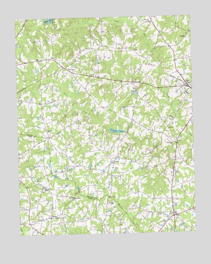
Bunn West, NC USGS Topographic Map
Click on map above to begin viewing in our Map Viewer.

This topographic map contains these locations and features:
Feature Name Type Latitude Longitude GNIS ID View Map
Bakers PondReservoirN35.9015°W78.3324°1008363View Map
Bethlehem ChurchChurchN35.9352°W78.3531°1019115View Map
BunnPopulated PlaceN35.9610°W78.2536°982260View Map
Bunn Fire Department Station 2BuildingN35.9740°W78.3440°2639131View Map
Bunn Post OfficePost OfficeN35.9605°W78.2532°2766581View Map
Bunn Rescue and Emergency Medical ServicesBuildingN35.9592°W78.2568°2720450View Map
Cliftons PondReservoirN35.9990°W78.3503°983286View Map
Dukes LakeReservoirN35.8956°W78.3360°984406View Map
Five PointsPopulated PlaceN35.9621°W78.2911°985135View Map
Gethsemane ChurchChurchN35.9349°W78.2669°1020421View Map
Gethsemane SchoolSchoolN35.9415°W78.2642°985648View Map
Halls CrossroadsPopulated PlaceN35.9827°W78.2650°1008374View Map
HopkinsPopulated PlaceN35.8849°W78.3522°1020832View Map
Hopkins ChapelChurchN35.9013°W78.3536°987060View Map
Hopkins Rural Fire Department Station 22BuildingN35.8851°W78.3547°2639483View Map
Lands PondReservoirN35.9558°W78.2909°988127View Map
Lands Pond DamDamN35.9568°W78.2897°999805View Map
New Harris School (historical)SchoolN35.9774°W78.3489°1008390View Map
New HopePopulated PlaceN35.9688°W78.3356°990983View Map
Norris CreekStreamN35.9304°W78.2517°991190View Map
PearcesPopulated PlaceN35.9165°W78.3069°991990View Map
Perry Pond DamDamN35.9335°W78.2981°999755View Map
Perrys PondReservoirN35.9341°W78.3006°992059View Map
Phelps ChapelChurchN35.9757°W78.3586°992116View Map
Pierce School (historical)SchoolN35.9163°W78.3064°1008393View Map
PilotPopulated PlaceN35.8849°W78.2650°992207View Map
Pilot Volunteer Fire and Rescue DepartmentBuildingN35.8884°W78.2659°2639154View Map
Poplar Springs ChurchChurchN35.9268°W78.2644°1022046View Map
Privetts PondReservoirN35.9087°W78.3486°1008397View Map
RileyPopulated PlaceN35.9315°W78.3531°1022291View Map
Riley FieldAirportN35.9301°W78.3503°2679121View Map
Rock Spring ChurchChurchN35.9974°W78.2786°1022330View Map
Saint Johns ChurchChurchN35.8849°W78.3456°993958View Map
Smiths PondReservoirN35.8935°W78.3047°999684View Map
Smiths Pond DamDamN35.8935°W78.3047°999683View Map
SuttonPopulated PlaceN35.9277°W78.2611°1022855View Map
Town of BunnCivilN35.9591°W78.2519°2405343View Map
Township of DunnCivilN35.9147°W78.2632°1026686View Map
Township of HarrisCivilN35.9955°W78.3295°1026687View Map
Union Gospel TabernacleChurchN35.9877°W78.2533°996472View Map
White Oak ChurchChurchN35.8857°W78.3481°997169View Map
Zebulon Country ClubLocaleN35.8932°W78.3081°997746View Map

Note: Coordinates in the location and feature list above are referenced to NAD83 datum.


Copyright (C) 2008-2025 Ryan Niemi / Sunset Dynamics ... All Rights Reserved