TopoQuest Logo
Do you find TopoQuest useful?
Help keep TopoQuest running and adding new maps/features by donating!
Bitcoin:  19c7KJd3qBynnjoSw5npx9KScwjBe4ifkT
Litecoin:  LXs6TkuXGGXo1vDsWCkWVdjQX94eUKd6ui
Home View Maps Find Maps Find Places Resources & Links


Madisonville, Texas Topographic Map

USGS Map Title: Madisonville, TX
USGS Map MRC: 30095H8
DRG (GeoTIFF) Download: o30095h8.tif


Neighboring USGS Topographic Map Quads:


  Normangee, TX  
31096A1
 

  Leona SW, TX  
31095A8
 

  Elwood, TX  
31095A7
 

  North Zulch, TX  
30096H1
 

  Madisonville, TX  
30095H8
 

  Connor, TX  
30095H7
 

  Iola, TX  
30096G1
 

  Bedias, TX  
30095G8
 

  Steep Branch, TX  
30095G7


Map MRC Location:

N31°
W96°
N31°
W95°
H8 H7 H6 H5 H4 H3 H2 H1
G8 G7 G6 G5 G4 G3 G2 G1
F8 F7 F6 F5 F4 F3 F2 F1
E8 E7 E6 E5 E4 E3 E2 E1
D8 D7 D6 D5 D4 D3 D2 D1
C8 C7 C6 C5 C4 C3 C2 C1
B8 B7 B6 B5 B4 B3 B2 B1
A8 A7 A6 A5 A4 A3 A2 A1
N30°
W96°
N30°
W95°

Madisonville, TX USGS 1:24K Topographic Map Preview:
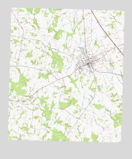
Madisonville, TX USGS Topographic Map
Click on map above to begin viewing in our Map Viewer.

This topographic map contains these locations and features:
Feature Name Type Latitude Longitude GNIS ID View Map
Anderson High SchoolSchoolN30.9441°W95.9227°1351105View Map
Brushy CreekStreamN30.9791°W95.9702°1353048View Map
Cedar GullyValleyN30.9866°W95.9976°1354098View Map
Center SchoolSchoolN30.9055°W95.9391°1354205View Map
City of MadisonvilleCivilN30.9537°W95.9091°2410908View Map
City of Madisonville Lake DamDamN30.9635°W95.9202°1860602View Map
Coon BranchStreamN30.9307°W95.9316°1354920View Map
Crescent LakeReservoirN30.9632°W95.9201°1355348View Map
Fellowship ChurchChurchN30.9419°W95.9661°1357274View Map
Ferry BranchStreamN30.9530°W95.9500°1357302View Map
Greenbriar CreekStreamN30.9738°W95.9569°1358391View Map
High Prairie CemeteryCemeteryN30.9585°W95.9888°1359190View Map
Jozye ChurchChurchN30.8966°W95.9219°1360446View Map
KMVL-AM (Madisonville)TowerN30.9346°W95.8813°1385627View Map
LaceolaPopulated PlaceN30.9719°W95.9869°1380046View Map
Madison CountyCivilN30.9655°W95.9284°1383939View Map
Madison County Constable's Office Precinct 1BuildingN30.9487°W95.9140°2739390View Map
Madison County Constable's Office Precinct 2BuildingN30.9487°W95.9140°2739391View Map
Madison County CourthouseBuildingN30.9491°W95.9141°2030550View Map
Madison County JailBuildingN30.9627°W95.8922°2738759View Map
Madison County Sheriff's OfficeBuildingN30.9625°W95.8923°2739177View Map
Madison Saint Joseph Health CenterHospitalN30.9423°W95.9108°2015763View Map
MadisonvillePopulated PlaceN30.9499°W95.9116°1362063View Map
Madisonville City HallBuildingN30.9495°W95.9156°2754034View Map
Madisonville DivisionCivilN30.9590°W95.8860°1938955View Map
Madisonville High SchoolSchoolN30.9444°W95.9083°2007724View Map
Madisonville Intermediate SchoolSchoolN30.9444°W95.9238°2007725View Map
Madisonville Junior High SchoolSchoolN30.9444°W95.9083°2007726View Map
Madisonville Municipal AirportAirportN30.9128°W95.9520°1387129View Map
Madisonville Police DepartmentBuildingN30.9497°W95.9157°2739193View Map
Madisonville Post OfficePost OfficeN30.9518°W95.9138°2731318View Map
Madisonville Volunteer Fire DepartmentBuildingN30.9577°W95.8962°2552189View Map
Mustang CreekStreamN30.9394°W95.9383°1363541View Map
Osborne LakeReservoirN30.9200°W95.9692°1860609View Map
Osborne Lake DamDamN30.9185°W95.9686°1860608View Map
Parten SchoolSchoolN30.9541°W95.9191°1364855View Map
Pooles BranchStreamN30.9180°W95.9761°1365580View Map
Reed BranchStreamN30.9096°W95.8963°1366291View Map
Shapira HotelBuildingN30.9682°W95.9158°2032652View Map
Soil Conservation Service Site 1 DamDamN30.9602°W95.9069°1860606View Map
Soil Conservation Service Site 1 ReservoirReservoirN30.9626°W95.9048°1860607View Map
Soil Conservation Service Site 2 DamDamN30.9485°W95.9052°1860604View Map
Soil Conservation Service Site 2 ReservoirReservoirN30.9490°W95.9032°1860605View Map
Stewart LakeReservoirN30.8834°W95.8758°1860611View Map
Stewart Lake DamDamN30.8852°W95.8752°1860610View Map
Town BranchStreamN30.9110°W95.9047°1370051View Map
Union SchoolSchoolN30.8874°W95.9752°1370469View Map

Note: Coordinates in the location and feature list above are referenced to NAD83 datum.


Copyright (C) 2008-2025 Ryan Niemi / Sunset Dynamics ... All Rights Reserved