TopoQuest Logo
Do you find TopoQuest useful?
Help keep TopoQuest running and adding new maps/features by donating!
Bitcoin:  19c7KJd3qBynnjoSw5npx9KScwjBe4ifkT
Litecoin:  LXs6TkuXGGXo1vDsWCkWVdjQX94eUKd6ui
Home View Maps Find Maps Find Places Resources & Links


Little Birch, West Virginia Topographic Map

USGS Map Title: Little Birch, WV
USGS Map MRC: 38080E6
DRG (GeoTIFF) Download: o38080e6.tif


Neighboring USGS Topographic Map Quads:


  Gassaway, WV  
38080F7
 

  Sutton, WV  
38080F6
 

  Newville, WV  
38080F5
 

  Herold, WV  
38080E7
 

  Little Birch, WV  
38080E6
 

  Erbacon, WV  
38080E5
 

  Widen, WV  
38080D7
 

  Tioga, WV  
38080D6
 

  Cowen, WV  
38080D5


Map MRC Location:

N39°
W81°
N39°
W80°
H8 H7 H6 H5 H4 H3 H2 H1
G8 G7 G6 G5 G4 G3 G2 G1
F8 F7 F6 F5 F4 F3 F2 F1
E8 E7 E6 E5 E4 E3 E2 E1
D8 D7 D6 D5 D4 D3 D2 D1
C8 C7 C6 C5 C4 C3 C2 C1
B8 B7 B6 B5 B4 B3 B2 B1
A8 A7 A6 A5 A4 A3 A2 A1
N38°
W81°
N38°
W80°

Little Birch, WV USGS 1:24K Topographic Map Preview:
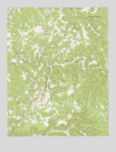
Little Birch, WV USGS Topographic Map
Click on map above to begin viewing in our Map Viewer.

This topographic map contains these locations and features:
Feature Name Type Latitude Longitude GNIS ID View Map
Baker Ridge CemeteryCemeteryN38.6235°W80.6520°2586323View Map
Barker RidgeRidgeN38.6195°W80.6437°1535234View Map
BaysLocaleN38.5293°W80.7162°1535322View Map
Bear RunStreamN38.5782°W80.7365°1535382View Map
Birch River Union ChurchChurchN38.5012°W80.7073°1536027View Map
Bluelick RunStreamN38.5620°W80.6301°1536139View Map
Brier RunStreamN38.5240°W80.7179°1536348View Map
Bug RidgeRidgeN38.6023°W80.6773°1536672View Map
Carpenter ForkStreamN38.5684°W80.6965°1537054View Map
Coon Den RunStreamN38.5515°W80.6395°1537624View Map
Crites Mountain School (historical)SchoolN38.5382°W80.6712°1537826View Map
Elizabeth ChapelChurchN38.5990°W80.6798°1538605View Map
Elizabeth Chapel CemeteryCemeteryN38.5994°W80.6797°2586226View Map
Fisher RunStreamN38.5707°W80.6904°1538999View Map
Gravel ForkStreamN38.5462°W80.7184°1539646View Map
Harris CemeteryCemeteryN38.5871°W80.6723°2574002View Map
Hickory FlatsFlatN38.5212°W80.6329°1540209View Map
Hickory Flats Cemetery CemeteryN38.5213°W80.6275°2728993View Map
Holstead (historical)Populated PlaceN38.5695°W80.6276°1727335View Map
Hoover CemeteryCemeteryN38.6021°W80.6782°2586163View Map
Jackson Memorial ChurchChurchN38.5765°W80.6529°1540784View Map
Laurel RunStreamN38.5729°W80.7390°1541497View Map
Little BirchPopulated PlaceN38.5790°W80.7068°1542030View Map
Little Birch Elementary SchoolSchoolN38.5796°W80.7098°1727354View Map
Little Birch MountainSummitN38.5382°W80.7120°1554960View Map
Little Birch Post OfficePost OfficeN38.5818°W80.7085°1727355View Map
May ForkStreamN38.5026°W80.6559°1542894View Map
Pilot KnobSummitN38.5304°W80.6251°1555353View Map
Ramp RunLocaleN38.5718°W80.6690°1545400View Map
Ramp RunStreamN38.5720°W80.6682°1545402View Map
Right Fork Little Birch RiverStreamN38.5668°W80.6448°1545664View Map
Road ForkStreamN38.5093°W80.6695°1545819View Map
Rose RunStreamN38.5004°W80.7020°1546075View Map
Seng RunStreamN38.5862°W80.7054°1546571View Map
Skyles (historical)Populated PlaceN38.5045°W80.6770°1727913View Map
Skyles CreekStreamN38.5040°W80.6779°1546876View Map
Spring RunStreamN38.5643°W80.6954°1547207View Map
Spruce ForkStreamN38.6132°W80.6509°1547246View Map
Spruce Fork ChurchChurchN38.6123°W80.6512°1547247View Map
Stump ChapelChurchN38.6043°W80.7054°1547597View Map
TeslaPopulated PlaceN38.6020°W80.7034°1555794View Map
Twolick RunStreamN38.5784°W80.7101°1548419View Map
Waggy (historical)Populated PlaceN38.5318°W80.6529°1741126View Map
Windy RunStreamN38.5787°W80.7337°1549245View Map
Windy Run Grade School (historical)SchoolN38.5970°W80.7232°1727393View Map

Note: Coordinates in the location and feature list above are referenced to NAD83 datum.


Copyright (C) 2008-2025 Ryan Niemi / Sunset Dynamics ... All Rights Reserved