TopoQuest Logo
Do you find TopoQuest useful?
Help keep TopoQuest running and adding new maps/features by donating!
Bitcoin:  19c7KJd3qBynnjoSw5npx9KScwjBe4ifkT
Litecoin:  LXs6TkuXGGXo1vDsWCkWVdjQX94eUKd6ui
Home View Maps Find Maps Find Places Resources & Links


Marienville West, Pennsylvania Topographic Map

USGS Map Title: Marienville West, PA
USGS Map MRC: 41079D2
DRG (GeoTIFF) Download: o41079d2.tif


Neighboring USGS Topographic Map Quads:


  Kellettville, PA  
41079E3
 

  Mayburg, PA  
41079E2
 

  Lynch, PA  
41079E1
 

  Tylersburg, PA  
41079D3
 

  Marienville West, PA  
41079D2
 

  Marienville East, PA  
41079D1
 

  Lucinda, PA  
41079C3
 

  Cooksburg, PA  
41079C2
 

  Sigel, PA  
41079C1


Map MRC Location:

N42°
W80°
N42°
W79°
H8 H7 H6 H5 H4 H3 H2 H1
G8 G7 G6 G5 G4 G3 G2 G1
F8 F7 F6 F5 F4 F3 F2 F1
E8 E7 E6 E5 E4 E3 E2 E1
D8 D7 D6 D5 D4 D3 D2 D1
C8 C7 C6 C5 C4 C3 C2 C1
B8 B7 B6 B5 B4 B3 B2 B1
A8 A7 A6 A5 A4 A3 A2 A1
N41°
W80°
N41°
W79°

Marienville West, PA USGS 1:24K Topographic Map Preview:
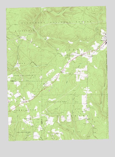
Marienville West, PA USGS Topographic Map
Click on map above to begin viewing in our Map Viewer.

This topographic map contains these locations and features:
Feature Name Type Latitude Longitude GNIS ID View Map
Bearpen RunStreamN41.3859°W79.1678°1199832View Map
BowmanvilleLocaleN41.4384°W79.2384°1210303View Map
CCC Camp (historical)LocaleN41.4601°W79.1864°1210304View Map
Chapel RunStreamN41.3778°W79.2425°1209491View Map
Clear Creek State Forest Maple Creek TractForestN41.4092°W79.1884°2352304View Map
East Forest Elementary SchoolSchoolN41.4737°W79.1256°1211634View Map
East Forrest Junior Senior High SchoolSchoolN41.4737°W79.1256°1211635View Map
Ellsworth RunStreamN41.4465°W79.2370°1198707View Map
GilfoylePopulated PlaceN41.4392°W79.1817°1203668View Map
Gilfoyle StationLocaleN41.4367°W79.1853°1212052View Map
Greeley FarmLocaleN41.4790°W79.1456°1210306View Map
Greenwood ChurchChurchN41.3809°W79.1906°1198840View Map
Greenwood SchoolSchoolN41.3909°W79.1928°1210305View Map
Guiton RunStreamN41.4995°W79.2028°1209651View Map
Little Salmon CreekStreamN41.4992°W79.2056°1209773View Map
Maple CreekLocaleN41.4220°W79.2073°1213441View Map
McAvoy SchoolSchoolN41.4209°W79.2378°1210302View Map
MuzettePopulated PlaceN41.4728°W79.2337°1209847View Map
Muzette Lookout TowerTowerN41.4845°W79.2400°1213295View Map
North Pine GrovePopulated PlaceN41.3953°W79.2220°1199233View Map
Pennsylvania State Police Troop C Marienville StationBuildingN41.3959°W79.1511°2777329View Map
RedclyffePopulated PlaceN41.3948°W79.1523°1204475View Map
Redclyffe ChurchChurchN41.4015°W79.1537°1199366View Map
RosesPopulated PlaceN41.4545°W79.1564°1199417View Map
Roses CemeteryCemeteryN41.4549°W79.1675°1199418View Map
Shadowood Farm Airport (historical)AirportN41.4278°W79.2025°1210250View Map
VowinckelPopulated PlaceN41.4115°W79.2287°1199730View Map
Vowinckel Census Designated PlaceCensusN41.4108°W79.2286°2630045View Map
Vowinckel Post OfficePost OfficeN41.4064°W79.2251°2779609View Map
WilliamsPopulated PlaceN41.4542°W79.1734°1212051View Map

Note: Coordinates in the location and feature list above are referenced to NAD83 datum.


Copyright (C) 2008-2025 Ryan Niemi / Sunset Dynamics ... All Rights Reserved