TopoQuest Logo
Do you find TopoQuest useful?
Help keep TopoQuest running and adding new maps/features by donating!
Bitcoin:  19c7KJd3qBynnjoSw5npx9KScwjBe4ifkT
Litecoin:  LXs6TkuXGGXo1vDsWCkWVdjQX94eUKd6ui
Home View Maps Find Maps Find Places Resources & Links


Strattanville, Pennsylvania Topographic Map

USGS Map Title: Strattanville, PA
USGS Map MRC: 41079B3
DRG (GeoTIFF) Download: o41079b3.tif


Neighboring USGS Topographic Map Quads:


  Fryburg, PA  
41079C4
 

  Lucinda, PA  
41079C3
 

  Cooksburg, PA  
41079C2
 

  Clarion, PA  
41079B4
 

  Strattanville, PA  
41079B3
 

  Corsica, PA  
41079B2
 

  Sligo, PA  
41079A4
 

  New Bethlehem, PA  
41079A3
 

  Summerville, PA  
41079A2


Map MRC Location:

N42°
W80°
N42°
W79°
H8 H7 H6 H5 H4 H3 H2 H1
G8 G7 G6 G5 G4 G3 G2 G1
F8 F7 F6 F5 F4 F3 F2 F1
E8 E7 E6 E5 E4 E3 E2 E1
D8 D7 D6 D5 D4 D3 D2 D1
C8 C7 C6 C5 C4 C3 C2 C1
B8 B7 B6 B5 B4 B3 B2 B1
A8 A7 A6 A5 A4 A3 A2 A1
N41°
W80°
N41°
W79°

Strattanville, PA USGS 1:24K Topographic Map Preview:
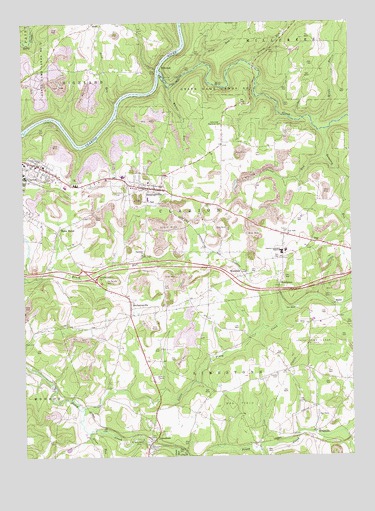
Strattanville, PA USGS Topographic Map
Click on map above to begin viewing in our Map Viewer.

This topographic map contains these locations and features:
Feature Name Type Latitude Longitude GNIS ID View Map
Asbury CemeteryCemeteryN41.1892°W79.2746°1168437View Map
Borough of StrattanvilleCivilN41.2025°W79.3268°1215092View Map
Calvary CemeteryCemeteryN41.1483°W79.2784°1170920View Map
Cedarview Memorial ParkCemeteryN41.2197°W79.3010°1171407View Map
Clarion Borough Police DepartmentBuildingN41.2068°W79.3647°2777107View Map
Clarion-Limestone High SchoolSchoolN41.1837°W79.2762°1171903View Map
DayPopulated PlaceN41.1867°W79.2648°1172999View Map
Douglass RunStreamN41.2187°W79.2589°1173426View Map
Fisher Mine StationLocaleN41.2009°W79.3189°1212169View Map
Frampton Post Office (historical)Post OfficeN41.1676°W79.3339°1214187View Map
Glade RunStreamN41.1270°W79.3173°1192518View Map
HendersonPopulated PlaceN41.1745°W79.2767°1203779View Map
Johnson School (historical)SchoolN41.2442°W79.2531°1200609View Map
Jones RunStreamN41.2120°W79.2592°1178153View Map
KingsvillePopulated PlaceN41.1317°W79.2639°1178507View Map
LimestonePopulated PlaceN41.1287°W79.3270°1179355View Map
Limestone Post OfficePost OfficeN41.1282°W79.3254°2773188View Map
Limestone Post Office (historical)Post OfficeN41.1301°W79.3248°1214190View Map
Limestone Township Fire Department Station 570BuildingN41.1349°W79.3236°2644791View Map
Little Mill CreekStreamN41.2226°W79.2506°1179601View Map
Little Piney CreekStreamN41.1390°W79.3520°1179640View Map
Maple Grove School (historical)SchoolN41.2137°W79.2873°1200608View Map
McGourvey RunStreamN41.2428°W79.3131°1180719View Map
MechanicsvillePopulated PlaceN41.1684°W79.3339°1180850View Map
Mill CreekStreamN41.2356°W79.3212°1209820View Map
Old Seceder CemeteryCemeteryN41.1755°W79.3436°1182938View Map
Parker-Cramer AirportAirportN41.2111°W79.3608°2443640View Map
Pinegrove SchoolSchoolN41.1456°W79.3064°1200633View Map
Poe RunStreamN41.1273°W79.2859°1184164View Map
RaderPopulated PlaceN41.1687°W79.2559°1204460View Map
Reed RunStreamN41.2267°W79.3387°1184822View Map
Rehoboth ChurchChurchN41.1831°W79.3295°1184866View Map
Showers Post Office (historical)Post OfficeN41.1776°W79.2914°1214188View Map
Sloan RunStreamN41.1320°W79.3500°1193379View Map
State Game Lands Number 74ParkN41.2320°W79.2912°1188531View Map
Stone HousePopulated PlaceN41.1903°W79.3617°1188725View Map
StrattanvillePopulated PlaceN41.2023°W79.3275°1188860View Map
Strattanville Post OfficePost OfficeN41.2029°W79.3259°2779974View Map
Strattanville Tower (historical)TowerN41.1859°W79.3464°1212170View Map
Strattanville Volunteer Fire Company Station 660BuildingN41.2033°W79.3277°2645644View Map
Stroup RunStreamN41.2378°W79.2870°1188892View Map
Tarkiln RunStreamN41.2490°W79.3709°1189285View Map
Township of ClarionCivilN41.1973°W79.3051°1216203View Map
Township of LimestoneCivilN41.1364°W79.2869°1216209View Map
Trap RunStreamN41.2378°W79.3056°1189724View Map
WatersonPopulated PlaceN41.1773°W79.2898°1190682View Map
Whites RunStreamN41.2317°W79.3173°1191339View Map
Woods RunStreamN41.2203°W79.2634°1191765View Map
WWCH-AM (Clarion)TowerN41.1762°W79.3392°1200484View Map

Note: Coordinates in the location and feature list above are referenced to NAD83 datum.


Copyright (C) 2008-2025 Ryan Niemi / Sunset Dynamics ... All Rights Reserved