TopoQuest Logo
Do you find TopoQuest useful?
Help keep TopoQuest running and adding new maps/features by donating!
Bitcoin:  19c7KJd3qBynnjoSw5npx9KScwjBe4ifkT
Litecoin:  LXs6TkuXGGXo1vDsWCkWVdjQX94eUKd6ui
Home View Maps Find Maps Find Places Resources & Links


Cooksburg, Pennsylvania Topographic Map

USGS Map Title: Cooksburg, PA
USGS Map MRC: 41079C2
DRG (GeoTIFF) Download: o41079c2.tif


Neighboring USGS Topographic Map Quads:


  Tylersburg, PA  
41079D3
 

  Marienville West, PA  
41079D2
 

  Marienville East, PA  
41079D1
 

  Lucinda, PA  
41079C3
 

  Cooksburg, PA  
41079C2
 

  Sigel, PA  
41079C1
 

  Strattanville, PA  
41079B3
 

  Corsica, PA  
41079B2
 

  Brookville, PA  
41079B1


Map MRC Location:

N42°
W80°
N42°
W79°
H8 H7 H6 H5 H4 H3 H2 H1
G8 G7 G6 G5 G4 G3 G2 G1
F8 F7 F6 F5 F4 F3 F2 F1
E8 E7 E6 E5 E4 E3 E2 E1
D8 D7 D6 D5 D4 D3 D2 D1
C8 C7 C6 C5 C4 C3 C2 C1
B8 B7 B6 B5 B4 B3 B2 B1
A8 A7 A6 A5 A4 A3 A2 A1
N41°
W80°
N41°
W79°

Cooksburg, PA USGS 1:24K Topographic Map Preview:
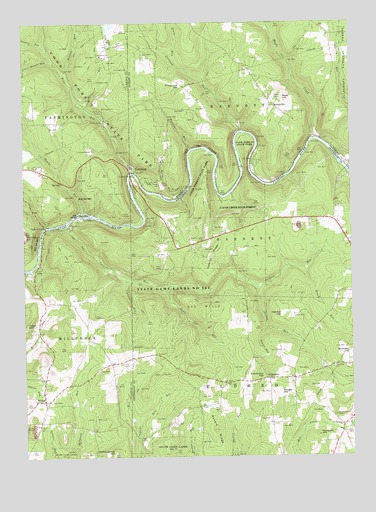
Cooksburg, PA USGS Topographic Map
Click on map above to begin viewing in our Map Viewer.

This topographic map contains these locations and features:
Feature Name Type Latitude Longitude GNIS ID View Map
Beer RunStreamN41.2609°W79.2064°1169124View Map
Black RunStreamN41.3042°W79.1425°1209428View Map
Browns RunStreamN41.3609°W79.2339°1170405View Map
C & W Milliron Flying FieldAirportN41.2877°W79.1691°2442967View Map
Cathers RunStreamN41.3167°W79.2337°1210152View Map
Cherry RunStreamN41.3331°W79.1256°1210155View Map
Clawson RunStreamN41.3006°W79.2106°1171940View Map
Coleman RunStreamN41.3440°W79.1656°1172188View Map
Cook Forest State ParkParkN41.3237°W79.1639°1210157View Map
Cook Forest TowerTowerN41.3209°W79.2098°1212166View Map
Cook TombPopulated PlaceN41.3287°W79.1964°1172385View Map
CooksburgPopulated PlaceN41.3334°W79.2095°1172395View Map
Cooksburg CemeteryCemeteryN41.3289°W79.1972°1172381View Map
Cooksburg Post OfficePost OfficeN41.3290°W79.2040°2773105View Map
Crawford Pumping StationBuildingN41.2673°W79.1306°1200920View Map
EllaPopulated PlaceN41.3101°W79.1906°1200918View Map
FisherPopulated PlaceN41.2665°W79.2425°1174812View Map
Fisher Post OfficePost OfficeN41.2665°W79.2406°2779586View Map
Fitzgerald HillSummitN41.3567°W79.1889°1174852View Map
Fitzgerald SchoolSchoolN41.3503°W79.1881°1200916View Map
Fowler RunStreamN41.2873°W79.1570°1175087View Map
Gravel LickPopulated PlaceN41.3167°W79.2417°1203708View Map
Gumbert HillSummitN41.2562°W79.1392°1176316View Map
Hefren RunStreamN41.3509°W79.2259°1176764View Map
Hemlock IslandIslandN41.3201°W79.2264°1176808View Map
Henry RunStreamN41.3242°W79.1920°1176842View Map
Henry RunStreamN41.3209°W79.2267°1176845View Map
Henry School (historical)SchoolN41.3462°W79.2498°1201231View Map
Hetrick HillSummitN41.2909°W79.1506°1176926View Map
Hominy RidgePopulated PlaceN41.3084°W79.1831°1202650View Map
Hominy RidgeRidgeN41.3103°W79.1764°1177335View Map
Hominy Ridge CemeteryCemeteryN41.3126°W79.1807°1177337View Map
HottelvillePopulated PlaceN41.3531°W79.1559°1177496View Map
Irwin RunStreamN41.3642°W79.1906°1177873View Map
Kahle RunStreamN41.2990°W79.1939°1178207View Map
KahletownPopulated PlaceN41.2726°W79.1573°1203908View Map
Kahletown HillSummitN41.2726°W79.1587°1178208View Map
Little Hefren RunStreamN41.3642°W79.2389°1179560View Map
Maple CreekStreamN41.3415°W79.1384°1180318View Map
Maze HillSummitN41.3534°W79.1503°1180590View Map
Millcreek Township Volunteer Fire Department Station 590BuildingN41.2657°W79.2416°2645640View Map
Pine Grove SchoolSchoolN41.3128°W79.1798°1200919View Map
Printer RunStreamN41.3695°W79.2284°1212165View Map
Rankin RidgeRidgeN41.2578°W79.1775°1184652View Map
Saint Dominics CemeteryCemeteryN41.2619°W79.1322°1185911View Map
Saint Dominics ChurchChurchN41.2592°W79.1286°1185912View Map
Seaton RunStreamN41.2992°W79.1606°1209963View Map
Shawkey HillSummitN41.2809°W79.1278°1187400View Map
Slocum SpringSpringN41.3292°W79.2355°1202281View Map
Songer HillSummitN41.2687°W79.1525°1187998View Map
State Game Lands Number 283ParkN41.3084°W79.2164°1208391View Map
Stone SchoolSchoolN41.2726°W79.1473°1200921View Map
Thompson HillSummitN41.3140°W79.2492°1189501View Map
Toms RunStreamN41.3320°W79.2070°1189652View Map
Toomey RunStreamN41.3681°W79.2414°1189660View Map
Township of BarnettCivilN41.3149°W79.1499°1216555View Map
Township of BarnettCivilN41.3748°W79.1520°1216451View Map
Township of EldredCivilN41.2510°W79.1277°1216559View Map
Troutman RunStreamN41.3390°W79.1848°1189873View Map
Turkey RidgePopulated PlaceN41.3251°W79.2448°1202651View Map
Woolford School (historical)SchoolN41.3109°W79.1253°1200917View Map
Zagst HillSummitN41.2881°W79.2492°1190971View Map

Note: Coordinates in the location and feature list above are referenced to NAD83 datum.


Copyright (C) 2008-2025 Ryan Niemi / Sunset Dynamics ... All Rights Reserved