TopoQuest Logo
Do you find TopoQuest useful?
Help keep TopoQuest running and adding new maps/features by donating!
Bitcoin:  19c7KJd3qBynnjoSw5npx9KScwjBe4ifkT
Litecoin:  LXs6TkuXGGXo1vDsWCkWVdjQX94eUKd6ui
Home View Maps Find Maps Find Places Resources & Links


Markle, Indiana Topographic Map

USGS Map Title: Markle, IN
USGS Map MRC: 40085G3
DRG (GeoTIFF) Download: o40085g3.tif


Neighboring USGS Topographic Map Quads:


  Huntington, IN  
40085H4
 

  Zanesville, IN  
40085H3
 

  Ossian, IN  
40085H2
 

  Majenica, IN  
40085G4
 

  Markle, IN  
40085G3
 

  Uniondale, IN  
40085G2
 

  Warren, IN  
40085F4
 

  Liberty Center, IN  
40085F3
 

  Bluffton, IN  
40085F2


Map MRC Location:

N41°
W86°
N41°
W85°
H8 H7 H6 H5 H4 H3 H2 H1
G8 G7 G6 G5 G4 G3 G2 G1
F8 F7 F6 F5 F4 F3 F2 F1
E8 E7 E6 E5 E4 E3 E2 E1
D8 D7 D6 D5 D4 D3 D2 D1
C8 C7 C6 C5 C4 C3 C2 C1
B8 B7 B6 B5 B4 B3 B2 B1
A8 A7 A6 A5 A4 A3 A2 A1
N40°
W86°
N40°
W85°

Markle, IN USGS 1:24K Topographic Map Preview:
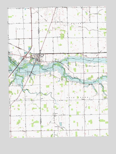
Markle, IN USGS Topographic Map
Click on map above to begin viewing in our Map Viewer.

This topographic map contains these locations and features:
Feature Name Type Latitude Longitude GNIS ID View Map
Buckeye ChurchChurchN40.7562°W85.3547°431743View Map
Emmanuel ChurchChurchN40.7728°W85.3175°434179View Map
Gordon DitchCanalN40.7556°W85.3027°435218View Map
Griffin DitchCanalN40.8217°W85.2591°435499View Map
Horeb CemeteryCemeteryN40.8278°W85.2764°436477View Map
Johnson AirportAirportN40.7732°W85.3386°2676924View Map
Lesh DitchCanalN40.7753°W85.2789°437787View Map
MarklePopulated PlaceN40.8246°W85.3388°438624View Map
Markle Police DepartmentBuildingN40.8258°W85.3390°2758296View Map
Markle Volunteer Fire and RescueBuildingN40.8262°W85.3389°2626617View Map
Redding DitchCanalN40.7664°W85.3219°441829View Map
Rock CreekStreamN40.8167°W85.3622°442195View Map
RockfordPopulated PlaceN40.7600°W85.3136°442219View Map
Saint Pauls ChurchChurchN40.7862°W85.2533°442783View Map
Sparks CemeteryCemeteryN40.7874°W85.3347°443911View Map
Spider Hill CemeteryCemeteryN40.7706°W85.3186°443948View Map
Town of MarkleCivilN40.8274°W85.3393°2396736View Map
Township of RockcreekCivilN40.7863°W85.2792°453811View Map
Township of UnionCivilN40.8737°W85.2794°453938View Map
Wells County Emergency Medical Services - Markle StationBuildingN40.8259°W85.3390°2719385View Map
Worster FarmsLocaleN40.7997°W85.3475°2635431View Map

Note: Coordinates in the location and feature list above are referenced to NAD83 datum.


Copyright (C) 2008-2025 Ryan Niemi / Sunset Dynamics ... All Rights Reserved