TopoQuest Logo
Do you find TopoQuest useful?
Help keep TopoQuest running and adding new maps/features by donating!
Bitcoin:  19c7KJd3qBynnjoSw5npx9KScwjBe4ifkT
Litecoin:  LXs6TkuXGGXo1vDsWCkWVdjQX94eUKd6ui
Home View Maps Find Maps Find Places Resources & Links


Midway, Arkansas Topographic Map

USGS Map Title: Midway, AR
USGS Map MRC: 36092D4
DRG (GeoTIFF) Download: o36092d4.tif


Neighboring USGS Topographic Map Quads:


  Isabella, MO  
36092E5
 

  Gainesville, MO  
36092E4
 

  Udall, MO  
36092E3
 

  Bull Shoals, AR  
36092D5
 

  Midway, AR  
36092D4
 

  Clarkridge, AR  
36092D3
 

  Cotter, AR  
36092C5
 

  Mountain Home West, AR  
36092C4
 

  Mountain Home East, AR  
36092C3


Map MRC Location:

N37°
W93°
N37°
W92°
H8 H7 H6 H5 H4 H3 H2 H1
G8 G7 G6 G5 G4 G3 G2 G1
F8 F7 F6 F5 F4 F3 F2 F1
E8 E7 E6 E5 E4 E3 E2 E1
D8 D7 D6 D5 D4 D3 D2 D1
C8 C7 C6 C5 C4 C3 C2 C1
B8 B7 B6 B5 B4 B3 B2 B1
A8 A7 A6 A5 A4 A3 A2 A1
N36°
W93°
N36°
W92°

Midway, AR USGS 1:24K Topographic Map Preview:
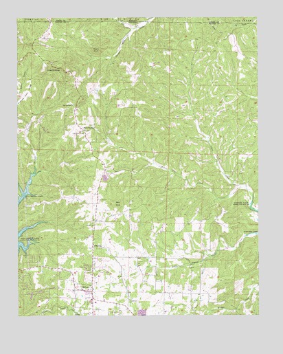
Midway, AR USGS Topographic Map
Click on map above to begin viewing in our Map Viewer.

This topographic map contains these locations and features:
Feature Name Type Latitude Longitude GNIS ID View Map
ArkawanaPopulated PlaceN36.4037°W92.4610°76195View Map
Bald DaveSummitN36.4220°W92.4479°76227View Map
Clarkridge Volunteer Fire Department Station 4BuildingN36.4898°W92.3940°2116278View Map
Conley CemeteryCemeteryN36.3812°W92.4427°76660View Map
Hutch CreekStreamN36.4278°W92.3807°50469View Map
Liberty Church of ChristChurchN36.4128°W92.4604°77489View Map
MidwayPopulated PlaceN36.3853°W92.4618°58176View Map
Midway Baptist ChurchChurchN36.3862°W92.4613°69401View Map
Midway Census Designated PlaceCensusN36.3916°W92.4725°2612129View Map
Midway Fire Protection District Volunteer Fire Department Station 2BuildingN36.4351°W92.4548°2116795View Map
Midway Post OfficePost OfficeN36.3862°W92.4673°84493View Map
Negro KnobSummitN36.4867°W92.4593°58248View Map
Oakland CemeteryCemeteryN36.4917°W92.4879°52958View Map
Pine CreekStreamN36.4959°W92.4399°724374View Map
Three BrothersPopulated PlaceN36.4526°W92.4657°55557View Map
Three BrothersSummitN36.4767°W92.4813°78546View Map
Three Brothers CemeteryCemeteryN36.4514°W92.4649°78547View Map
Three Brothers ChurchChurchN36.4634°W92.4713°55558View Map
Three Brothers School (historical)SchoolN36.4520°W92.4657°69447View Map
Township of LoganCivilN36.4481°W92.4722°69562View Map
Walker CemeteryCemeteryN36.3812°W92.4093°55959View Map

Note: Coordinates in the location and feature list above are referenced to NAD83 datum.


Copyright (C) 2008-2025 Ryan Niemi / Sunset Dynamics ... All Rights Reserved