TopoQuest Logo
Do you find TopoQuest useful?
Help keep TopoQuest running and adding new maps/features by donating!
Bitcoin:  19c7KJd3qBynnjoSw5npx9KScwjBe4ifkT
Litecoin:  LXs6TkuXGGXo1vDsWCkWVdjQX94eUKd6ui
Home View Maps Find Maps Find Places Resources & Links


Mountville, Georgia Topographic Map

USGS Map Title: Mountville, GA
USGS Map MRC: 33084A8
DRG (GeoTIFF) Download: o33084a8.tif


Neighboring USGS Topographic Map Quads:


  Hillcrest, GA  
33085B1
 

  Hogansville, GA  
33084B8
 

  Grantville, GA  
33084B7
 

  La Grange, GA  
33085A1
 

  Mountville, GA  
33084A8
 

  Odessadale, GA  
33084A7
 

  Cannonville, GA  
32085H1
 

  Hilyer, GA  
32084H8
 

  Durand, GA  
32084H7


Map MRC Location:

N34°
W85°
N34°
W84°
H8 H7 H6 H5 H4 H3 H2 H1
G8 G7 G6 G5 G4 G3 G2 G1
F8 F7 F6 F5 F4 F3 F2 F1
E8 E7 E6 E5 E4 E3 E2 E1
D8 D7 D6 D5 D4 D3 D2 D1
C8 C7 C6 C5 C4 C3 C2 C1
B8 B7 B6 B5 B4 B3 B2 B1
A8 A7 A6 A5 A4 A3 A2 A1
N33°
W85°
N33°
W84°

Mountville, GA USGS 1:24K Topographic Map Preview:
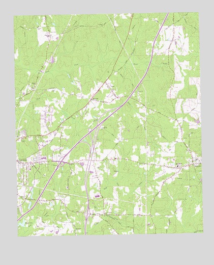
Mountville, GA USGS Topographic Map
Click on map above to begin viewing in our Map Viewer.

This topographic map contains these locations and features:
Feature Name Type Latitude Longitude GNIS ID View Map
Bryant DamDamN33.0071°W84.9966°337577View Map
Bryant LakeReservoirN33.0074°W84.9966°311938View Map
Butler CemeteryCemeteryN33.0137°W84.9605°312097View Map
Callaway Chapel Missionary Baptist ChurchChurchN33.0404°W84.9635°354937View Map
Callaway Elementary SchoolSchoolN33.1117°W84.9734°2545693View Map
Callaway High SchoolSchoolN33.0850°W84.9803°2545570View Map
Callaway Middle SchoolSchoolN33.1150°W84.9734°2545528View Map
Camp ViolaLocaleN33.0571°W84.8822°312264View Map
Clinton Chapel School (historical)SchoolN33.0407°W84.9641°1673183View Map
Cox CemeteryCemeteryN33.0543°W84.8869°313071View Map
Days LakeReservoirN33.0618°W84.9494°340568View Map
Days Lake DamDamN33.0618°W84.9483°340567View Map
Evans CemeteryCemeteryN33.0612°W84.8799°313993View Map
Exit 15CrossingN33.0123°W84.9527°1673195View Map
Exit 4CrossingN33.0421°W84.9694°1673193View Map
Exit 5CrossingN33.0590°W84.9483°1673194View Map
Gardner Newman Middle SchoolSchoolN33.0682°W84.9845°2545738View Map
Hanks LakeReservoirN33.0404°W84.9557°340141View Map
Hanks Lake DamDamN33.0401°W84.9549°340140View Map
Heard CemeteryCemeteryN33.0823°W84.9747°315276View Map
Hickory Grove School (historical)SchoolN33.1182°W84.9841°1673217View Map
Jones CemeteryCemeteryN33.0110°W84.9180°316215View Map
KnottPopulated PlaceN33.0118°W84.9380°332158View Map
Lagrange Fire Department Station 1BuildingN33.0193°W84.9948°1673074View Map
LaGrange Seventh Day Adventist SchoolSchoolN33.0430°W84.9761°2545644View Map
LaGrange Transitional CenterBuildingN33.0271°W84.9659°2735732View Map
Lake ForestReservoirN33.0129°W84.9340°1673204View Map
Lasater DamDamN33.0618°W84.8766°337573View Map
Lasater LakeReservoirN33.0634°W84.8775°337574View Map
LouisePopulated PlaceN33.0840°W84.9358°332270View Map
Louise CemeteryCemeteryN33.0726°W84.9074°317431View Map
Louise ChurchChurchN33.0707°W84.9083°1673244View Map
Louise ChurchChurchN33.0810°W84.9163°317432View Map
Mallory DamDamN33.0218°W84.9899°340190View Map
Mallory LakeReservoirN33.0217°W84.9898°340191View Map
McGhee ChapelChurchN33.0862°W84.9855°317915View Map
Mount Olive ChurchChurchN33.0112°W84.9441°318761View Map
Mount Pleasant SchoolSchoolN33.0382°W84.8913°318865View Map
Mount Zion ChurchChurchN33.0607°W84.9405°318996View Map
MountvillePopulated PlaceN33.0393°W84.8808°319091View Map
Mountville Elementary SchoolSchoolN33.0381°W84.8914°2545614View Map
Newberry LakeReservoirN33.0996°W84.9743°340139View Map
Newberry Lake DamDamN33.0985°W84.9749°340138View Map
Newsom CemeteryCemeteryN33.0221°W84.9966°319581View Map
Old Mount Olive ChurchChurchN33.0035°W84.9608°320001View Map
Owens CemeteryCemeteryN33.0468°W84.8833°320127View Map
Reid CemeteryCemeteryN33.0448°W84.9710°321511View Map
Ridley DamDamN33.0168°W84.9916°340192View Map
Ridley LakeReservoirN33.0177°W84.9914°340193View Map
Saint Bethel ChurchChurchN33.1187°W84.9388°322052View Map
Shilolt CemeteryCemeteryN33.1154°W84.9749°322906View Map
Spring Hill ChurchChurchN33.1132°W84.9755°323433View Map
Thrash CemeteryCemeteryN33.0196°W84.8869°324136View Map
Traylor Johnson CemeteryCemeteryN33.0123°W84.9416°324282View Map
Troup County Fire Department Station 9BuildingN33.0401°W84.8754°2604589View Map
Union CemeteryCemeteryN33.0829°W84.9858°1673304View Map
Union ChapelChurchN33.0835°W84.9869°324498View Map
Welcome ChurchChurchN33.0568°W84.9822°324977View Map
West Georgia Commons Shopping CenterLocaleN33.0440°W84.9816°1673308View Map
WhitfieldPopulated PlaceN33.0771°W84.9480°333422View Map
WMXY-AM (Hogansville)TowerN33.0648°W84.9558°352465View Map

Note: Coordinates in the location and feature list above are referenced to NAD83 datum.


Copyright (C) 2008-2024 Ryan Niemi / Sunset Dynamics ... All Rights Reserved