TopoQuest Logo
Do you find TopoQuest useful?
Help keep TopoQuest running and adding new maps/features by donating!
Bitcoin:  19c7KJd3qBynnjoSw5npx9KScwjBe4ifkT
Litecoin:  LXs6TkuXGGXo1vDsWCkWVdjQX94eUKd6ui
Home View Maps Find Maps Find Places Resources & Links


Odessadale, Georgia Topographic Map

USGS Map Title: Odessadale, GA
USGS Map MRC: 33084A7
DRG (GeoTIFF) Download: o33084a7.tif


Neighboring USGS Topographic Map Quads:


  Hogansville, GA  
33084B8
 

  Grantville, GA  
33084B7
 

  Luthersville, GA  
33084B6
 

  Mountville, GA  
33084A8
 

  Odessadale, GA  
33084A7
 

  Greenville, GA  
33084A6
 

  Hilyer, GA  
32084H8
 

  Durand, GA  
32084H7
 

  Warm Springs, GA  
32084H6


Map MRC Location:

N34°
W85°
N34°
W84°
H8 H7 H6 H5 H4 H3 H2 H1
G8 G7 G6 G5 G4 G3 G2 G1
F8 F7 F6 F5 F4 F3 F2 F1
E8 E7 E6 E5 E4 E3 E2 E1
D8 D7 D6 D5 D4 D3 D2 D1
C8 C7 C6 C5 C4 C3 C2 C1
B8 B7 B6 B5 B4 B3 B2 B1
A8 A7 A6 A5 A4 A3 A2 A1
N33°
W85°
N33°
W84°

Odessadale, GA USGS 1:24K Topographic Map Preview:
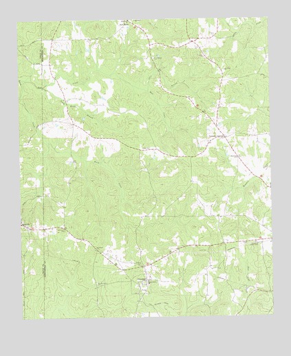
Odessadale, GA USGS Topographic Map
Click on map above to begin viewing in our Map Viewer.

This topographic map contains these locations and features:
Feature Name Type Latitude Longitude GNIS ID View Map
Bear CreekStreamN33.1001°W84.8730°310929View Map
Bethlehem ChurchChurchN33.1248°W84.8152°311240View Map
Branch Hebron CemeteryCemeteryN33.0146°W84.8377°311722View Map
Branch Hebron ChurchChurchN33.0151°W84.8122°354833View Map
Cousins CemeteryCemeteryN33.1185°W84.7760°313044View Map
Florence CemeteryCemeteryN33.0226°W84.8152°314234View Map
Jones CemeteryCemeteryN33.0279°W84.7827°316216View Map
Jones-Florence PlantationLocaleN33.0271°W84.8149°346878View Map
Marchman CemeteryCemeteryN33.0671°W84.7663°317683View Map
Martin CemeteryCemeteryN33.0307°W84.7644°317739View Map
McLaughin CemeteryCemeteryN33.1096°W84.7816°317950View Map
Meriwether Lookout TowerTowerN33.0301°W84.7569°344290View Map
Mountville CemeteryCemeteryN33.0376°W84.8713°1673250View Map
Needmore CemeteryCemeteryN33.0371°W84.8530°319230View Map
Oak Ridge ChurchChurchN33.1037°W84.7716°319851View Map
OdessadalePopulated PlaceN33.0160°W84.8130°332557View Map
Odessadale ChurchChurchN33.0148°W84.8377°346904View Map
Odessadale United Methodist ChurchChurchN33.0101°W84.8172°346905View Map
Ollie BranchStreamN33.0951°W84.8097°320061View Map
Ollie Branch CemeteryCemeteryN33.1090°W84.8066°320062View Map
Piney Woods BranchStreamN33.1004°W84.8730°320736View Map
Powell DamDamN33.0235°W84.8699°340465View Map
Powell LakeReservoirN33.0245°W84.8697°340466View Map
Thompson CrossroadPopulated PlaceN33.0751°W84.7722°333217View Map
Turner CemeteryCemeteryN33.1129°W84.7863°324404View Map
White Plain ChurchChurchN33.1248°W84.8185°325183View Map
Woodward CemeteryCemeteryN33.0293°W84.8374°325553View Map

Note: Coordinates in the location and feature list above are referenced to NAD83 datum.


Copyright (C) 2008-2025 Ryan Niemi / Sunset Dynamics ... All Rights Reserved