TopoQuest Logo
Do you find TopoQuest useful?
Help keep TopoQuest running and adding new maps/features by donating!
Bitcoin:  19c7KJd3qBynnjoSw5npx9KScwjBe4ifkT
Litecoin:  LXs6TkuXGGXo1vDsWCkWVdjQX94eUKd6ui
Home View Maps Find Maps Find Places Resources & Links


Banner, Missouri Topographic Map

USGS Map Title: Banner, MO
USGS Map MRC: 37090F7
DRG (GeoTIFF) Download: o37090f7.tif


Neighboring USGS Topographic Map Quads:


  Palmer, MO  
37090G8
 

  Belgrade, MO  
37090G7
 

  Irondale, MO  
37090G6
 

  Johnson Mountain, MO  
37090F8
 

  Banner, MO  
37090F7
 

  Graniteville, MO  
37090F6
 

  Edgehill, MO  
37090E8
 

  Johnson Shut-ins, MO  
37090E7
 

  Ironton, MO  
37090E6


Map MRC Location:

N38°
W91°
N38°
W90°
H8 H7 H6 H5 H4 H3 H2 H1
G8 G7 G6 G5 G4 G3 G2 G1
F8 F7 F6 F5 F4 F3 F2 F1
E8 E7 E6 E5 E4 E3 E2 E1
D8 D7 D6 D5 D4 D3 D2 D1
C8 C7 C6 C5 C4 C3 C2 C1
B8 B7 B6 B5 B4 B3 B2 B1
A8 A7 A6 A5 A4 A3 A2 A1
N37°
W91°
N37°
W90°

Banner, MO USGS 1:24K Topographic Map Preview:
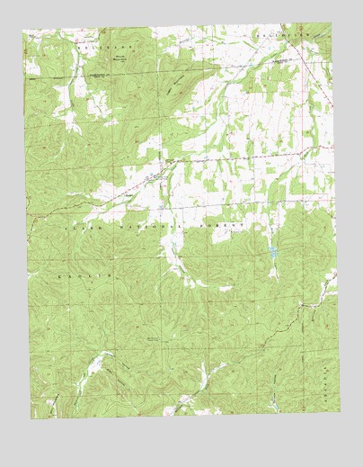
Banner, MO USGS Topographic Map
Click on map above to begin viewing in our Map Viewer.

This topographic map contains these locations and features:
Feature Name Type Latitude Longitude GNIS ID View Map
Alec HollowValleyN37.6414°W90.8471°748568View Map
BannerPopulated PlaceN37.6970°W90.8346°748661View Map
Bell MountainSummitN37.6262°W90.8662°748774View Map
Bell Mountain Lookout TowerTowerN37.6495°W90.8226°755000View Map
Bell Mountain WildernessReserveN37.6331°W90.8692°754385View Map
Belleview Valley Nursing HomeHospitalN37.7014°W90.8223°748778View Map
Cedar Grove ChurchChurchN37.7062°W90.8018°749294View Map
Cedar Grove School (historical)SchoolN37.7070°W90.8015°748140View Map
Coon HollowValleyN37.6920°W90.8157°749462View Map
Full Gospel ChapelChurchN37.7062°W90.8157°750006View Map
Hansop SchoolSchoolN37.7467°W90.8593°748139View Map
Keesling BranchStreamN37.6981°W90.8285°736621View Map
Lambert HollowValleyN37.6448°W90.8460°750645View Map
Logan MountainSummitN37.7312°W90.8121°750823View Map
McClurg BranchStreamN37.7050°W90.8151°736620View Map
Nelson CemeteryCemeteryN37.7006°W90.8251°751275View Map
Pruitt MountainSummitN37.7389°W90.8351°751769View Map
Reid CreekStreamN37.7395°W90.7579°751849View Map
Richardson CemeteryCemeteryN37.6837°W90.7926°751865View Map
Ried Creek School (historical)SchoolN37.6934°W90.7765°748142View Map
Ruddick School (historical)SchoolN37.6914°W90.8262°748141View Map
Rutledge RunStreamN37.7395°W90.7768°751992View Map
Saline CreekStreamN37.7437°W90.7585°752012View Map
Thomas ChapelChurchN37.7475°W90.8696°752527View Map
Thomas Chapel CemeteryCemeteryN37.7473°W90.8698°1759792View Map
Trailhead Parking AreaLocaleN37.6662°W90.8507°753959View Map
Tullock CemeteryCemeteryN37.7473°W90.8451°752590View Map

Note: Coordinates in the location and feature list above are referenced to NAD83 datum.


Copyright (C) 2008-2025 Ryan Niemi / Sunset Dynamics ... All Rights Reserved