TopoQuest Logo
Do you find TopoQuest useful?
Help keep TopoQuest running and adding new maps/features by donating!
Bitcoin:  19c7KJd3qBynnjoSw5npx9KScwjBe4ifkT
Litecoin:  LXs6TkuXGGXo1vDsWCkWVdjQX94eUKd6ui
Home View Maps Find Maps Find Places Resources & Links


De Loutre, Louisiana Topographic Map

USGS Map Title: De Loutre, LA
USGS Map MRC: 32092G3
DRG (GeoTIFF) Download: o32092g3.tif


Neighboring USGS Topographic Map Quads:


  Truxno, LA  
32092H4
 

  Marion West, LA  
32092H3
 

  Marion East, LA  
32092H2
 

  Farmerville, LA  
32092G4
 

  De Loutre, LA  
32092G3
 

  Haile, LA  
32092G2
 

  Downsville North, LA  
32092F4
 

  Point, LA  
32092F3
 

  Rocky Branch, LA  
32092F2


Map MRC Location:

N33°
W93°
N33°
W92°
H8 H7 H6 H5 H4 H3 H2 H1
G8 G7 G6 G5 G4 G3 G2 G1
F8 F7 F6 F5 F4 F3 F2 F1
E8 E7 E6 E5 E4 E3 E2 E1
D8 D7 D6 D5 D4 D3 D2 D1
C8 C7 C6 C5 C4 C3 C2 C1
B8 B7 B6 B5 B4 B3 B2 B1
A8 A7 A6 A5 A4 A3 A2 A1
N32°
W93°
N32°
W92°

De Loutre, LA USGS 1:24K Topographic Map Preview:
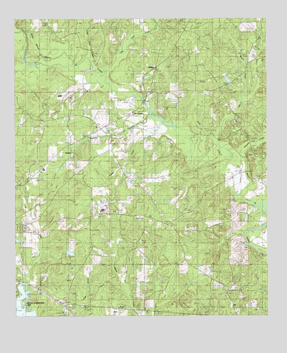
De Loutre, LA USGS Topographic Map
Click on map above to begin viewing in our Map Viewer.

This topographic map contains these locations and features:
Feature Name Type Latitude Longitude GNIS ID View Map
Antioch CemeteryCemeteryN32.7585°W92.2718°532178View Map
Antioch ChurchChurchN32.7610°W92.2696°532190View Map
Beaver CreekStreamN32.8415°W92.2632°532859View Map
Big Cane CreekStreamN32.8515°W92.3315°533057View Map
Big CreekStreamN32.8246°W92.2746°544855View Map
CanbealPopulated PlaceN32.8196°W92.3532°543051View Map
De LoutrePopulated PlaceN32.8326°W92.3113°543132View Map
Defees Ferry (historical)CrossingN32.8343°W92.3079°548708View Map
Edwards CemeteryCemeteryN32.8378°W92.2686°534775View Map
Enterprise CemeteryCemeteryN32.7537°W92.3234°544056View Map
Enterprise ChurchChurchN32.7537°W92.3243°534828View Map
Farmerville Elementary SchoolSchoolN32.8120°W92.3614°2462910View Map
Halls ChurchChurchN32.8157°W92.3610°535500View Map
Jerusalem ChurchChurchN32.8737°W92.3021°536037View Map
KTDL-AM (Farmerville)TowerN32.8060°W92.3735°1632522View Map
KWJM-FM (Farmerville)TowerN32.8060°W92.3735°1632442View Map
Liberty ChurchChurchN32.8249°W92.3274°536423View Map
Little Cane CreekStreamN32.8579°W92.3390°536503View Map
Ouchley Pond DamDamN32.7768°W92.3485°556842View Map
Ouchleys PondReservoirN32.7768°W92.3477°556843View Map
Owens CreekStreamN32.8290°W92.2938°537923View Map
Parish Governing Authority District 7CivilN32.7668°W92.3000°1930213View Map
QuigleyPopulated PlaceN32.8549°W92.3049°543607View Map
Railroad BranchStreamN32.8343°W92.3079°538482View Map
Saint Johns ChapelChurchN32.7835°W92.3132°538890View Map
Salem ChurchChurchN32.8324°W92.3618°539094View Map
Smith BranchStreamN32.8604°W92.3626°539430View Map
Steward CreekStreamN32.8193°W92.2624°544871View Map
Sweet Lily ChurchChurchN32.8596°W92.3346°539764View Map
Taylor CemeteryCemeteryN32.8237°W92.3282°539803View Map
Union ChurchChurchN32.8440°W92.2718°540099View Map
Union ParishCivilN32.8319°W92.3748°559528View Map
Wards ChapelChurchN32.7935°W92.3238°540232View Map
Zion Watch ChurchChurchN32.8687°W92.3454°540610View Map

Note: Coordinates in the location and feature list above are referenced to NAD83 datum.


Copyright (C) 2008-2025 Ryan Niemi / Sunset Dynamics ... All Rights Reserved