TopoQuest Logo
Do you find TopoQuest useful?
Help keep TopoQuest running and adding new maps/features by donating!
Bitcoin:  19c7KJd3qBynnjoSw5npx9KScwjBe4ifkT
Litecoin:  LXs6TkuXGGXo1vDsWCkWVdjQX94eUKd6ui
Home View Maps Find Maps Find Places Resources & Links


Marienville East, Pennsylvania Topographic Map

USGS Map Title: Marienville East, PA
USGS Map MRC: 41079D1
DRG (GeoTIFF) Download: o41079d1.tif


Neighboring USGS Topographic Map Quads:


  Mayburg, PA  
41079E2
 

  Lynch, PA  
41079E1
 

  Russell City, PA  
41078E8
 

  Marienville West, PA  
41079D2
 

  Marienville East, PA  
41079D1
 

  Hallton, PA  
41078D8
 

  Cooksburg, PA  
41079C2
 

  Sigel, PA  
41079C1
 

  Munderf, PA  
41078C8


Map MRC Location:

N42°
W80°
N42°
W79°
H8 H7 H6 H5 H4 H3 H2 H1
G8 G7 G6 G5 G4 G3 G2 G1
F8 F7 F6 F5 F4 F3 F2 F1
E8 E7 E6 E5 E4 E3 E2 E1
D8 D7 D6 D5 D4 D3 D2 D1
C8 C7 C6 C5 C4 C3 C2 C1
B8 B7 B6 B5 B4 B3 B2 B1
A8 A7 A6 A5 A4 A3 A2 A1
N41°
W80°
N41°
W79°

Marienville East, PA USGS 1:24K Topographic Map Preview:
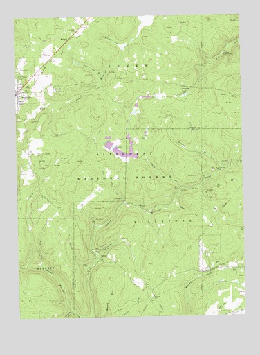
Marienville East, PA USGS Topographic Map
Click on map above to begin viewing in our Map Viewer.

This topographic map contains these locations and features:
Feature Name Type Latitude Longitude GNIS ID View Map
Brush CreekStreamN41.3978°W79.1184°1198490View Map
Buzzard SwampSwampN41.4459°W79.0709°1198511View Map
Buzzard Swamp Coop Wildlife Management AreaParkN41.4476°W79.0636°1210478View Map
Crooked RunStreamN41.4509°W79.0625°1210474View Map
Dry RunStreamN41.3973°W79.1114°1198666View Map
Gurgling RunStreamN41.4362°W79.0114°1198848View Map
Jakes RunStreamN41.4184°W79.0514°1200858View Map
Jakes RunStreamN41.4209°W79.0392°1198938View Map
Kelly Pines Recreation AreaLocaleN41.4842°W79.0092°1198966View Map
LamonavillePopulated PlaceN41.4701°W79.0264°1198993View Map
Laurel RunStreamN41.3956°W79.0861°1199004View Map
Lick RunStreamN41.4215°W79.0656°1199036View Map
Log RunStreamN41.4117°W79.0814°1199072View Map
LoletaPopulated PlaceN41.3990°W79.0795°1204052View Map
Loleta Fire Tower (historical)TowerN41.4034°W79.0814°1200859View Map
Loleta Interpretive TrailTrailN41.4087°W79.0720°1210476View Map
Loleta Recreation AreaLocaleN41.4045°W79.0795°1199074View Map
MarienvillePopulated PlaceN41.4690°W79.1231°1213633View Map
Marienville Census Designated PlaceCensusN41.4687°W79.1182°2584484View Map
Marienville District Ranger StationLocaleN41.4881°W79.0984°1210477View Map
Marienville Post OfficePost OfficeN41.4677°W79.1232°2780019View Map
Marienville Volunteer Fire CompanyBuildingN41.4701°W79.1231°2645401View Map
McCray RunStreamN41.4881°W79.0645°1199132View Map
McCraysPopulated PlaceN41.4906°W79.0948°1204129View Map
Muddy ForkStreamN41.4276°W79.0331°1199209View Map
North Forest CemeteryCemeteryN41.4743°W79.1244°1199231View Map
Penelec Retention DamDamN41.3967°W79.0664°1195539View Map
Scott RunStreamN41.4759°W79.0773°1199497View Map
Shippen RunStreamN41.3781°W79.0961°1209977View Map
Sigel Volunteer Fire Department Ward 2 Station 14BuildingN41.3758°W79.0077°2644952View Map
Songbird Station Interpretive TrailTrailN41.4548°W79.0786°1210473View Map
State Correctional Institution ForestBuildingN41.4805°W79.0988°2757201View Map
Steck RunStreamN41.4290°W79.0220°1199613View Map
Sugarcamp RunStreamN41.4015°W79.0809°1199643View Map
Township of JenksCivilN41.4782°W79.0935°1216456View Map
Township of MillstoneCivilN41.4015°W79.0279°1216404View Map
Trout RunStreamN41.4642°W79.1053°1210450View Map
Ung Overbeck Pumping StationLocaleN41.3837°W79.0509°1210475View Map
United States Forest Service Marienville Ranger StationBuildingN41.4882°W79.1026°2645571View Map

Note: Coordinates in the location and feature list above are referenced to NAD83 datum.


Copyright (C) 2008-2025 Ryan Niemi / Sunset Dynamics ... All Rights Reserved