TopoQuest Logo
Do you find TopoQuest useful?
Help keep TopoQuest running and adding new maps/features by donating!
Bitcoin:  19c7KJd3qBynnjoSw5npx9KScwjBe4ifkT
Litecoin:  LXs6TkuXGGXo1vDsWCkWVdjQX94eUKd6ui
Home View Maps Find Maps Find Places Resources & Links


Saranac, Louisiana Topographic Map

USGS Map Title: Saranac, LA
USGS Map MRC: 32091A3
DRG (GeoTIFF) Download: o32091a3.tif


Neighboring USGS Topographic Map Quads:


  Tensas Bluff, LA  
32091B4
 

  Westwood, LA  
32091B3
 

  Somerset, LA  
32091B2
 

  Newlight, LA  
32091A4
 

  Saranac, LA  
32091A3
 

  Newellton, LA  
32091A2
 

  Gretna Green, LA  
31091H4
 

  Lake Bruin, LA  
31091H3
 

  Saint Joseph, LA  
31091H2


Map MRC Location:

N33°
W92°
N33°
W91°
H8 H7 H6 H5 H4 H3 H2 H1
G8 G7 G6 G5 G4 G3 G2 G1
F8 F7 F6 F5 F4 F3 F2 F1
E8 E7 E6 E5 E4 E3 E2 E1
D8 D7 D6 D5 D4 D3 D2 D1
C8 C7 C6 C5 C4 C3 C2 C1
B8 B7 B6 B5 B4 B3 B2 B1
A8 A7 A6 A5 A4 A3 A2 A1
N32°
W92°
N32°
W91°

Saranac, LA USGS 1:24K Topographic Map Preview:
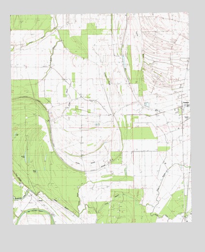
Saranac, LA USGS Topographic Map
Click on map above to begin viewing in our Map Viewer.

This topographic map contains these locations and features:
Feature Name Type Latitude Longitude GNIS ID View Map
Beck BayouStreamN32.1165°W91.3429°532866View Map
Bethany Baptist ChurchChurchN32.0757°W91.3265°553611View Map
Brushy LakeLakeN32.0395°W91.3659°553811View Map
Caney BayouSwampN32.0265°W91.3054°533731View Map
Church of ChristChurchN32.0649°W91.2743°541657View Map
Church of God (historical)ChurchN32.0832°W91.2923°541658View Map
Clark BayouGutN32.0118°W91.3051°533964View Map
Cow SloughGutN32.0318°W91.3284°534212View Map
Dorthy SloughStreamN32.0446°W91.3448°534566View Map
Glade BayouLakeN32.1059°W91.3677°535242View Map
Justina Gas FieldOilfieldN32.0099°W91.3746°549322View Map
Long LakeLakeN32.0529°W91.3737°555148View Map
Molen LakeLakeN32.0302°W91.3573°555346View Map
Morning Star ChurchChurchN32.0240°W91.3698°537225View Map
Nable BayouStreamN32.0604°W91.3484°537514View Map
Newell CemeteryCemeteryN32.0843°W91.2929°537659View Map
Palmetto SloughStreamN32.0735°W91.3065°537952View Map
Paradise Church (historical)ChurchN32.0254°W91.2707°549348View Map
Saddletree LakeLakeN32.0156°W91.3690°555875View Map
SaranacPopulated PlaceN32.0093°W91.3529°543647View Map
TensasPopulated PlaceN32.0502°W91.2504°540690View Map
Tensas ParishCivilN32.0017°W91.3401°559509View Map
Tensas Parish Fire District 1 Station 4BuildingN32.0786°W91.2907°2673010View Map
Young BayouGutN32.0057°W91.3737°540572View Map

Note: Coordinates in the location and feature list above are referenced to NAD83 datum.


Copyright (C) 2008-2024 Ryan Niemi / Sunset Dynamics ... All Rights Reserved