TopoQuest Logo
Do you find TopoQuest useful?
Help keep TopoQuest running and adding new maps/features by donating!
Bitcoin:  19c7KJd3qBynnjoSw5npx9KScwjBe4ifkT
Litecoin:  LXs6TkuXGGXo1vDsWCkWVdjQX94eUKd6ui
Home View Maps Find Maps Find Places Resources & Links


Stinson Neck, Maine Topographic Map

USGS Map Title: Stinson Neck, ME
USGS Map MRC: 44068B5
DRG (GeoTIFF) Download: o44068b5.tif


Neighboring USGS Topographic Map Quads:


  Sargentville, ME  
44068C6
 

  Brooklin, ME  
44068C5
 

  Bartlett Island, ME  
44068C4
 

  Deer Isle, ME  
44068B6
 

  Stinson Neck, ME  
44068B5
 

  Swans Island, ME  
44068B4
 

  Isle Au Haut West, ME  
44068A6
 

  Isle Au Haut East, ME  
44068A5
 

  Johns Island, ME  
44068A4


Map MRC Location:

N45°
W69°
N45°
W68°
H8 H7 H6 H5 H4 H3 H2 H1
G8 G7 G6 G5 G4 G3 G2 G1
F8 F7 F6 F5 F4 F3 F2 F1
E8 E7 E6 E5 E4 E3 E2 E1
D8 D7 D6 D5 D4 D3 D2 D1
C8 C7 C6 C5 C4 C3 C2 C1
B8 B7 B6 B5 B4 B3 B2 B1
A8 A7 A6 A5 A4 A3 A2 A1
N44°
W69°
N44°
W68°

Stinson Neck, ME USGS 1:24K Topographic Map Preview:
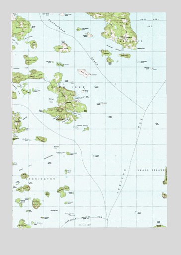
Stinson Neck, ME USGS Topographic Map
Click on map above to begin viewing in our Map Viewer.

This topographic map contains these locations and features:
Feature Name Type Latitude Longitude GNIS ID View Map
Babson IslandIslandN44.2367°W68.5622°561393View Map
Bear IslandIslandN44.2195°W68.5861°561839View Map
Beth Eden ChurchChurchN44.2348°W68.5322°580033View Map
Big Hay IslandIslandN44.2073°W68.6200°580039View Map
Billings CoveBayN44.1992°W68.5928°580041View Map
Black PointCapeN44.1929°W68.5659°580043View Map
Bold IslandIslandN44.1545°W68.6142°562710View Map
Bold Island LedgesBarN44.1606°W68.6072°580036View Map
Buckle IslandIslandN44.1420°W68.6100°563115View Map
Buckmaster LedgeBarN44.1720°W68.6234°580037View Map
Campbell IslandIslandN44.2217°W68.6084°563438View Map
Channel RockBarN44.2154°W68.5436°580024View Map
Clam IslandIslandN44.1615°W68.5950°564011View Map
Coles PointCapeN44.1817°W68.6147°564223View Map
Coles Point CemeteryCemeteryN44.1817°W68.6147°2736632View Map
Conary CoveBayN44.1904°W68.5703°564275View Map
Conary HeadSummitN44.2312°W68.5815°579957View Map
Conary IslandIslandN44.2279°W68.5831°564276View Map
Conary LedgeBarN44.2365°W68.5867°581711View Map
Coombs IslandsIslandN44.1406°W68.6197°564332View Map
Coot IslandsIslandN44.1479°W68.6239°564353View Map
Crow IslandIslandN44.1962°W68.5517°564604View Map
Deep CoveBayN44.1879°W68.5903°564950View Map
Deer Island ThorofareChannelN44.1587°W68.6147°564989View Map
Devil IslandIslandN44.1481°W68.6131°565068View Map
Devils HeadCapeN44.2215°W68.5450°565073View Map
Door LegeBarN44.1690°W68.6184°580038View Map
East Mark Island LedgeBarN44.1723°W68.5828°581728View Map
East Side CoveBayN44.2004°W68.5711°580042View Map
Eastern Mark IslandIslandN44.1673°W68.5789°565730View Map
Eaton PointCapeN44.1929°W68.5995°580040View Map
Egg RockBarN44.1845°W68.5092°565808View Map
Enchanted IslandIslandN44.1392°W68.5820°565914View Map
Fish CreekStreamN44.2298°W68.6161°566198View Map
Freese IslandIslandN44.2045°W68.6139°581424View Map
Gray CoveBayN44.2356°W68.6100°579971View Map
Green LedgeBarN44.1887°W68.5470°567242View Map
Greenlaw NeckCapeN44.2134°W68.6059°567289View Map
Grog IslandIslandN44.1617°W68.6236°579091View Map
Gunning RockBarN44.1345°W68.5942°567397View Map
Halibut RocksBarN44.1334°W68.5247°567493View Map
Hanus LedgeBarN44.1645°W68.5067°581767View Map
Harbor IslandIslandN44.2251°W68.5317°567589View Map
Haskell LedgeBarN44.1667°W68.6072°581772View Map
Hat IslandIslandN44.1426°W68.5017°567743View Map
Hat Island LedgeBarN44.1426°W68.5072°581773View Map
Hay LedgeBarN44.2137°W68.5481°581775View Map
Haycock RockBarN44.1690°W68.5886°581776View Map
Haystack Mountain School of Crafts LibraryBuildingN44.1881°W68.5842°1911680View Map
Haystack Mountains School of CraftsLocaleN44.1879°W68.5845°580044View Map
Hells Half AcreBarN44.1504°W68.6192°567914View Map
Hen IslandIslandN44.2009°W68.5664°567933View Map
Hog IslandIslandN44.2256°W68.5484°568157View Map
Jericho BayBayN44.1731°W68.5250°568802View Map
Jims HillSummitN44.1936°W68.5862°568849View Map
Jims IslandIslandN44.2095°W68.5781°580027View Map
Lazygut IslandIslandN44.1820°W68.5645°579983View Map
Lazygut LedgeBarN44.1787°W68.5617°581798View Map
Little Babson IslandIslandN44.2398°W68.5697°569661View Map
Little Bear IslandIslandN44.2212°W68.5925°580029View Map
Little Freese IslandIslandN44.2051°W68.6086°580028View Map
Little McGlathery IslandIslandN44.1273°W68.6086°569900View Map
Little Sheep IslandIslandN44.1762°W68.6100°570055View Map
Long LedgeBarN44.1804°W68.5472°581810View Map
Long PointCapeN44.1259°W68.5075°570257View Map
Louse IslandIslandN44.2104°W68.5828°580031View Map
Lower Torrey IslandIslandN44.2487°W68.5828°581374View Map
Mahoney IslandIslandN44.2167°W68.5120°570662View Map
Mahoney LedgeBarN44.2145°W68.5181°581816View Map
Millet IslandIslandN44.1442°W68.5959°571381View Map
Mud CoveBayN44.2081°W68.5870°580030View Map
NaskeagPopulated PlaceN44.2345°W68.5320°572060View Map
Naskeag HarborBayN44.2301°W68.5439°572061View Map
Naskeag PointCapeN44.2287°W68.5239°572062View Map
No Mans IslandIslandN44.1306°W68.6006°572204View Map
Oak PointCapeN44.2312°W68.6064°572624View Map
OceanvillePopulated PlaceN44.1865°W68.6220°572667View Map
Phoebe IslandIslandN44.1451°W68.5759°573275View Map
Pickering CoveBayN44.2065°W68.6200°573296View Map
Poplar PointCapeN44.2404°W68.6092°573644View Map
Potato IslandIslandN44.2067°W68.5584°580026View Map
Potato LedgeBarN44.1751°W68.5497°581871View Map
Ram IslandIslandN44.1342°W68.6125°573996View Map
ReachPopulated PlaceN44.2492°W68.6236°574067View Map
Rudder RockBarN44.1945°W68.5481°581885View Map
Saddleback IslandIslandN44.1479°W68.5822°574661View Map
Sellers IslandIslandN44.2217°W68.5395°580034View Map
Shabby IslandIslandN44.1662°W68.5586°575266View Map
Sheep IslandIslandN44.1766°W68.6014°575340View Map
Sheep IslandIslandN44.2034°W68.5670°575342View Map
Sheep Island LedgeBarN44.1712°W68.5911°575355View Map
Sheep RockBarN44.1709°W68.6042°581900View Map
Sheldrake LedgeBarN44.1317°W68.5792°575368View Map
Sheldrake LedgeIslandN44.1715°W68.5917°581901View Map
Shingle IslandIslandN44.1576°W68.5814°575409View Map
Smuttynose IslandIslandN44.2209°W68.5217°575655View Map
Southern Mark IslandIslandN44.1323°W68.5792°580568View Map
Spruce IslandIslandN44.1392°W68.6042°576136View Map
Stinson NeckIslandN44.1987°W68.5847°576360View Map
Sunken Egg RockBarN44.1692°W68.5153°580035View Map
SunshinePopulated PlaceN44.1973°W68.5811°576560View Map
Sunshine CampgroundLocaleN44.2448°W68.5792°1911992View Map
The BouldersBarN44.2129°W68.5497°580025View Map
The ShiversBarN44.1520°W68.6084°576923View Map
The TrianglesBarN44.2304°W68.5472°581944View Map
The WoodburyBarN44.1570°W68.5236°581965View Map
West Halibut RockBarN44.1292°W68.5442°580687View Map
West PointCapeN44.1504°W68.5022°578197View Map
Western CoveBayN44.1854°W68.5836°578249View Map
Whaleback LedgeBarN44.1884°W68.6136°580013View Map
White IslandIslandN44.2148°W68.5664°578358View Map
Whitmore CemeteryCemeteryN44.1864°W68.6229°2736344View Map

Note: Coordinates in the location and feature list above are referenced to NAD83 datum.


Copyright (C) 2008-2025 Ryan Niemi / Sunset Dynamics ... All Rights Reserved