TopoQuest Logo
Do you find TopoQuest useful?
Help keep TopoQuest running and adding new maps/features by donating!
Bitcoin:  19c7KJd3qBynnjoSw5npx9KScwjBe4ifkT
Litecoin:  LXs6TkuXGGXo1vDsWCkWVdjQX94eUKd6ui
Home View Maps Find Maps Find Places Resources & Links


Strongstown, Pennsylvania Topographic Map

USGS Map Title: Strongstown, PA
USGS Map MRC: 40078E8
DRG (GeoTIFF) Download: o40078e8.tif


Neighboring USGS Topographic Map Quads:


  Clymer, PA  
40079F1
 

  Commodore, PA  
40078F8
 

  Barnesboro, PA  
40078F7
 

  Brush Valley, PA  
40079E1
 

  Strongstown, PA  
40078E8
 

  Colver, PA  
40078E7
 

  New Florence, PA  
40079D1
 

  Vintondale, PA  
40078D8
 

  Nanty Glo, PA  
40078D7


Map MRC Location:

N41°
W79°
N41°
W78°
H8 H7 H6 H5 H4 H3 H2 H1
G8 G7 G6 G5 G4 G3 G2 G1
F8 F7 F6 F5 F4 F3 F2 F1
E8 E7 E6 E5 E4 E3 E2 E1
D8 D7 D6 D5 D4 D3 D2 D1
C8 C7 C6 C5 C4 C3 C2 C1
B8 B7 B6 B5 B4 B3 B2 B1
A8 A7 A6 A5 A4 A3 A2 A1
N40°
W79°
N40°
W78°

Strongstown, PA USGS 1:24K Topographic Map Preview:
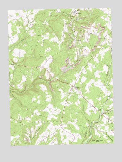
Strongstown, PA USGS Topographic Map
Click on map above to begin viewing in our Map Viewer.

This topographic map contains these locations and features:
Feature Name Type Latitude Longitude GNIS ID View Map
Adams CrossingPopulated PlaceN40.5426°W78.8800°1202949View Map
Apollo 2 Mine StationLocaleN40.6156°W78.9189°1212073View Map
Barkley ChurchChurchN40.5195°W78.9859°1168716View Map
Belsano CampLocaleN40.5209°W78.8767°1169210View Map
BlaidesLocaleN40.5356°W78.9548°1201025View Map
Carney RunStreamN40.5165°W78.9022°1171233View Map
Charlies GrovePopulated PlaceN40.5312°W78.8934°1171586View Map
CroftLocaleN40.5187°W78.9806°1200993View Map
Downey RunStreamN40.5015°W78.9084°1173433View Map
East Union ChurchChurchN40.5081°W78.9548°1173891View Map
Elk CreekStreamN40.5278°W78.8892°1174107View Map
Ewings MillPopulated PlaceN40.5753°W78.9923°1205043View Map
Faith TempleChurchN40.5103°W78.9472°1174567View Map
Heiiwood Post OfficePost OfficeN40.6218°W78.9155°2773153View Map
HeilwoodPopulated PlaceN40.6209°W78.9150°1176777View Map
Laurel RunStreamN40.6151°W78.9675°1179013View Map
Leonard RunStreamN40.6162°W78.9198°1179207View Map
Maple Grove ChurchChurchN40.6009°W78.9595°1180333View Map
Mount Zion CemeteryCemeteryN40.6231°W78.8862°1181902View Map
NoloPopulated PlaceN40.5723°W78.9595°1182500View Map
Pine Land CemeteryCemeteryN40.5513°W78.9184°1183859View Map
Pine Township Volunteer Fire Department Station 570BuildingN40.6214°W78.9160°2645539View Map
PinetonPopulated PlaceN40.6012°W78.9017°1183928View Map
Red MillPopulated PlaceN40.5145°W78.9017°1184767View Map
Rocky Hollow FieldAirportN40.5682°W78.8821°2442981View Map
Rose RunStreamN40.6117°W78.9748°1185456View Map
Saint Patricks ChurchChurchN40.5945°W78.9159°1186535View Map
Simmons RunStreamN40.5309°W78.8809°1187699View Map
Spruce Grove ChurchChurchN40.5962°W78.9775°1188329View Map
Stevens RunStreamN40.5434°W78.8786°1198129View Map
StrongstownPopulated PlaceN40.5528°W78.9217°1188890View Map
Township of BuffingtonCivilN40.5137°W78.9630°1216535View Map
Township of PineCivilN40.5928°W78.9112°1216547View Map
Walker RunStreamN40.5040°W78.9047°1190502View Map
White Mill CrossingPopulated PlaceN40.5276°W78.8895°1191288View Map

Note: Coordinates in the location and feature list above are referenced to NAD83 datum.


Copyright (C) 2008-2025 Ryan Niemi / Sunset Dynamics ... All Rights Reserved