TopoQuest Logo
Do you find TopoQuest useful?
Help keep TopoQuest running and adding new maps/features by donating!
Bitcoin:  19c7KJd3qBynnjoSw5npx9KScwjBe4ifkT
Litecoin:  LXs6TkuXGGXo1vDsWCkWVdjQX94eUKd6ui
Home View Maps Find Maps Find Places Resources & Links


Casnovia, Michigan Topographic Map

USGS Map Title: Casnovia, MI
USGS Map MRC: 43085B7
DRG (GeoTIFF) Download: o43085b7.tif


Neighboring USGS Topographic Map Quads:


  Bridgeton, MI  
43085C8
 

  Grant, MI  
43085C7
 

  Sand Lake SW, MI  
43085C6
 

  Ravenna, MI  
43085B8
 

  Casnovia, MI  
43085B7
 

  Sparta, MI  
43085B6
 

  Coopersville, MI  
43085A8
 

  Marne, MI  
43085A7
 

  Cedar Springs SW, MI  
43085A6


Map MRC Location:

N44°
W86°
N44°
W85°
H8 H7 H6 H5 H4 H3 H2 H1
G8 G7 G6 G5 G4 G3 G2 G1
F8 F7 F6 F5 F4 F3 F2 F1
E8 E7 E6 E5 E4 E3 E2 E1
D8 D7 D6 D5 D4 D3 D2 D1
C8 C7 C6 C5 C4 C3 C2 C1
B8 B7 B6 B5 B4 B3 B2 B1
A8 A7 A6 A5 A4 A3 A2 A1
N43°
W86°
N43°
W85°

Casnovia, MI USGS 1:24K Topographic Map Preview:
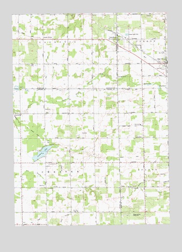
Casnovia, MI USGS Topographic Map
Click on map above to begin viewing in our Map Viewer.

This topographic map contains these locations and features:
Feature Name Type Latitude Longitude GNIS ID View Map
Bennet CemeteryCemeteryN43.1939°W85.8487°621104View Map
Camelot Village Mobile Home ParkPopulated PlaceN43.2492°W85.7972°2548815View Map
Canada CornersPopulated PlaceN43.2353°W85.8492°622673View Map
Canada Corners Post Office (historical)Post OfficeN43.2353°W85.8492°2571703View Map
Canada Corners SchoolSchoolN43.2281°W85.8503°622674View Map
CasnoviaPopulated PlaceN43.2347°W85.7906°622844View Map
Casnovia Post OfficePost OfficeN43.2356°W85.7908°2548814View Map
Casnovia Reformed ChurchChurchN43.2331°W85.7897°2566765View Map
Casnovia StationLocaleN43.2378°W85.7911°2548813View Map
Chapel Hill ChurchChurchN43.2306°W85.7717°2106554View Map
Clark SchoolSchoolN43.2486°W85.7720°623370View Map
Crockery LakeLakeN43.1680°W85.8526°624073View Map
Gooding Post Office (historical)Post OfficeN43.1617°W85.7917°2572878View Map
Gooding Station (historical)LocaleN43.1617°W85.7914°2572845View Map
Grose ParkParkN43.1744°W85.8472°2106579View Map
HarrisburgPopulated PlaceN43.1920°W85.8739°627849View Map
Harrisburg Post Office (historical)Post OfficeN43.1919°W85.8739°2572877View Map
Harrisburg Station (historical)LocaleN43.1919°W85.8744°2572844View Map
Hayward SchoolSchoolN43.2209°W85.7912°628011View Map
Hilton CemeteryCemeteryN43.2208°W85.8598°628336View Map
Johnson SchoolSchoolN43.2067°W85.8139°629354View Map
Kent CityPopulated PlaceN43.2200°W85.7512°629599View Map
Kent City Baptist ChurchChurchN43.2217°W85.7508°2565384View Map
Kent City Elementary SchoolSchoolN43.2208°W85.7503°2565364View Map
Kent City High SchoolSchoolN43.2264°W85.7533°2565385View Map
Kent City Medical CenterHospitalN43.2178°W85.7508°2565382View Map
Kent City StationLocaleN43.2175°W85.7506°2565362View Map
Lachman SchoolSchoolN43.1336°W85.8087°629931View Map
LisbonPopulated PlaceN43.1472°W85.7892°2106552View Map
Lisbon CemeteryCemeteryN43.1470°W85.7792°630533View Map
Lisbon Post Office (historical)Post OfficeN43.1472°W85.7892°2570721View Map
Lisbon SchoolSchoolN43.1472°W85.7917°630534View Map
Lutheran SchoolSchoolN43.1517°W85.8295°631220View Map
Mamrelund ChurchChurchN43.1839°W85.7728°2106553View Map
Manchester SchoolSchoolN43.1836°W85.7706°631376View Map
Mill CreekStreamN43.1497°W85.7720°632320View Map
North Chester ChurchChurchN43.1920°W85.8298°633558View Map
Porter SchoolSchoolN43.1925°W85.8198°635308View Map
Reister SchoolSchoolN43.1628°W85.8300°635792View Map
Rexford LakeLakeN43.2084°W85.7650°635819View Map
Saint Francis ChurchChurchN43.1622°W85.8395°636643View Map
Saint Francis Xavier's CemeteryCemeteryN43.1608°W85.8406°2571628View Map
Schaefer Orchards Landing Strip (historical)AirportN43.1308°W85.7833°2106551View Map
Scott and Tanner DrainCanalN43.1258°W85.8744°2106578View Map
Smith DrainCanalN43.2234°W85.8467°638142View Map
South Casnovia CemeteryCemeteryN43.2131°W85.7912°638330View Map
Spangenberg SchoolSchoolN43.1517°W85.7506°638465View Map
Township of CasnoviaCivilN43.2493°W85.8492°1626042View Map
Township of ChesterCivilN43.1620°W85.8489°1626073View Map
Trinity ChurchChurchN43.1336°W85.8239°1615077View Map
Trinity Lutheran CemeteryCemeteryN43.1347°W85.8236°2571629View Map
Trinity Lutheran ChurchChurchN43.1331°W85.8239°2571593View Map
Trinity SchoolSchoolN43.1333°W85.8244°2106577View Map
Village of CasnoviaCivilN43.2336°W85.7895°2397569View Map
Village of Kent CityCivilN43.2203°W85.7538°2398340View Map
Waller SchoolSchoolN43.1478°W85.8481°1615726View Map
Wegal LakeLakeN43.2056°W85.7573°1615968View Map

Note: Coordinates in the location and feature list above are referenced to NAD83 datum.


Copyright (C) 2008-2025 Ryan Niemi / Sunset Dynamics ... All Rights Reserved