TopoQuest Logo
Do you find TopoQuest useful?
Help keep TopoQuest running and adding new maps/features by donating!
Bitcoin:  19c7KJd3qBynnjoSw5npx9KScwjBe4ifkT
Litecoin:  LXs6TkuXGGXo1vDsWCkWVdjQX94eUKd6ui
Home View Maps Find Maps Find Places Resources & Links


Gordonsville, Alabama Topographic Map

USGS Map Title: Gordonsville, AL
USGS Map MRC: 32086B6
DRG (GeoTIFF) Download: o32086b6.tif


Neighboring USGS Topographic Map Quads:


  Benton, AL  
32086C7
 

  White Hall, AL  
32086C6
 

  Lowndesboro, AL  
32086C5
 

  Collirene, AL  
32086B7
 

  Gordonsville, AL  
32086B6
 

  Hayneville, AL  
32086B5
 

  Braggs, AL  
32086A7
 

  Mount Willing, AL  
32086A6
 

  Calhoun, AL  
32086A5


Map MRC Location:

N33°
W87°
N33°
W86°
H8 H7 H6 H5 H4 H3 H2 H1
G8 G7 G6 G5 G4 G3 G2 G1
F8 F7 F6 F5 F4 F3 F2 F1
E8 E7 E6 E5 E4 E3 E2 E1
D8 D7 D6 D5 D4 D3 D2 D1
C8 C7 C6 C5 C4 C3 C2 C1
B8 B7 B6 B5 B4 B3 B2 B1
A8 A7 A6 A5 A4 A3 A2 A1
N32°
W87°
N32°
W86°

Gordonsville, AL USGS 1:24K Topographic Map Preview:
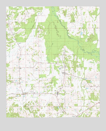
Gordonsville, AL USGS Topographic Map
Click on map above to begin viewing in our Map Viewer.

This topographic map contains these locations and features:
Feature Name Type Latitude Longitude GNIS ID View Map
Ash Creek Baptist ChurchChurchN32.1679°W86.7319°164185View Map
BeechwoodPopulated PlaceN32.1260°W86.6561°113826View Map
Bessie Beck LakeReservoirN32.1685°W86.7333°130223View Map
Bessie Beck Lake DamDamN32.1685°W86.7333°130222View Map
Bogahoma CemeteryCemeteryN32.1810°W86.7091°136325View Map
Bogahoma ChurchChurchN32.1804°W86.7319°136326View Map
Bogahoma Church (historical)ChurchN32.1688°W86.7214°136327View Map
Central High SchoolSchoolN32.1524°W86.6789°136333View Map
Central SchoolSchoolN32.1513°W86.6816°136334View Map
CollinsDamN32.1918°W86.7350°130263View Map
Garr CemeteryCemeteryN32.2160°W86.7083°136356View Map
Gordon CemeteryCemeteryN32.1546°W86.7178°136363View Map
GordonsvillePopulated PlaceN32.1629°W86.7325°156419View Map
GordonvillePopulated PlaceN32.1520°W86.7154°2407582View Map
Halls BranchStreamN32.2232°W86.6816°119591View Map
Hicks HillPopulated PlaceN32.2393°W86.7486°120041View Map
Hollidays PondReservoirN32.1928°W86.7345°136371View Map
Hope Well CemeteryCemeteryN32.2346°W86.6594°164187View Map
Kellys DitchStreamN32.1865°W86.6900°143004View Map
Lowndes CountyCivilN32.1547°W86.6501°161568View Map
Martins DamDamN32.2185°W86.6500°130308View Map
Martins LakeReservoirN32.2196°W86.6491°130309View Map
Miles CemeteryCemeteryN32.1929°W86.6722°136399View Map
Morass CemeteryCemeteryN32.1568°W86.6330°136403View Map
Moss ChurchChurchN32.1743°W86.6700°136405View Map
MossesPopulated PlaceN32.1746°W86.6719°136404View Map
Mosses Volunteer Fire DepartmentBuildingN32.1837°W86.6711°2691601View Map
Mount Carmel ChurchChurchN32.1518°W86.7241°136407View Map
Mount Elam ChurchChurchN32.2396°W86.7483°143005View Map
Mount Moriah ChurchChurchN32.1818°W86.6714°136412View Map
Mount Moriah ChurchChurchN32.1315°W86.6747°136413View Map
New Mount Lily ChurchChurchN32.2168°W86.7497°163498View Map
Powers PondReservoirN32.1685°W86.6432°136433View Map
Rambo BranchStreamN32.1974°W86.6369°151624View Map
Rudolf HillLocaleN32.1501°W86.7261°136445View Map
Rudolph Hill CemeteryCemeteryN32.1515°W86.7261°1805542View Map
Russells PondLakeN32.1365°W86.6806°136446View Map
Saint Joseph ChurchChurchN32.1510°W86.6986°136448View Map
Saint Paul ChurchChurchN32.2129°W86.7372°136450View Map
Sellers Memorial ChurchChurchN32.2396°W86.7244°136453View Map
Town of GordonvilleCivilN32.1531°W86.7116°2406593View Map
Town of MossesCivilN32.1870°W86.7142°2406201View Map
Turners CemeteryCemeteryN32.1607°W86.6325°136467View Map
Woods ChapelChurchN32.1513°W86.7275°136473View Map

Note: Coordinates in the location and feature list above are referenced to NAD83 datum.


Copyright (C) 2008-2024 Ryan Niemi / Sunset Dynamics ... All Rights Reserved