TopoQuest Logo
Do you find TopoQuest useful?
Help keep TopoQuest running and adding new maps/features by donating!
Bitcoin:  19c7KJd3qBynnjoSw5npx9KScwjBe4ifkT
Litecoin:  LXs6TkuXGGXo1vDsWCkWVdjQX94eUKd6ui
Home View Maps Find Maps Find Places Resources & Links


Eureka Springs, Arkansas Topographic Map

USGS Map Title: Eureka Springs, AR
USGS Map MRC: 36093D6
DRG (GeoTIFF) Download: o36093d6.tif


Neighboring USGS Topographic Map Quads:


  Eagle Rock, MO  
36093E7
 

  Golden, MO  
36093E6
 

  Viola, MO  
36093E5
 

  Beaver, AR  
36093D7
 

  Eureka Springs, AR  
36093D6
 

  Grandview, AR  
36093D5
 

  Sandstone Mountain, AR  
36093C7
 

  Rockhouse, AR  
36093C6
 

  Berryville, AR  
36093C5


Map MRC Location:

N37°
W94°
N37°
W93°
H8 H7 H6 H5 H4 H3 H2 H1
G8 G7 G6 G5 G4 G3 G2 G1
F8 F7 F6 F5 F4 F3 F2 F1
E8 E7 E6 E5 E4 E3 E2 E1
D8 D7 D6 D5 D4 D3 D2 D1
C8 C7 C6 C5 C4 C3 C2 C1
B8 B7 B6 B5 B4 B3 B2 B1
A8 A7 A6 A5 A4 A3 A2 A1
N36°
W94°
N36°
W93°

Eureka Springs, AR USGS 1:24K Topographic Map Preview:
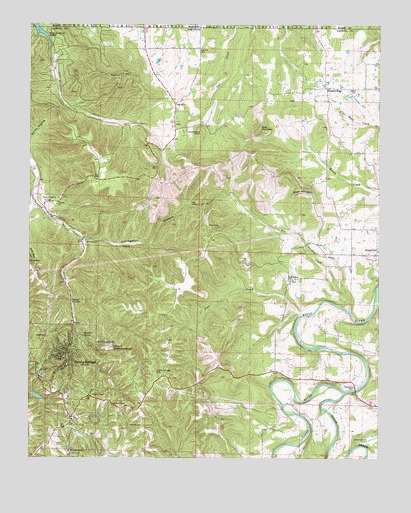
Eureka Springs, AR USGS Topographic Map
Click on map above to begin viewing in our Map Viewer.

This topographic map contains these locations and features:
Feature Name Type Latitude Longitude GNIS ID View Map
Bee CreekStreamN36.4176°W93.6357°46300View Map
Boat MountainSummitN36.4701°W93.6688°57403View Map
Brush MountainSummitN36.4526°W93.6530°57453View Map
Charcoal GapGapN36.4484°W93.6874°69201View Map
Christ of the OzarksChurchN36.4090°W93.7252°82002View Map
Church of ChristChurchN36.3903°W93.7202°69203View Map
City of Eureka SpringsCivilN36.4108°W93.7451°2403579View Map
Eureka SpringsPopulated PlaceN36.4012°W93.7380°48926View Map
Eureka Springs CemeteryCemeteryN36.4001°W93.7057°48927View Map
Eureka Springs City LakeReservoirN36.3927°W93.7470°79659View Map
Eureka Springs City Lake DamDamN36.3934°W93.7469°79658View Map
Eureka Springs Elementary SchoolSchoolN36.3817°W93.7323°69206View Map
Eureka Springs Fire Department AmbulanceBuildingN36.3916°W93.7379°2119201View Map
Eureka Springs Fire Department Station 1BuildingN36.3916°W93.7378°2116410View Map
Eureka Springs Fire Department Station 2BuildingN36.4046°W93.7420°2116411View Map
Eureka Springs Fire Department Station 3BuildingN36.4009°W93.7392°2116412View Map
Eureka Springs Fire Department Station 4BuildingN36.3945°W93.7125°2116413View Map
Eureka Springs High SchoolSchoolN36.3984°W93.7461°69207View Map
Eureka Springs Historic DistrictParkN36.4028°W93.7366°69208View Map
Eureka Springs HospitalHospitalN36.4002°W93.7442°69209View Map
Eureka Springs Middle SchoolSchoolN36.3827°W93.7338°2039014View Map
Eureka Springs Police DepartmentBuildingN36.3949°W93.7119°2118861View Map
First Presbyterian ChurchChurchN36.4076°W93.7355°69215View Map
Freewill ChurchChurchN36.3845°W93.7099°49241View Map
Gaskins (historical)Populated PlaceN36.4453°W93.7432°69217View Map
Gaskins Switch CemeteryCemeteryN36.4490°W93.7446°49354View Map
Grandview CemeteryCemeteryN36.4340°W93.6288°1959671View Map
Haddock CreekStreamN36.4948°W93.7432°49754View Map
Hammond Bell MuseumBuildingN36.4048°W93.7391°69220View Map
Harmon ParkParkN36.4109°W93.7407°69222View Map
Harps Doll MuseumBuildingN36.4031°W93.7357°69223View Map
Holiday IslandPopulated PlaceN36.4853°W93.7321°69227View Map
Holiday Island Census Designated PlaceCensusN36.4762°W93.7341°2612127View Map
Holiday Island Post OfficePost OfficeN36.4546°W93.7190°2781861View Map
Holiday Island Volunteer Fire Department Station 2BuildingN36.4535°W93.7205°2116584View Map
Huckleberry PointSummitN36.4687°W93.6894°57953View Map
Junction (historical)Populated PlaceN36.4365°W93.7066°69228View Map
KTCN-FM (Eureka Springs)TowerN36.3801°W93.7482°85178View Map
Livingston HollowValleyN36.4376°W93.7294°51350View Map
Magnetic SpringSpringN36.4103°W93.7305°51610View Map
Mount OberammergauSummitN36.4067°W93.7210°58295View Map
Oak HillPopulated PlaceN36.4773°W93.6985°77883View Map
Oak Hill CemeteryCemeteryN36.4928°W93.6905°52927View Map
Oak Hill School (historical)SchoolN36.4803°W93.6921°69235View Map
Osage CreekStreamN36.3937°W93.6377°77926View Map
Pine CreekStreamN36.4162°W93.6521°53412View Map
Pivot RockPillarN36.4315°W93.7494°53512View Map
Pleasant RidgePopulated PlaceN36.4817°W93.6441°57159View Map
Rock Springs Baptist ChurchChurchN36.4262°W93.6571°78201View Map
Rock Springs School (historical)SchoolN36.4259°W93.6571°69239View Map
Saint Elizabeth Catholic ChurchChurchN36.4076°W93.7371°69242View Map
Silver Wings FieldAirportN36.4314°W93.6956°2717694View Map
Township of CrossCivilN36.4774°W93.6394°66895View Map
Township of FranklinCivilN36.4731°W93.7110°66898View Map
Township of Kings RiverCivilN36.4282°W93.6505°66900View Map
Tunnel (historical)Populated PlaceN36.4484°W93.6874°1977845View Map
West Leatherwood CreekStreamN36.4478°W93.7485°56192View Map

Note: Coordinates in the location and feature list above are referenced to NAD83 datum.


Copyright (C) 2008-2025 Ryan Niemi / Sunset Dynamics ... All Rights Reserved