TopoQuest Logo
Do you find TopoQuest useful?
Help keep TopoQuest running and adding new maps/features by donating!
Bitcoin:  19c7KJd3qBynnjoSw5npx9KScwjBe4ifkT
Litecoin:  LXs6TkuXGGXo1vDsWCkWVdjQX94eUKd6ui
Home View Maps Find Maps Find Places Resources & Links


Mayburg, Pennsylvania Topographic Map

USGS Map Title: Mayburg, PA
USGS Map MRC: 41079E2
DRG (GeoTIFF) Download: o41079e2.tif


Neighboring USGS Topographic Map Quads:


  Cobham, PA  
41079F3
 

  Cherry Grove, PA  
41079F2
 

  Sheffield, PA  
41079F1
 

  Kellettville, PA  
41079E3
 

  Mayburg, PA  
41079E2
 

  Lynch, PA  
41079E1
 

  Tylersburg, PA  
41079D3
 

  Marienville West, PA  
41079D2
 

  Marienville East, PA  
41079D1


Map MRC Location:

N42°
W80°
N42°
W79°
H8 H7 H6 H5 H4 H3 H2 H1
G8 G7 G6 G5 G4 G3 G2 G1
F8 F7 F6 F5 F4 F3 F2 F1
E8 E7 E6 E5 E4 E3 E2 E1
D8 D7 D6 D5 D4 D3 D2 D1
C8 C7 C6 C5 C4 C3 C2 C1
B8 B7 B6 B5 B4 B3 B2 B1
A8 A7 A6 A5 A4 A3 A2 A1
N41°
W80°
N41°
W79°

Mayburg, PA USGS 1:24K Topographic Map Preview:
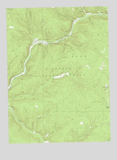
Mayburg, PA USGS Topographic Map
Click on map above to begin viewing in our Map Viewer.

This topographic map contains these locations and features:
Feature Name Type Latitude Longitude GNIS ID View Map
BalltownPopulated PlaceN41.6015°W79.1723°1209395View Map
Blood RunStreamN41.6073°W79.1673°1209430View Map
Blue JayPopulated PlaceN41.5509°W79.1281°1209432View Map
Bobbs CreekStreamN41.5928°W79.2159°1209439View Map
CCC Camp (historical)LocaleN41.5648°W79.2314°1210307View Map
Coalbed RunStreamN41.5620°W79.1678°1209514View Map
Doe RunStreamN41.5103°W79.1925°1209564View Map
Fools CreekStreamN41.6184°W79.1348°1209605View Map
Forest CountyCivilN41.5131°W79.2360°1213669View Map
Fourmile RunStreamN41.5103°W79.2206°1209612View Map
Kingsley RunStreamN41.5931°W79.2000°1209730View Map
Little Minister RunStreamN41.5509°W79.2489°1209770View Map
Logan RunStreamN41.5984°W79.1709°1209779View Map
MayburgPopulated PlaceN41.5934°W79.1987°1210502View Map
MinisterPopulated PlaceN41.6190°W79.1484°1209827View Map
Minister CreekStreamN41.6176°W79.1500°1209828View Map
Minister Creek Recreation AreaParkN41.6209°W79.1534°1209829View Map
Mud Lick RunStreamN41.5517°W79.2103°1209840View Map
Panther RunStreamN41.5642°W79.2284°1209876View Map
Phelps RunStreamN41.5942°W79.1848°1209882View Map
Porcupine RunStreamN41.6126°W79.1642°1209900View Map
PorkeyPopulated PlaceN41.6120°W79.1656°1209901View Map
Seldom Seen CornersLocaleN41.5320°W79.1253°1209965View Map
TruemansPopulated PlaceN41.6187°W79.1337°1210060View Map
Twomile RunStreamN41.5170°W79.2314°1210051View Map
Wildcat RunStreamN41.6165°W79.1500°1210117View Map

Note: Coordinates in the location and feature list above are referenced to NAD83 datum.


Copyright (C) 2008-2024 Ryan Niemi / Sunset Dynamics ... All Rights Reserved