TopoQuest Logo
Do you find TopoQuest useful?
Help keep TopoQuest running and adding new maps/features by donating!
Bitcoin:  19c7KJd3qBynnjoSw5npx9KScwjBe4ifkT
Litecoin:  LXs6TkuXGGXo1vDsWCkWVdjQX94eUKd6ui
Home View Maps Find Maps Find Places Resources & Links


Maxeys, Georgia Topographic Map

USGS Map Title: Maxeys, GA
USGS Map MRC: 33083G2
DRG (GeoTIFF) Download: o33083g2.tif


Neighboring USGS Topographic Map Quads:


  Athens East, GA  
33083H3
 

  Crawford, GA  
33083H2
 

  Sandy Cross, GA  
33083H1
 

  Barnett Shoals, GA  
33083G3
 

  Maxeys, GA  
33083G2
 

  Lexington, GA  
33083G1
 

  Greshamville, GA  
33083F3
 

  Penfield, GA  
33083F2
 

  Woodville, GA  
33083F1


Map MRC Location:

N34°
W84°
N34°
W83°
H8 H7 H6 H5 H4 H3 H2 H1
G8 G7 G6 G5 G4 G3 G2 G1
F8 F7 F6 F5 F4 F3 F2 F1
E8 E7 E6 E5 E4 E3 E2 E1
D8 D7 D6 D5 D4 D3 D2 D1
C8 C7 C6 C5 C4 C3 C2 C1
B8 B7 B6 B5 B4 B3 B2 B1
A8 A7 A6 A5 A4 A3 A2 A1
N33°
W84°
N33°
W83°

Maxeys, GA USGS 1:24K Topographic Map Preview:
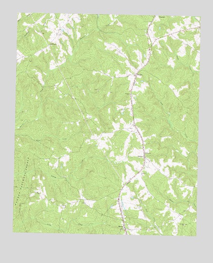
Maxeys, GA USGS Topographic Map
Click on map above to begin viewing in our Map Viewer.

This topographic map contains these locations and features:
Feature Name Type Latitude Longitude GNIS ID View Map
Antioch ChurchChurchN33.7968°W83.1610°354361View Map
Arnold Grove ChurchChurchN33.8582°W83.2265°326968View Map
Bowling Green (historical)Populated PlaceN33.7621°W83.1365°335729View Map
Brightwells Mill (historical)LocaleN33.7818°W83.2152°335732View Map
Center Academy (historical)SchoolN33.7851°W83.1629°335735View Map
Center ChurchChurchN33.7848°W83.1629°355075View Map
Days Station (historical)LocaleN33.8296°W83.1715°335745View Map
Dogwood School (historical)SchoolN33.8107°W83.2315°335747View Map
Faithful ChurchChurchN33.8298°W83.1718°327787View Map
HutchinsPopulated PlaceN33.8418°W83.1679°332048View Map
Lake OglethorpeReservoirN33.8717°W83.2288°336469View Map
Lake Oglethorpe DamDamN33.8651°W83.2332°336468View Map
MaxeysPopulated PlaceN33.7543°W83.1735°328731View Map
Maxeys Volunteer Fire DepartmentBuildingN33.7550°W83.1743°2604798View Map
McWhorter CemeteryCemeteryN33.7646°W83.1324°335771View Map
Midway Church (historical)ChurchN33.7729°W83.2357°335773View Map
Moody CemeteryCemeteryN33.7598°W83.1349°335776View Map
Mount Zion ChurchChurchN33.7562°W83.1332°328915View Map
Odums BranchStreamN33.8619°W83.2442°2548617View Map
StephensPopulated PlaceN33.7948°W83.1615°356560View Map
Town of MaxeysCivilN33.7555°W83.1737°2406110View Map
Wolfskin Volunteer Fire DepartmentBuildingN33.8503°W83.2439°2604805View Map

Note: Coordinates in the location and feature list above are referenced to NAD83 datum.


Copyright (C) 2008-2025 Ryan Niemi / Sunset Dynamics ... All Rights Reserved