TopoQuest Logo
Do you find TopoQuest useful?
Help keep TopoQuest running and adding new maps/features by donating!
Bitcoin:  19c7KJd3qBynnjoSw5npx9KScwjBe4ifkT
Litecoin:  LXs6TkuXGGXo1vDsWCkWVdjQX94eUKd6ui
Home View Maps Find Maps Find Places Resources & Links


Penfield, Georgia Topographic Map

USGS Map Title: Penfield, GA
USGS Map MRC: 33083F2
DRG (GeoTIFF) Download: o33083f2.tif


Neighboring USGS Topographic Map Quads:


  Barnett Shoals, GA  
33083G3
 

  Maxeys, GA  
33083G2
 

  Lexington, GA  
33083G1
 

  Greshamville, GA  
33083F3
 

  Penfield, GA  
33083F2
 

  Woodville, GA  
33083F1
 

  Buckhead, GA  
33083E3
 

  Greensboro, GA  
33083E2
 

  Union Point, GA  
33083E1


Map MRC Location:

N34°
W84°
N34°
W83°
H8 H7 H6 H5 H4 H3 H2 H1
G8 G7 G6 G5 G4 G3 G2 G1
F8 F7 F6 F5 F4 F3 F2 F1
E8 E7 E6 E5 E4 E3 E2 E1
D8 D7 D6 D5 D4 D3 D2 D1
C8 C7 C6 C5 C4 C3 C2 C1
B8 B7 B6 B5 B4 B3 B2 B1
A8 A7 A6 A5 A4 A3 A2 A1
N33°
W84°
N33°
W83°

Penfield, GA USGS 1:24K Topographic Map Preview:
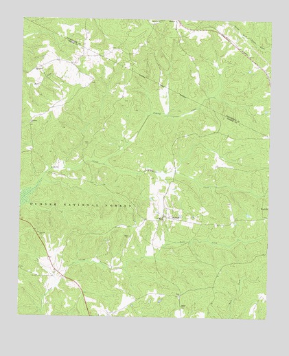
Penfield, GA USGS Topographic Map
Click on map above to begin viewing in our Map Viewer.

This topographic map contains these locations and features:
Feature Name Type Latitude Longitude GNIS ID View Map
Bethabara ChurchChurchN33.7060°W83.2454°327081View Map
Durant School (historical)SchoolN33.7337°W83.2207°348664View Map
Finley CemeteryCemeteryN33.7157°W83.1985°1705400View Map
Geer CemeteryCemeteryN33.6890°W83.1521°1705405View Map
Harmonia ChurchChurchN33.7493°W83.1802°328066View Map
Janes CemeteryCemeteryN33.6979°W83.2154°328305View Map
Jenkins CemeteryCemeteryN33.6596°W83.2399°1705412View Map
Macedonia CemeteryCemeteryN33.7304°W83.2424°1705418View Map
Macedonia ChurchChurchN33.7285°W83.2432°328685View Map
McWhorter CreekStreamN33.6890°W83.2082°328751View Map
Mercer Institute (historical)SchoolN33.6679°W83.1763°348692View Map
Moore CemeteryCemeteryN33.7232°W83.2152°1705423View Map
Mount Zion ChurchChurchN33.6593°W83.2396°328928View Map
Oak Grove School (historical)SchoolN33.6368°W83.1310°348701View Map
Old Mercer ChapelChurchN33.6671°W83.1779°329093View Map
PenfieldPopulated PlaceN33.6673°W83.1774°329162View Map
Penfield Baptist ChurchChurchN33.6687°W83.1752°348702View Map
Penfield CemeteryCemeteryN33.6732°W83.1729°1705427View Map
Penfield Female Seminary (historical)SchoolN33.6676°W83.1771°348703View Map
Penfield Historic DistrictParkN33.6673°W83.1777°348704View Map
Penfield Hunt CampLocaleN33.6535°W83.1738°330974View Map
Penfield School (historical)SchoolN33.6676°W83.1771°348705View Map
Roberts Bike CampLocaleN33.6479°W83.1468°330976View Map
Roswell ChapelChurchN33.6298°W83.1679°329527View Map
Sanders ChapelChurchN33.6621°W83.1807°348715View Map
Shiloh CemeteryCemeteryN33.6587°W83.1940°329668View Map
Shiloh CemeteryCemeteryN33.6340°W83.1693°1705433View Map
Shiloh ChurchChurchN33.6337°W83.1690°329672View Map
Town Creek Bike TrailTrailN33.6523°W83.1618°330975View Map
Town Creek Hunt CampLocaleN33.6451°W83.1915°330973View Map
Woodville DivisionCivilN33.6877°W83.1841°1936657View Map

Note: Coordinates in the location and feature list above are referenced to NAD83 datum.


Copyright (C) 2008-2025 Ryan Niemi / Sunset Dynamics ... All Rights Reserved