TopoQuest Logo
Do you find TopoQuest useful?
Help keep TopoQuest running and adding new maps/features by donating!
Bitcoin:  19c7KJd3qBynnjoSw5npx9KScwjBe4ifkT
Litecoin:  LXs6TkuXGGXo1vDsWCkWVdjQX94eUKd6ui
Home View Maps Find Maps Find Places Resources & Links


Monroeton, Pennsylvania Topographic Map

USGS Map Title: Monroeton, PA
USGS Map MRC: 41076F4
DRG (GeoTIFF) Download: o41076f4.tif


Neighboring USGS Topographic Map Quads:


  Ulster, PA  
41076G5
 

  Towanda, PA  
41076G4
 

  Rome, PA  
41076G3
 

  Powell, PA  
41076F5
 

  Monroeton, PA  
41076F4
 

  Wyalusing, PA  
41076F3
 

  Overton, PA  
41076E5
 

  Dushore, PA  
41076E4
 

  Colley, PA  
41076E3


Map MRC Location:

N42°
W77°
N42°
W76°
H8 H7 H6 H5 H4 H3 H2 H1
G8 G7 G6 G5 G4 G3 G2 G1
F8 F7 F6 F5 F4 F3 F2 F1
E8 E7 E6 E5 E4 E3 E2 E1
D8 D7 D6 D5 D4 D3 D2 D1
C8 C7 C6 C5 C4 C3 C2 C1
B8 B7 B6 B5 B4 B3 B2 B1
A8 A7 A6 A5 A4 A3 A2 A1
N41°
W77°
N41°
W76°

Monroeton, PA USGS 1:24K Topographic Map Preview:
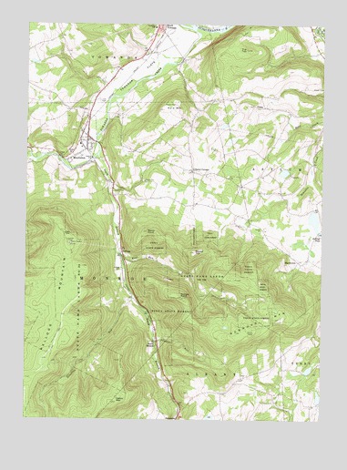
Monroeton, PA USGS Topographic Map
Click on map above to begin viewing in our Map Viewer.

This topographic map contains these locations and features:
Feature Name Type Latitude Longitude GNIS ID View Map
Borough of MonroeCivilN41.7123°W76.4759°1214953View Map
Bradford County AirportAirportN41.7395°W76.4456°1194276View Map
Bull SchoolSchoolN41.6970°W76.3922°1197351View Map
Cole CemeteryCemeteryN41.7259°W76.4688°1172171View Map
Fenner RunStreamN41.6498°W76.4447°1174683View Map
Hale MountainSummitN41.7229°W76.4355°1176378View Map
Hatch MountainSummitN41.6304°W76.4630°1176644View Map
KelloggPopulated PlaceN41.6781°W76.4597°1203922View Map
Kellogg CemeteryCemeteryN41.6728°W76.4592°1178329View Map
Kellogg MountainSummitN41.6812°W76.4805°1178330View Map
Kellogg Mountain Lookout TowerTowerN41.6809°W76.4811°1212952View Map
Kent RunStreamN41.6767°W76.4586°1178383View Map
Liberty CornersLocaleN41.7037°W76.4294°1179261View Map
Liberty Corners CemeteryCemeteryN41.7041°W76.4327°2776455View Map
Marcy PointSummitN41.6845°W76.4480°1180395View Map
MarshviewPopulated PlaceN41.6754°W76.3847°1204108View Map
Monroe Hose Company Station 7BuildingN41.7146°W76.4745°2652752View Map
MonroetonPopulated PlaceN41.7126°W76.4747°1217362View Map
Monroeton CemeteryCemeteryN41.7127°W76.4728°2776463View Map
Monroeton Post OfficePost OfficeN41.7142°W76.4738°2772845View Map
Nichols PointSummitN41.6637°W76.4336°1182439View Map
Robwood MountainSummitN41.6526°W76.4105°1185239View Map
Round TopSummitN41.6781°W76.4283°1193228View Map
Satterlee RunStreamN41.6631°W76.4547°1186997View Map
Scrivens Hollow CemeteryCemeteryN41.6324°W76.3929°2776495View Map
South BranchPopulated PlaceN41.6484°W76.4447°1204687View Map
South Branch Towanda CreekStreamN41.7087°W76.4691°1193404View Map
State Game Lands Number 240ParkN41.6717°W76.4230°1188502View Map
Teeter Family CemeteryCemeteryN41.6251°W76.4124°2776505View Map
Tip TopSummitN41.7420°W76.4069°1189594View Map
Towanda CreekStreamN41.7484°W76.4286°1189675View Map
Towanda FlatsFlatN41.7334°W76.4547°1189676View Map
Township of MonroeCivilN41.6783°W76.4741°1215984View Map
Township of TowandaCivilN41.7458°W76.4773°1215998View Map
UhdeyPopulated PlaceN41.7242°W76.4036°1204846View Map

Note: Coordinates in the location and feature list above are referenced to NAD83 datum.


Copyright (C) 2008-2024 Ryan Niemi / Sunset Dynamics ... All Rights Reserved